Catalog Archive
Auction 123, Lot 143
"L'Isle de Terre-Neuve, L'Acadie, ou la Nouvelle Ecosse, l'Isle St Jean et la Partie Orientale du Canada", Bonne, Rigobert
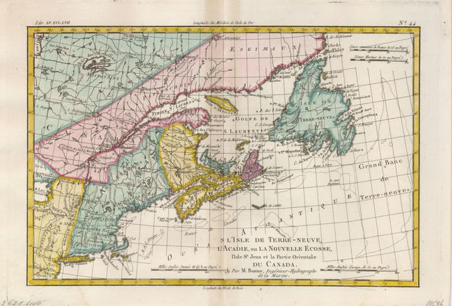
Subject: Colonial Canada and New England
Period: 1775 (circa)
Publication: Raynal's Atlas de toutes les parties connues du Globe Terrestre
Color: Hand Color
Size:
12.6 x 8.5 inches
32 x 21.6 cm
Download High Resolution Image
(or just click on image to launch the Zoom viewer)
(or just click on image to launch the Zoom viewer)