Subject: United States
Period: 1874-1917
Publication:
Color: Printed Color
A nice set of folding maps show the evolution of Indian Reservations over a period of 43 years.
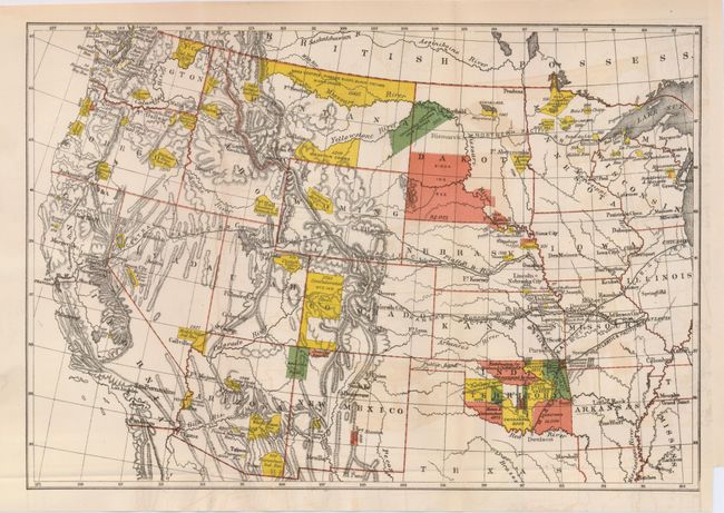
1) Untitled, 1874. Depicts the United States from Chicago westward. The extent of Indian Reservations are detailed throughout the West in yellow, rust and green and it locates railroads, towns, watershed and mountains. An uncommon map that we've not seen before. Not dated, but published in 1874. (14.4 x 8.5") Folding as issued. A hint of offsetting ((B+), else very good.
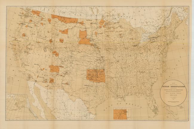
2) Map Showing the Location of the Indian Reservations within the Limits of the United States and Territories... Shows reservations across the United States, with insets of Alaska and Indian Territory. It locates towns, railroads, military stations and Indian agencies. Washington D.C., 1884 Some color. (33.5 x 21") A fold intersection split and light fold toning (B+), else very good.
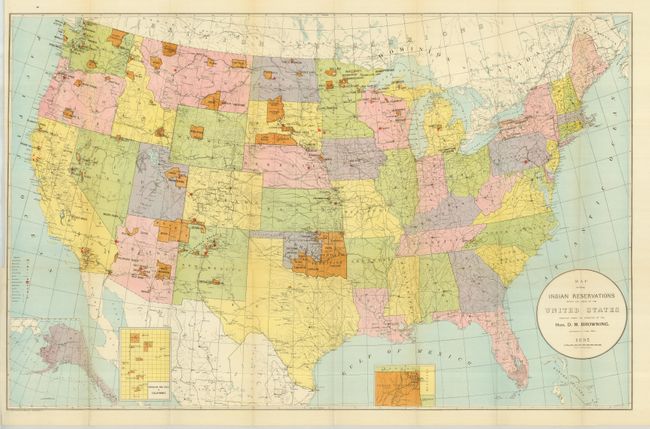
3) Map Showing Indian Reservations within the Limits of the United States... Colorful map shows reservations across the United States and locates towns, railroads, military stations, schools, and Indian agencies. This map also has insets of Indian Territory, Mission Ind. Res. of California and Alaska. Norris Peters Co., Washington D.C., 1895. (33 x 21"). Folding as issued with just a hint of some fold toning, still very good (A).
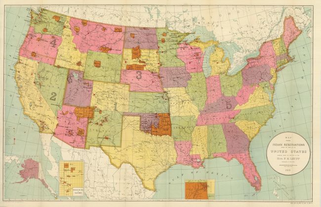
4) Map Showing Indian Reservations within the Limits of the United States... This the same as map #3, but shows the changes and development a decade later. The map also shows reservations across the United States, locating towns, railroads, military stations, schools, and Indian agencies, with insets of Indian Territory, Mission Ind. Res. of California and Alaska. Norris Peters Co. Washington D.C., 1905. (33 x 21"). Folding as issued. (A+)
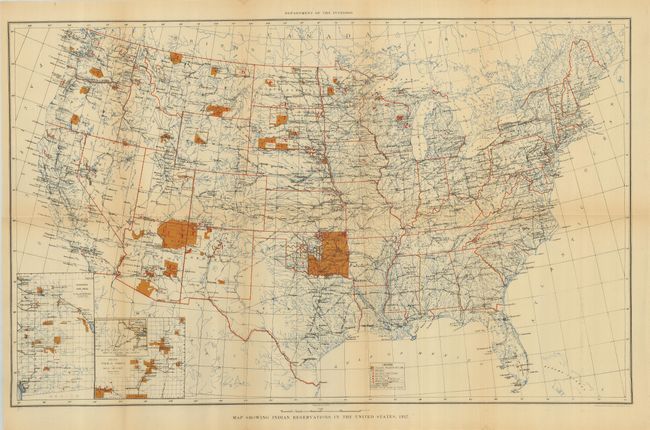
5) Map Showing Indian Reservations in the United States, 1917. This map of the United States is finely engraved and filled with information. It shows Indian Reservations and locates towns, railroads, schools, asylums, and the watershed. It includes two insets: Mission Ind. Res. of California and Indian Pueblo Grants in New Mexico. (24.3 x 15") U.S. Geological Survey, Department of the Interior. Folding, as issued with a little folding toning (B+).
References:
Condition:
See descriptions.