Subject: Colonial Mid-Atlantic
Period: 1680 (circa)
Publication:
Color: Hand Color
Size:
18.3 x 14.5 inches
46.5 x 36.8 cm
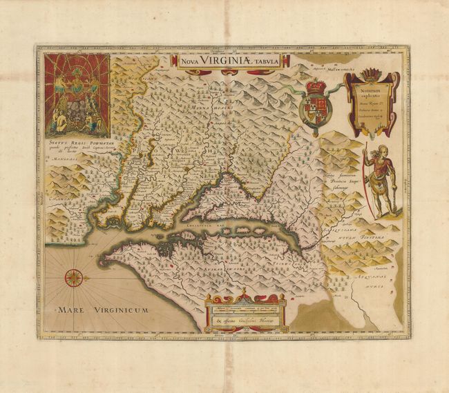
This is one of the most important seventeenth century maps of the Chesapeake Bay region. The early settlement of Jamestown is noted as Iamestowne, and there are a number of other place names, both English and Native American. The map was derived from Capt. John Smith's map of 1612, which was the first to depict the bay and its tributaries with any accuracy. In the upper left corner is an engraving of the great Indian chief, Powhatan, seated on his throne and surrounded by his subjects. A Susquehanna chief is depicted on the right under the British coat-of-arms and a key cartouche. The plate was engraved by D. Grijp and originally published by Jodocus Hondius Jr. in 1618. It was purchased by Willem Blaeu shortly after Hondius' death (1629) and Blaeu's imprint replaced that of Hondius. Following the death of Joan Blaeu in 1673 the plate was sold and appears in a number of Dutch composite atlases, all without text on verso like this example.
References: Burden #193.
Condition: B
Lightly toned, more so along centerfold, with slightly oxidized original color. There is an area of paper restoration along upper centerfold with neat facsimile of a few trees. The map has been backed with light Japanese tissue.