Subject: Eastern United States
Period: 1883 (dated)
Publication:
Color: Printed Color
Size:
21.7 x 14.3 inches
55.1 x 36.3 cm
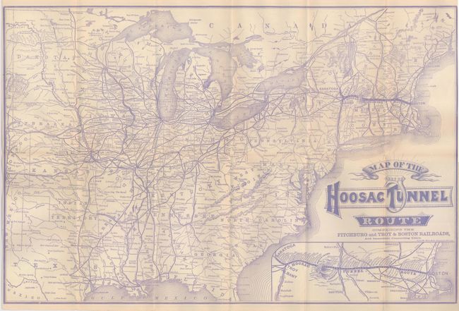
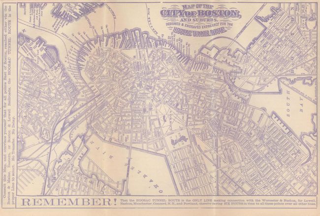
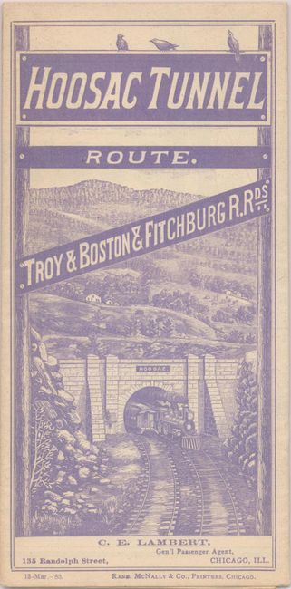
This folding railroad map and timetable brochure is beautifully printed in unusual lavender ink. The map extends west to include Texas, Nebraska and Dakota. The Hoosac Tunnel Route travels between Boston to Albany or Saratoga. A large inset at lower right is a more detailed map of the Hoosac route. The map's title includes a ribbon banner and diamond ring logo containing the words "Hoosac Tunnel." One quarter of the verso is a large city plan of Boston titled "Map of the City of Boston and Suburbs. Designed & Engraved Expressly for the Hoosac Tunnel Route." The rest of the verso is time tables and a full panel with interesting information on the tunnel -- at the time the third longest tunnel in the world, it is 4.75 miles long, cost $1,948,557, and used over 20 million bricks. The 12 panel brochure self folds into pictorial covers "Hoosac Tunnel Route. Troy & Boston & Fitchburg R.R.ds." and features a locomotive exiting the tunnel. This rarely seen timetable is dated March 13, 1883.
References:
Condition: A+