Catalog Archive
Auction 123, Lot 171

"[Lot of 2] Colton's United States Shewing the Military Stations, Forts &c…For the 'Rebellion Record'… [and] … For Victor's History of the Southern Rebellion", Colton, Joseph Hutchins

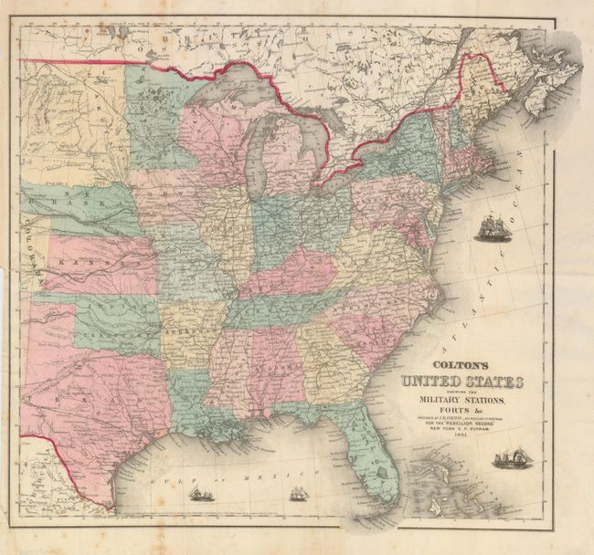
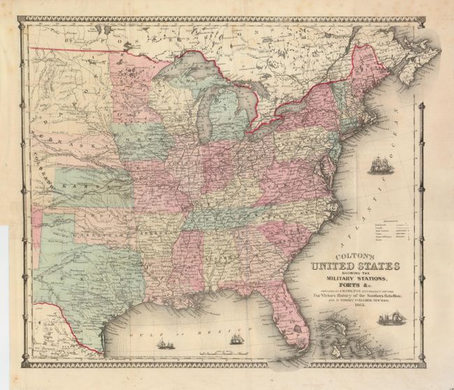
Subject: Eastern United States

Period: 1861-62 (dated)

Publication: Victor's History of the Southern Rebellion

Color: Hand Color

Size:
15.8 x 14.8 inches
40.1 x 37.6 cm
Download High Resolution Image
(or just click on image to launch the Zoom viewer)

These matched pair of unusual, folding Civil War period maps extend to about the 103rd meridian to include Dakota and most of Texas. They have great details throughout with the Pony Express Route, railroads, U.S. Mail routes and other important roads together with hundreds of forts. Both show four tiny ships sailing in the Atlantic and Gulf of Mexico symbolize the Union blockade of the Confederacy. The 1862 edition has an added legend and fancy border engraving.

References:

Condition: B+

Both are printed on fine banknote paper with original coloring. Originally issued flat, now they are pressed and backed with archival tissue. The 1861 edition has a little foxing at upper and lower left. The 1862 map is very good with just a trace of a few spots in upper middle.

Estimate: $300 - $400

Sold for: $200

Closed on 2/20/2008

Archived