Subject: Canada & Alaska
Period: 1772 (published)
Publication: Diderot's Encyclopedie (Supplement)
Color: Black & White
Size:
19 x 11.5 inches
48.3 x 29.2 cm
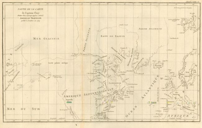
When Charles Joseph Panckoucke took over publication of Diderot's Encyclopedie in 1768, he promised to correct the cursory treatment of geography for which the first seventeen volumes had been criticized, with emphasis on the discoveries of the last 25 years. He employed Samuel Engel, a Swiss geographer, to write a series of articles about the northern regions and Didier Robert de Vaugondy to prepare ten maps to illustrate them. Engel rejected the De la Fonte Northwest Passage discoveries and believed the most sensible route from the Atlantic to the Pacific was along the north coast of Siberia. These maps illustrate the discoveries and various cartographic theories concerning the Pacific Northwest, East Asia and the North Pacific Ocean and include some of the most interesting comparative cartography of the eighteenth century
While this fascinating map covers the Arctic from Asia through Europe, the focus of the map is the Arctic region of North America. The most important feature of the map is the early depiction of what is present-day Alaska, patterned after Muller's epic map of 1750 that was the first to show the Russian discoveries, also noted here. A very interesting Northwest Passage is shown going from Repulse Bay in the north part of Hudson's Bay into the Arctic Ocean at Cape Fowler.
References:
Condition: A
Faint toning along folds, else fine.