Catalog Archive
Auction 123, Lot 138

"A Map of the Brittish-Plantations on the Continent of America", Salmon, Thomas

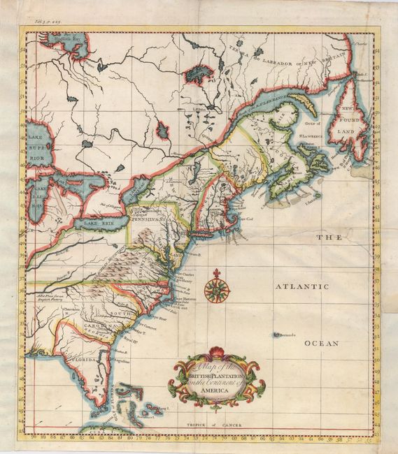
Subject: Colonial United States and Canada

Period: 1739 (published)

Publication: Modern History

Color: Hand Color

Size:
12 x 13.8 inches
30.5 x 35.1 cm
Download High Resolution Image
(or just click on image to launch the Zoom viewer)

An uncommon map with information derived from Popple's large map of 1733. It shows the area from Labrador and Hudson Bay to Florida, and west to the Great Lakes. It is crisply engraved, and names the Province of Main, and Massachusets Bay for Massachusetts. Near present-day Nashville, Tennessee is a note mentioning that the area is A Fit Place for an English Factory.

References:

Condition: B

A crisp impression on a sheet with a repaired tear entering the right side to the middle of the map. It has been repaired on the verso with paper. The left and right sides have paper added to facilitate framing. Later hand color.

Estimate: $350 - $400

Sold for: $400

Closed on 2/20/2008

Archived