Subject: Colonial United States
Period: 1755 (dated)
Publication: Atlas Universel
Color: Hand Color
Size:
25 x 19 inches
63.5 x 48.3 cm
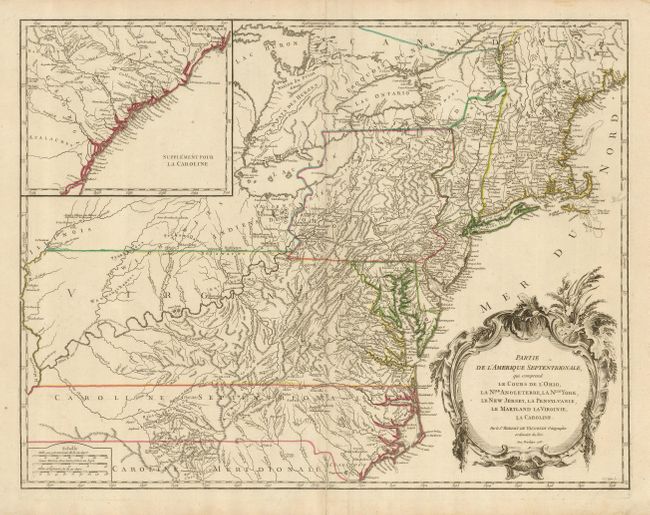
Beautifully engraved, large map of the eastern seaboard with an inset at upper left that continues the main map from Cape Fear south through the Carolinas and Georgia to F. St. Georges. It is based on the seminal map by John Mitchell, published in 1755, the same year this plate was initially engraved. The mapping of the trans-Allegheny and Great Lakes regions and in the interior of New England is of particular interest, for this shows some of the earliest accurate information of these regions incorporating data from the Mitchell, Evans and Fry-Jefferson maps. This is the second state of the map, with the notation of privilege for 1755 still present. The 1763 Treaty of Paris boundary is shown as a dotted line extending the claims of Virginia and the Carolinas to the Mississippi River. Pennsylvania extends to take in most of present-day New York and in New England New-Hamp-Shire and Prov. De Sagadahock have been added. A handsome title cartouche fills the Atlantic.
References: Cumming (SE) #295; McCorkle #755-37; Pedley #469; Sellers & Van Ee #718.
Condition: B+
A sharp impression on a sheet with a minor crease along the right side. The centerfold has been reinforced with paper on the verso. Original outline color.