Filtered by Category:Canada(Show All Categories)
Showing results for:Auction 123
Catalog Archive
29 lots
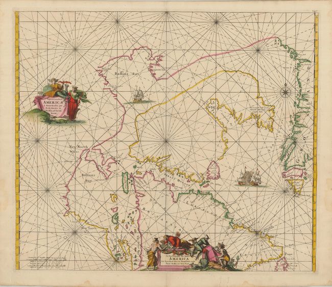
Auction 123, Lot 125
Subject: Canada and Greenland
Wit, Frederick de
Septemtrionaliora Americae a Groenlandia, per Freta Davidis, et Hudson, ad Terram Novam / De Noordelyckste Zee kusten van America van Groenland door de Straet Davis ende Straet Hudson tot Terra Neuf, 1680
Size: 22 x 19 inches (55.9 x 48.3 cm)
Estimate: $1,200 - $1,500
Unsold
Closed on 2/20/2008
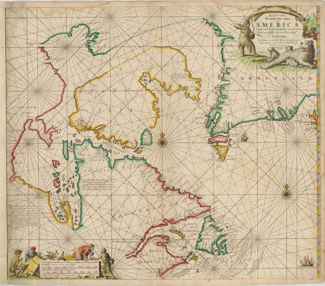
Auction 123, Lot 126
Subject: Canada and Greenland
Keulen, Johannes van
Pascaarte vande Noorder Zee custen van America, vande West-hoeck van Ysland doorde Straet Davis en Hudson, tot aen Terra Neuf, 1728
Size: 23.5 x 19.7 inches (59.7 x 50 cm)
Estimate: $700 - $900
Sold for: $600
Closed on 2/20/2008
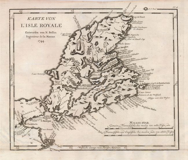
Auction 123, Lot 127
Subject: Canada, Cape Breton Island
Bellin, Jacques Nicolas
Karte von l'Isle Royale Entworfen von N. Bellin Ingenieur da la Marine, 1744
Size: 10.8 x 9 inches (27.4 x 22.9 cm)
Estimate: $120 - $160
Unsold
Closed on 2/20/2008
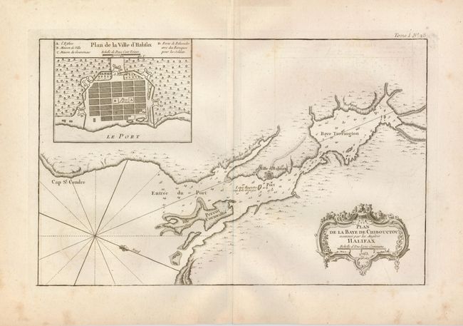
Auction 123, Lot 128
Subject: Canada
Bellin, Jacques Nicolas
Plan de la Baye de Chibouctou nommee par les Anglois Halifax. No. 28, 1764
Size: 13.8 x 8.7 inches (35.1 x 22.1 cm)
Estimate: $150 - $250
Sold for: $210
Closed on 2/20/2008
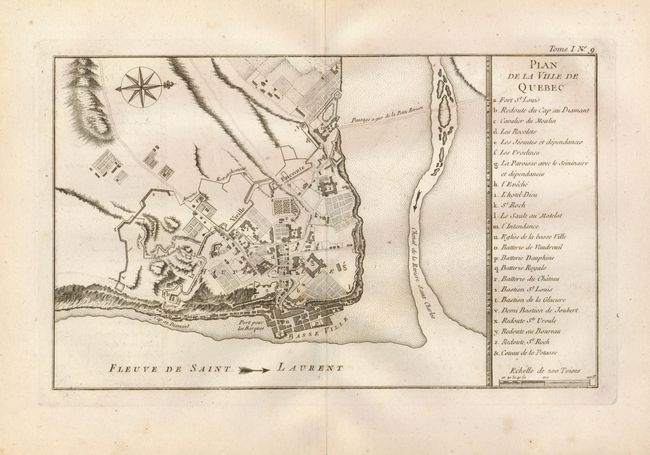
Auction 123, Lot 129
Subject: Canada, Quebec
Bellin, Jacques Nicolas
Plan de la Ville de Quebec, 1764
Size: 13.5 x 8.1 inches (34.3 x 20.6 cm)
Estimate: $160 - $200
Sold for: $120
Closed on 2/20/2008
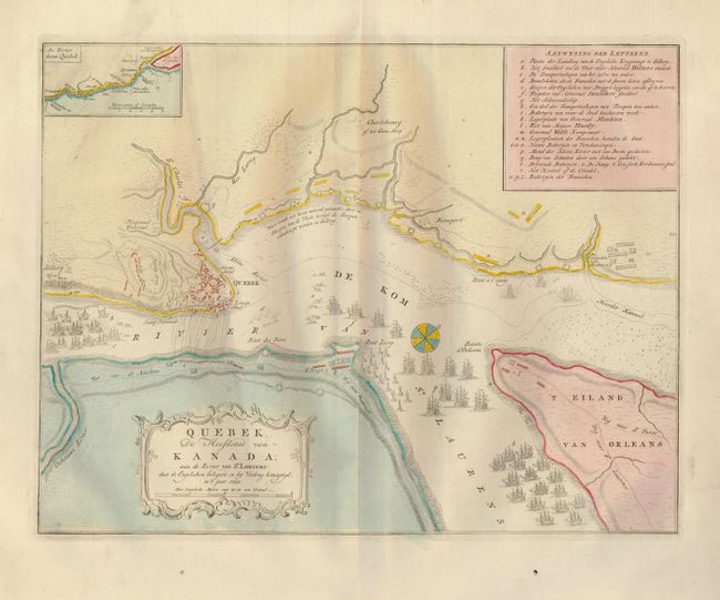
Auction 123, Lot 130
Subject: Canada, Quebec
Tirion, Isaac
Quebek, de Hoofdstad van Kanada; aan de Rivier van St. Laurens…, 1769
Size: 16.7 x 12.7 inches (42.4 x 32.3 cm)
Estimate: $275 - $350
Sold for: $200
Closed on 2/20/2008
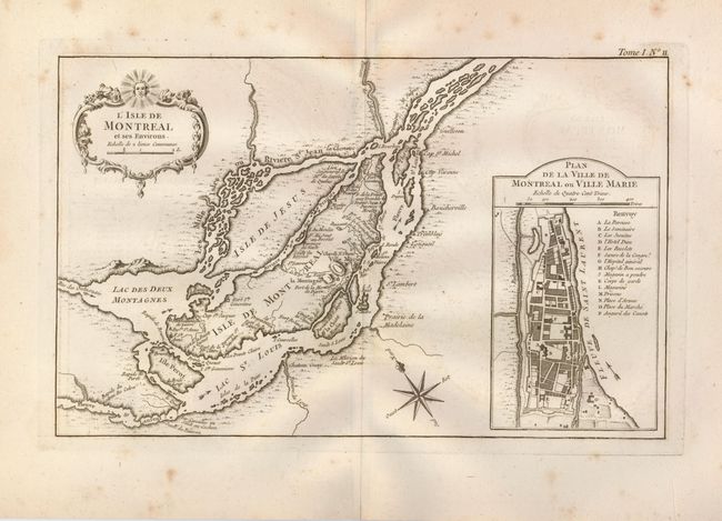
Auction 123, Lot 131
Subject: Canada, Montreal
Bellin, Jacques Nicolas
L'Isle de Montreal et ses Environs, 1764
Size: 13.7 x 8.5 inches (34.8 x 21.6 cm)
Estimate: $200 - $250
Sold for: $325
Closed on 2/20/2008
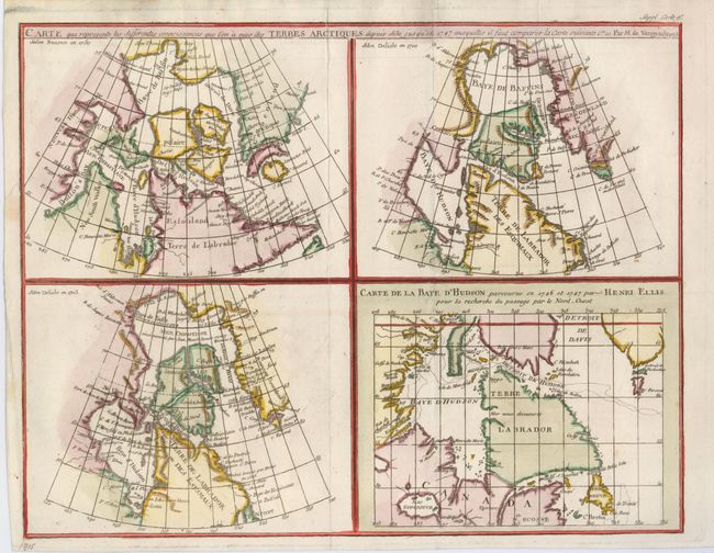
Auction 123, Lot 132
Subject: Canada
Robert de Vaugondy, Didier
Carte qui represente les differentes connoissances que l'on a eues des Terres Arctiques depuis 1650, jusqu ' en 1747…, 1770
Size: 14.8 x 11.5 inches (37.6 x 29.2 cm)
Estimate: $150 - $200
Sold for: $110
Closed on 2/20/2008
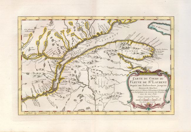
Auction 123, Lot 133
Subject: Canada
Bellin, Jacques Nicolas
Carte du Cours du Fleuve de St. Laurent Depuis son Embouchure jusqu'au dessus de Quebec, 1773
Size: 11.5 x 7.3 inches (29.2 x 18.5 cm)
Estimate: $200 - $250
Sold for: $160
Closed on 2/20/2008
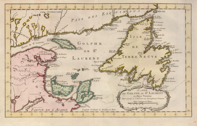
Auction 123, Lot 134
Subject: Canada
Bellin, Jacques Nicolas
Carte du Golphe de St. Laurent et Pays Voisins pour servir a l'Histoire des Establissemens Europeens, 1780
Size: 14.2 x 8.6 inches (36.1 x 21.8 cm)
Estimate: $150 - $200
Sold for: $110
Closed on 2/20/2008
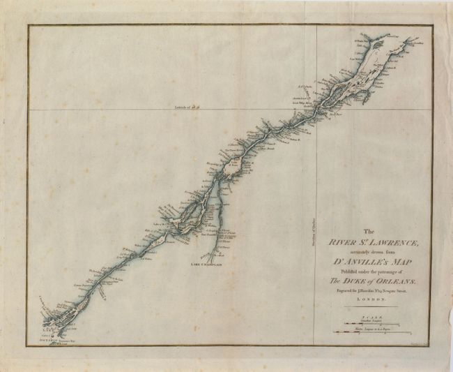
Auction 123, Lot 135
Subject: Canada
Harrison, John
The River St. Lawrence, Accurately Drawn from d'Anville's Map Publish'd under the Patronage of the Duke of Orleans, 1784
Size: 16.8 x 13.3 inches (42.7 x 33.8 cm)
Estimate: $190 - $230
Sold for: $140
Closed on 2/20/2008
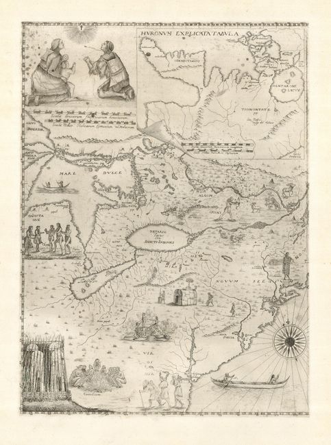
Auction 123, Lot 136
Subject: Colonial United States & Canada, Great Lakes
Bressani, Francesco
[Novae Franciae Accurata Delineatio 1657], 1657/1900
Size: 15 x 20 inches (38.1 x 50.8 cm)
Estimate: $1,500 - $2,000
Sold for: $4,500
Closed on 2/20/2008
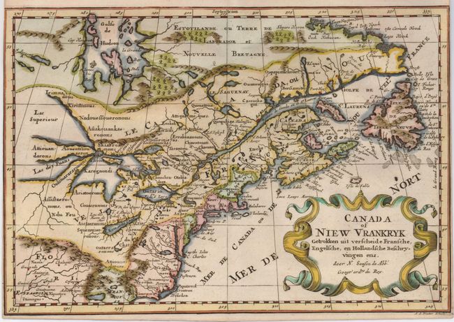
Auction 123, Lot 137
Subject: Colonial United States and Canada
Sanson, Nicolas
Canada of Niew Vrankryk Getrokken uit verscheide Fransche, Engelsche, en Hollandsche Beschryvingen enz, 1705
Size: 11.7 x 8.2 inches (29.7 x 20.8 cm)
Estimate: $750 - $850
Sold for: $650
Closed on 2/20/2008
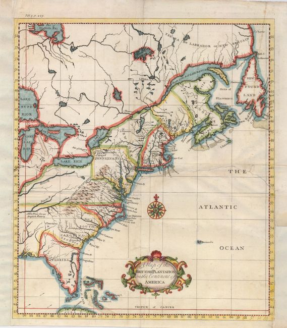
Auction 123, Lot 138
Subject: Colonial United States and Canada
Salmon, Thomas
A Map of the Brittish-Plantations on the Continent of America, 1739
Size: 12 x 13.8 inches (30.5 x 35.1 cm)
Estimate: $350 - $400
Sold for: $400
Closed on 2/20/2008
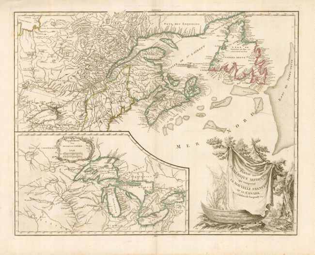
Auction 123, Lot 139
Subject: Colonial United States and Canada, Great Lakes
Robert de Vaugondy
Partie de l'Amerique Septent? qui comprend la Nouvelle France ou le Canada, 1755
Size: 24.5 x 19 inches (62.2 x 48.3 cm)
Estimate: $850 - $1,000
Sold for: $650
Closed on 2/20/2008
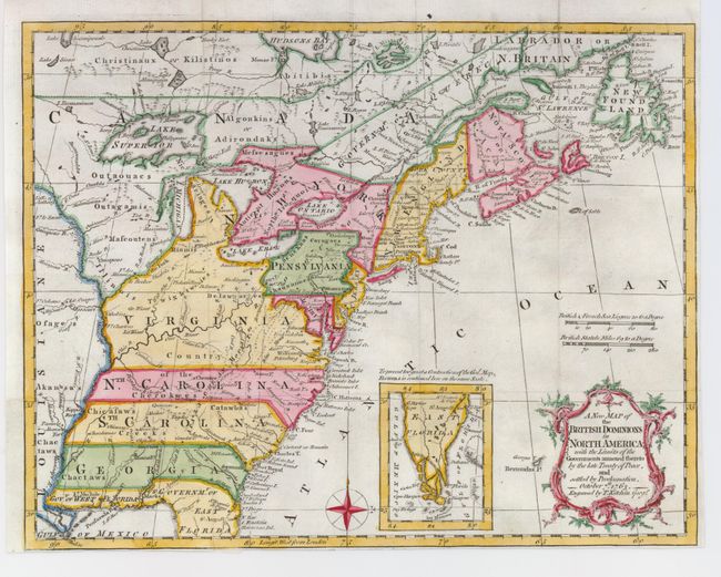
Auction 123, Lot 140
Subject: Colonial United States and Canada
Kitchin, Thomas
A New Map of the British Dominions in North America; with the Limits of the Governments Annexed thereto by the Late Treaty of Peace, and Settled by Proclamation, October 7th, 1763, 1763
Size: 11.8 x 9.4 inches (30 x 23.9 cm)
Estimate: $350 - $450
Sold for: $1,100
Closed on 2/20/2008
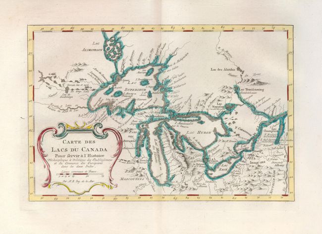
Auction 123, Lot 141
Subject: Colonial United States and Canada, Great Lakes
Bellin, Jacques Nicolas
Carte des Lacs du Canada…, 1773
Size: 11.3 x 7.4 inches (28.7 x 18.8 cm)
Estimate: $600 - $800
Sold for: $550
Closed on 2/20/2008
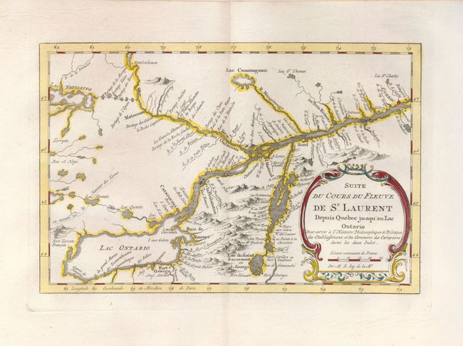
Auction 123, Lot 142
Subject: Colonial United States and Canada
Bellin, Jacques Nicolas
Suite du Cours du Fleuve de St. Laurent depuis Quebec jusqu'au Lac Ontario, 1773
Size: 11 x 7.3 inches (27.9 x 18.5 cm)
Estimate: $200 - $250
Sold for: $300
Closed on 2/20/2008
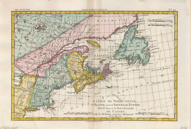
Auction 123, Lot 143
Subject: Colonial Canada and New England
Bonne, Rigobert
L'Isle de Terre-Neuve, L'Acadie, ou la Nouvelle Ecosse, l'Isle St Jean et la Partie Orientale du Canada, 1775
Size: 12.6 x 8.5 inches (32 x 21.6 cm)
Estimate: $200 - $250
Sold for: $150
Closed on 2/20/2008
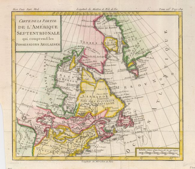
Auction 123, Lot 144
Subject: Colonial Canada & United States
Brion de la Tour, Louis
Carte de la Partie de l'Amerique Septentrionale qui Comprend les Possessions Anglaises, 1782
Size: 10 x 8.8 inches (25.4 x 22.4 cm)
Estimate: $150 - $200
Sold for: $170
Closed on 2/20/2008
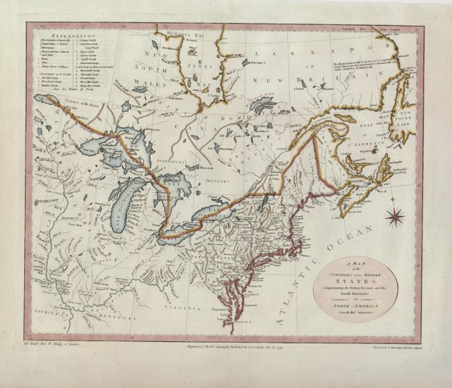
Auction 123, Lot 145
Subject: Canada & Northeast United States
Stockdale, John
A Map of the Northern and Middle States; Comprehending the Western Territory and the British Dominions in North America from the Best Authorities, 1792
Size: 15.8 x 12.8 inches (40.1 x 32.5 cm)
Estimate: $650 - $750
Sold for: $600
Closed on 2/20/2008
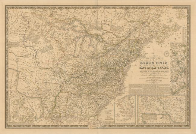
Auction 123, Lot 146
Subject: Canada & United States
Brue, Adrien Hubert
Nouvelle Carte des Etats-Unis des Haut et Bas-Canada…, 1836
Size: 37 x 25 inches (94 x 63.5 cm)
Estimate: $650 - $750
Unsold
Closed on 2/20/2008
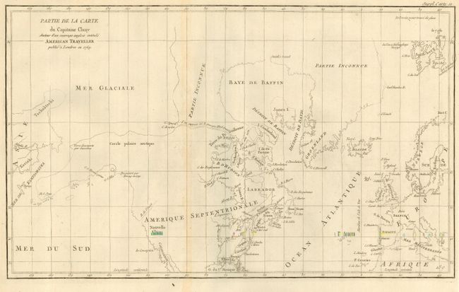
Auction 123, Lot 147
Subject: Canada & Alaska
Robert de Vaugondy, Didier
Partie de la Carte du Capitaine Cluny Auteur d'un ouvrage anglois intitule American Traveller, 1772
Size: 19 x 11.5 inches (48.3 x 29.2 cm)
Estimate: $180 - $230
Unsold
Closed on 2/20/2008
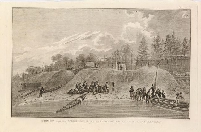
Auction 123, Lot 148
Subject: Alaska & Western Canada
Cook, James (Capt.)
[Lot of 3 Views], 1795
Size: 14 x 8.5 inches (35.6 x 21.6 cm)
Estimate: $150 - $200
Sold for: $110
Closed on 2/20/2008
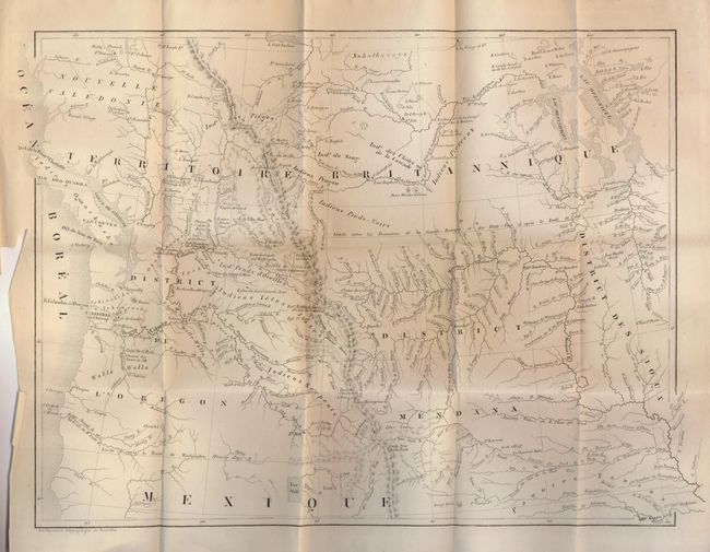
Auction 123, Lot 149
Subject: Western United States and Canada
De Smet, Father Pierre-Jean
Voyages Aux Montagnes Rocheuses, et une Annee de Sejour Chez les Tribus Indiennes du Vaste Territoire de l'Oregon, Defendant des Etats-Unis d'Amerique, 1844
Size: 15.5 x 12 inches (39.4 x 30.5 cm)
Estimate: $500 - $700
Sold for: $900
Closed on 2/20/2008
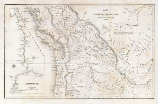
Auction 123, Lot 150
Subject: Western Canada and United States
Wilkes, Charles
Map of the Oregon Territory from the Best Authorities, 1849
Size: 13 x 8 inches (33 x 20.3 cm)
Estimate: $150 - $250
Sold for: $400
Closed on 2/20/2008
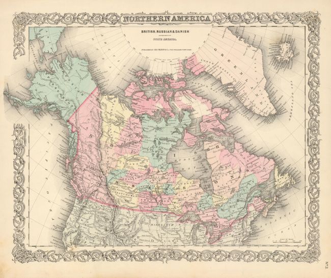
Auction 123, Lot 151
Subject: Canada and Alaska
Colton, Joseph Hutchins
Northern America British, Russian & Danish Possessions in North America, 1855
Size: 15.7 x 12.8 inches (39.9 x 32.5 cm)
Estimate: $120 - $150
Sold for: $160
Closed on 2/20/2008
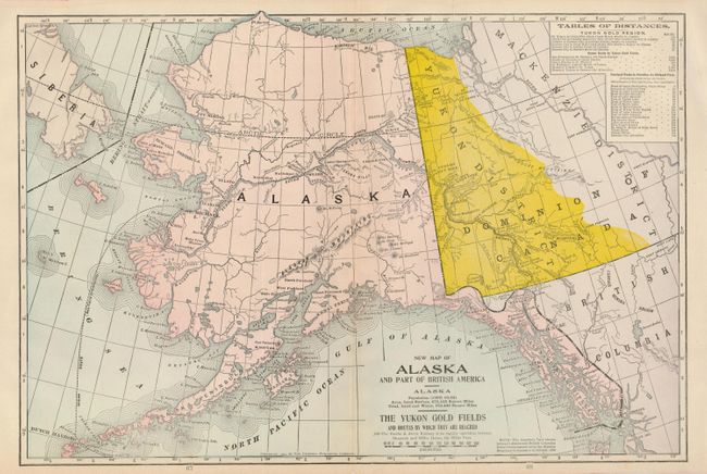
Auction 123, Lot 152
Subject: Alaska and Western Canada
Crowell Publishing Co.
New Map of Alaska and Part of British America…The Yukon Gold Fields and Routes by Which They are Reached, 1904
Size: 19 x 12.6 inches (48.3 x 32 cm)
Estimate: $100 - $130
Sold for: $70
Closed on 2/20/2008
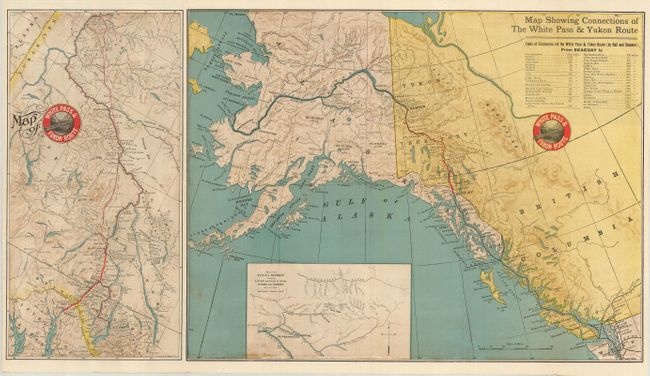
Auction 123, Lot 153
Subject: Alaska and Western Canada
Railroad Companies, (Various)
Map of White Pass & Yukon Route [on sheet with] Map Showing Connections of the White Pass & Yukon Route, 1905
Size: 27.3 x 15 inches (69.3 x 38.1 cm)
Estimate: $140 - $180
Sold for: $150
Closed on 2/20/2008
29 lots