Catalog Archive
Auction 123, Lot 161

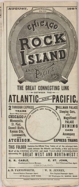
"New and Correct Map of the Great Rock Island Route Chicago Rock Island & Pacific Railway The Passengers Favorite Route…", Railroad Companies, (Various)

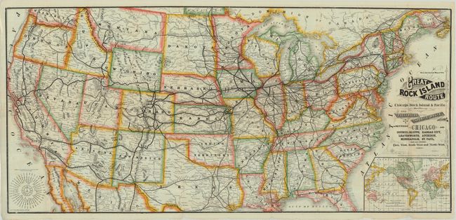
Subject: United States

Period: 1883 (dated)

Publication:

Color: Printed Color

Size:
40.2 x 19 inches
102.1 x 48.3 cm
Download High Resolution Image
(or just click on image to launch the Zoom viewer)

Large and colorful cerographic map by George Cram showing the United States with dozens of railroads winding across it. All the terminals along the lines are named. This map includes an inset, Map of the World Showing the Route Across the United States via the Chicago, Rock Island and Pacific RY, that shows shipping lines to and from San Francisco, New York and Boston. A timetable at lower left is based on 12:00 PM in Chicago. This handsome map folds into timetables for twelve railroads.

References:

Condition: B+

Some small edge tears and light toning.

Estimate: $200 - $275

Sold for: $160

Closed on 2/20/2008

Archived