Subject: United States - Eastern and Central
Period: 1832 (dated)
Publication:
Color: Hand Color
Size:
18 x 13 inches
45.7 x 33 cm
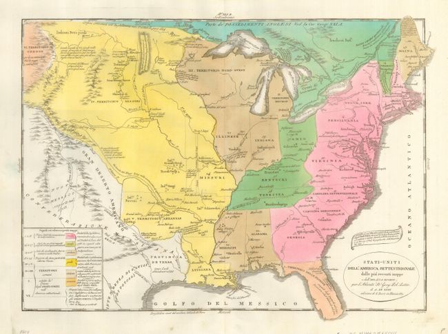
Uncommon map from an Italian edition of Le Sage's historical atlas published by Girolamo Tasso. The title cartouche also credits Buchon, who originated the map in 1825. The map covers the United States up to the Rocky Mountains. It depicts by color and extensive notations the expansion of the United States from the original thirteen colonies through the acquisition of various territories up to 1825, including the Louisiana Purchase. The uncolored area at the left is labeled Messicana, and includes the Provincia de Texas, which will be an independent republic in four years. Major cities, forts, roads and Indian villages are located. There is a color key at lower left, and the routes of Long and Talcott are noted.
References: Phillips (A) #127-21b.
Condition: A