Subject: United States
Period: 1860-72
Publication:
Color: Hand Color
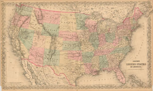
The first map is a later (1872) edition from G.W. & C.B. Colton's Atlas of the World. This example details the country just seven years after the close of the Civil War. All state and territorial boundaries are set except for Dakota, which has not split, and Oklahoma is still divided between Indian Territory and the Public Lands in its panhandle. Railroads dominate the landscape with full transcontinental service on at least three routes. (27.5 x 16.3")
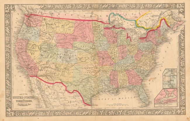
The second map was published by Samuel A. Mitchell in his New General Atlas (21.2" x 13.2") Philadelphia. This great map shows transitional territorial borders in the West. Arizona Territory includes the southern portion of Nevada. Nevada has not obtained its full width with a fat Utah extending west to about 115°. The large Dacotah Territory spans today's Wyoming as "Attached to Dacotah," and includes part of today's northeast Idaho. Oklahoma is Indian Territory. The extensive railroad network throughout the East gives way to proposed railroads, wagon roads and emigrant routes in the western territories. Insets of Hampton Roads and Norfolk Harbor, and Pensacola Bay. A decorative grapevine border surrounds this attractive map. Dated 1860 but territorial borders suggest a publication date of 1864-65.
References:
Condition:
#1 has a dark impression and light hand coloring. Split at lower centerfold into map a couple inches that is closed on verso and nearly invisible. Both lower corners with chipped paper just touching border (B). #2 has a long split along centerfold that enters map at bottom, with scattered foxing or flower pressing stains (C).