Subject: United States
Period: 1861 (dated)
Publication: Illustrated Family Atlas of the World
Color: Hand Color
Size:
22.5 x 15.8 inches
57.2 x 40.1 cm
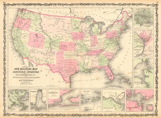
This is the more desirable issue of this Civil War period map, showing the state and territory borders instead of the Military Districts. The large western territories include Dakota, which incorporates present-day Montana and part of Wyoming, Nebraska with its western border on Washington and Utah, Washington with the inverted "L" shape encompassing present-day Idaho, a very narrow Nevada, and Arizona located below New Mexico Territory. Hundreds of military forts are located. Nine inset plans detail the major towns and harbors including Hampton Roads, Charleston Harbor, Key West, Baltimore, Washington, and more. All surrounded by a decorative strapwork border. Most likely published circa 1863.
References:
Condition: B
Printed on very strong paper for a map of this type. A few light stains, else fine.