Subject: United States
Period: 1858 (circa)
Publication: Black's General Atlas
Color: Printed Color
Size:
21.5 x 16.2 inches
54.6 x 41.1 cm
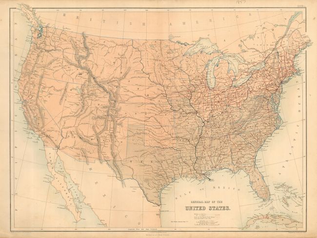
A lithographed map that was published at a time when many territorial borders were in very interesting configurations. Utah is a large territory that includes much of today's Colorado. New Mexico extends between Kansas, Texas and California, and includes part of present-day Colorado. The boundary between Utah and New Mexico is indistinct. Oregon and Washington Territory extend to the Continental Divide. The huge Nebraska Territory extends from Kansas to the Canadian border, and from the Continental Divide to the large Minnesota Territory. It includes today's Montana, Wyoming and much of the Dakotas. Oklahoma is Indian Territory. Minnesota appears to be bounded on the west by the Missouri River. Filled with many details including forts, railroads and wagon roads. The routes of exploration for the Proposed Pacific Railway are shown including those of Stevens, Capt. Gunnison, Capt. Pope and Lieut. Whipple. An extensive railroad network stretches throughout the East.
References:
Condition: A
Very nice example with full margins. A little soiling or offsetting in lower portion, else very good.