Filtered by Category:United States(Show All Categories)
Showing results for:Auction 116
Catalog Archive
238 lots
Page 1 of 5
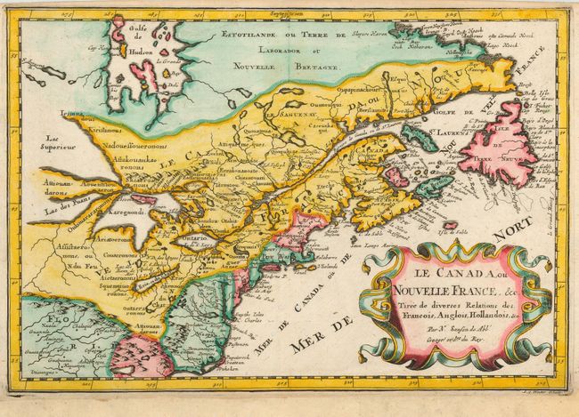
Auction 116, Lot 112
Subject: Colonial United States and Canada
Sanson, Nicolas
Le Canada, ou Nouvelle France, &c Tiree de diverses Relations des Francois, Anglois, Hollandois, &c., 1683
Size: 12 x 8 inches (30.5 x 20.3 cm)
Estimate: $550 - $650
Sold for: $550
Closed on 9/20/2006
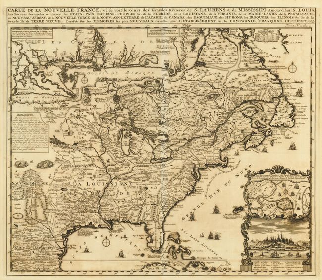
Auction 116, Lot 113
Subject: Colonial United States and Canada
Chatelain, Henry Abraham
Carte de la Nouvelle France, ou se voit le cours des Grandes Rivieres de S. Laurens & de Mississipi Aujour d'hui S. Louis, Aux Environs des-quelles se trouvent les Etats, Pais, Nations, Peuples &c., 1719
Size: 19 x 16.5 inches (48.3 x 41.9 cm)
Estimate: $2,400 - $2,750
Sold for: $2,400
Closed on 9/20/2006
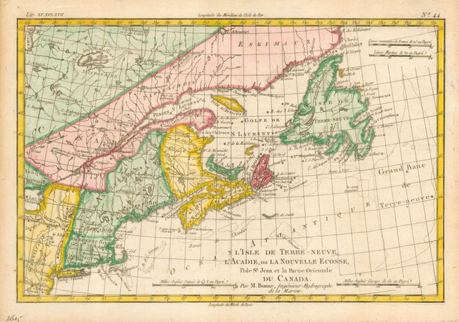
Auction 116, Lot 114
Subject: Colonial United States and Canada
Bonne, Rigobert
L'Isle de Terre-Neuve, L'Acadie, ou la Nouvelle Ecosse, l'Isle St Jean et la Partie Orientale du Canada, 1775
Size: 12.6 x 8.5 inches (32 x 21.6 cm)
Estimate: $200 - $250
Sold for: $160
Closed on 9/20/2006
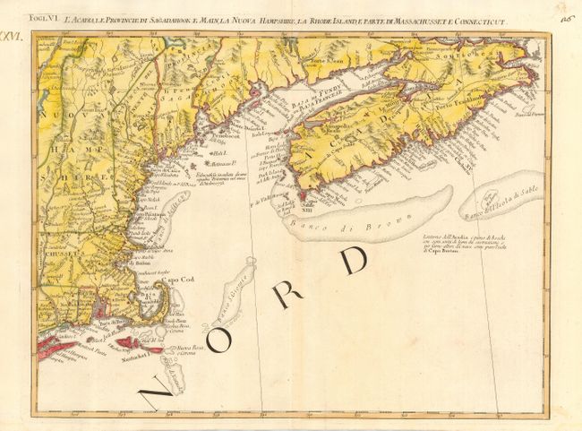
Auction 116, Lot 115
Subject: Colonial United States and Canada
Zatta, Antonio
L'Acadia, le Provincie di Sagadahook e Main, la Nuova Hampshire, la Rhode Island, e Parte di Massachusset e Connecticut, 1778
Size: 16.7 x 12.5 inches (42.4 x 31.8 cm)
Estimate: $300 - $400
Sold for: $400
Closed on 9/20/2006
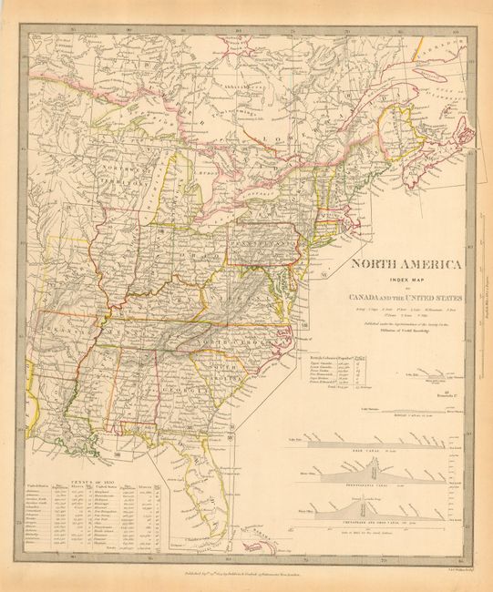
Auction 116, Lot 116
Subject: Canada & United States
SDUK Society for the Diffusion of Useful Knowledge
[Lot of 15 - Set Including Index and North America I through XIV], 1833-40
Size: 12 x 15 inches (30.5 x 38.1 cm)
Estimate: $800 - $1,000
Sold for: $850
Closed on 9/20/2006
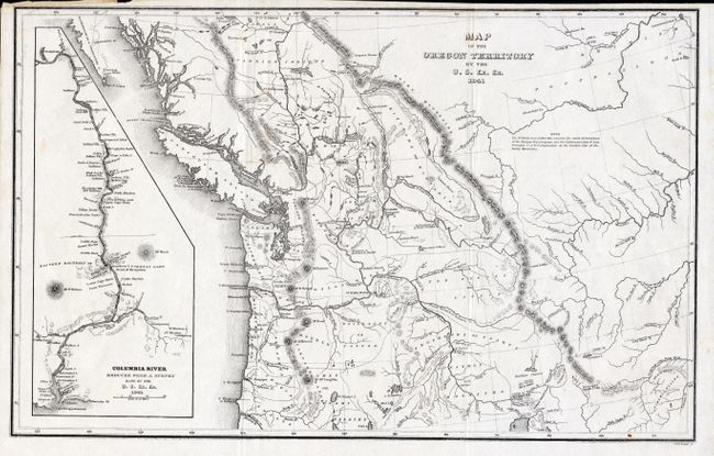
Auction 116, Lot 117
Subject: Northwestern United States and Canada
Wilkes, Charles
Map of the Oregon Territory by the U.S. Ex. Ex., 1841
Size: 13 x 8.5 inches (33 x 21.6 cm)
Estimate: $250 - $300
Sold for: $180
Closed on 9/20/2006
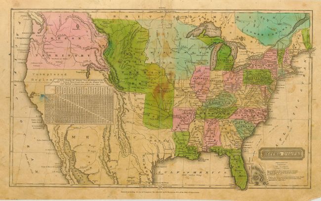
Auction 116, Lot 118
Subject: United States
Robinson, D.F. & Co.
United States, 1835
Size: 16.8 x 10 inches (42.7 x 25.4 cm)
Estimate: $100 - $140
Sold for: $190
Closed on 9/20/2006
Auction 116, Lot 119
Subject: United States
Throop, O. H.
[United States], 1846
Size: 16 x 9.5 inches (40.6 x 24.1 cm)
Estimate: $150 - $200
Sold for: $300
Closed on 9/20/2006
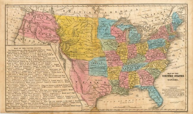
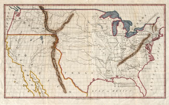
Auction 116, Lot 120
Subject: United States
Stiles, Sherman & Smith
Map of the United States and Canada, 1846
Size: 17.8 x 10.5 inches (45.2 x 26.7 cm)
Estimate: $140 - $180
Sold for: $50
Closed on 9/20/2006
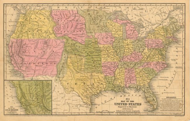
Auction 116, Lot 121
Subject: United States
Mitchell, Samuel Augustus
No. 5 Map of the United States Engraved to Illustrate Mitchell's School and Family Geography, 1849
Size: 16.8 x 10.3 inches (42.7 x 26.2 cm)
Estimate: $180 - $220
Sold for: $180
Closed on 9/20/2006
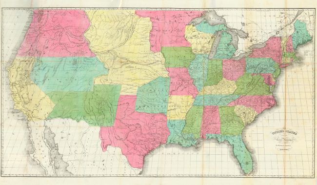
Auction 116, Lot 122
Subject: United States
Hayward, George
The United States from the Latest Authorities for Haywood's Gazetteer, 1853
Size: 40 x 22 inches (101.6 x 55.9 cm)
Estimate: $400 - $450
Sold for: $300
Closed on 9/20/2006
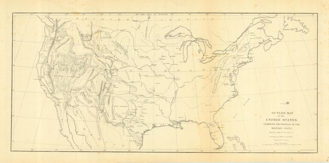
Auction 116, Lot 123
Subject: United States
U.S. Army
Outline Map of the United States Exhibiting the Positions of the Military Posts, 1856
Size: 20.5 x 9.4 inches (52.1 x 23.9 cm)
Estimate: $80 - $120
Sold for: $150
Closed on 9/20/2006
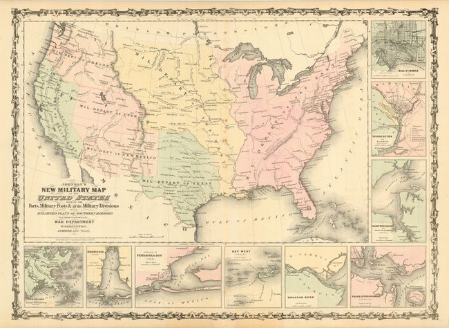
Auction 116, Lot 124
Subject: United States
Johnson and Ward
Johnson's New Military Map of the United States Showing the Forts, Military Posts &c. all the Military Divisions with Enlarged Plans of Southern Harbors…, 1861
Size: 23.5 x 17.2 inches (59.7 x 43.7 cm)
Estimate: $140 - $180
Sold for: $130
Closed on 9/20/2006
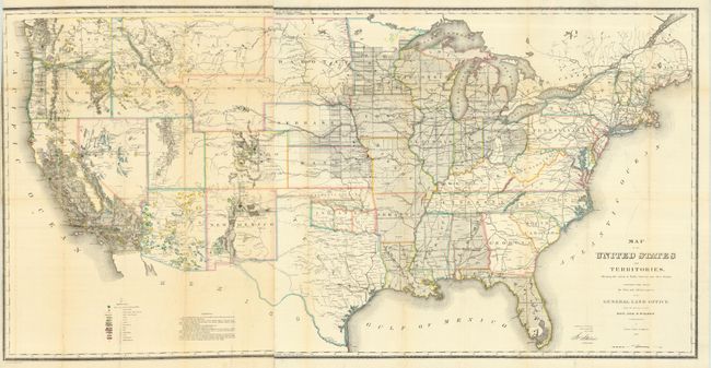
Auction 116, Lot 125
Subject: United States
General Land Office
Map of the United States and Territories Shewing the extent of Public Surveys and other details constructed from the Plats and official sources of the General Land Office…, 1866
Size: 55 x 28 inches (139.7 x 71.1 cm)
Estimate: $500 - $600
Unsold
Closed on 9/20/2006
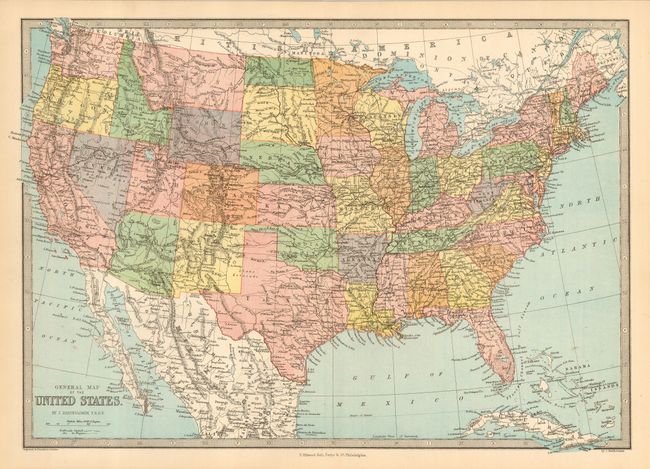
Auction 116, Lot 126
Subject: United States
Zell, T. Elwood
General Map of the United States, 1877
Size: 16 x 11 inches (40.6 x 27.9 cm)
Estimate: $200 - $300
Sold for: $650
Closed on 9/20/2006
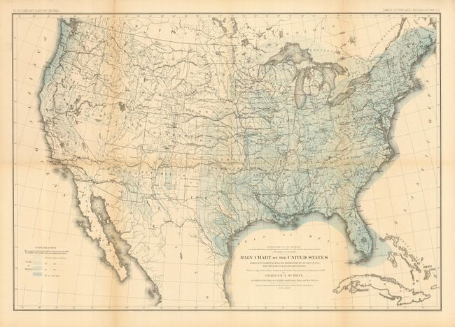
Auction 116, Lot 127
Subject: United States
Powell, John Wesley
Rain Chart of the United States Showing by Isohyetal Lines the Distribution of the Mean Annual Precipitation in Rain and Melted Snow, 1878
Size: 28.4 x 19.6 inches (72.1 x 49.8 cm)
Estimate: $80 - $120
Sold for: $40
Closed on 9/20/2006
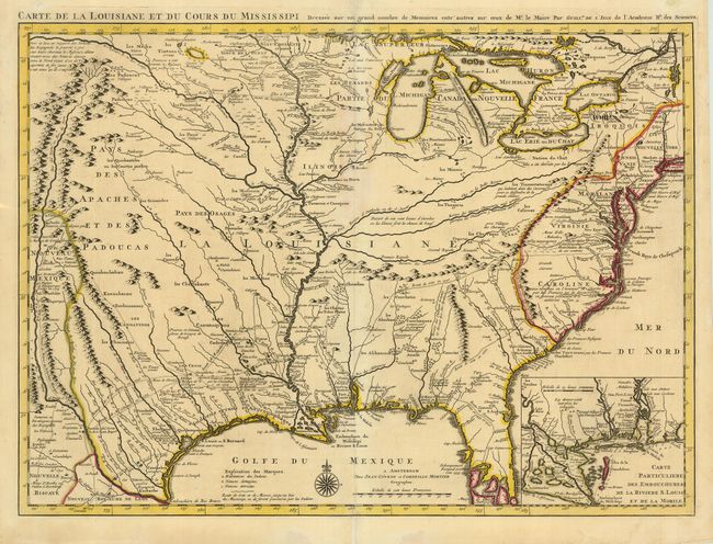
Auction 116, Lot 128
Subject: Colonial United States
Delisle/Covens & Mortier
Carte de la Louisiane et du Cours du Mississipi Dressee sur un Grand Nombre de Memoires entrautres sur ceux de Mr. le Maire, 1730
Size: 23.8 x 17.5 inches (60.5 x 44.5 cm)
Estimate: $3,000 - $3,500
Sold for: $2,500
Closed on 9/20/2006
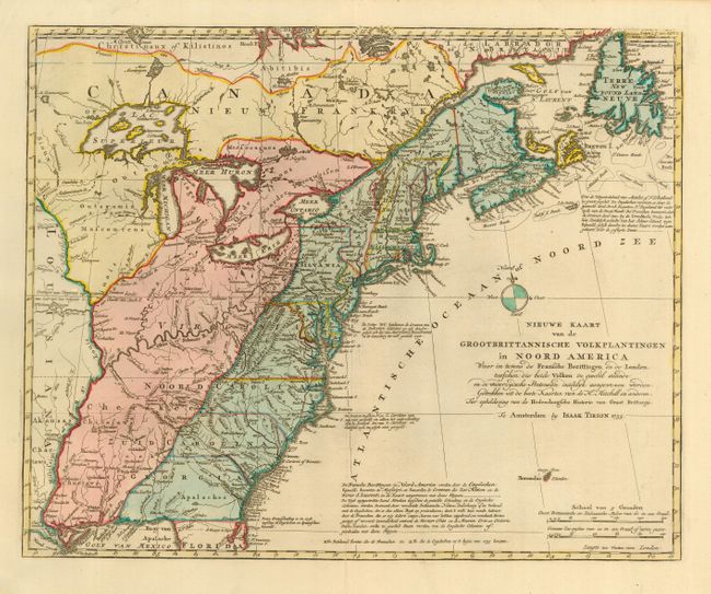
Auction 116, Lot 129
Subject: Colonial United States
Tirion, Isaac
Nieuwe Kaart van de Grootbrittannische Volkplantingen in Noord America, 1755
Size: 17.5 x 14 inches (44.5 x 35.6 cm)
Estimate: $850 - $950
Sold for: $700
Closed on 9/20/2006
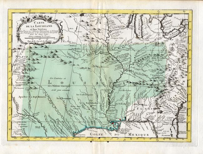
Auction 116, Lot 130
Subject: Colonial Central United States
Bellin, Jacques Nicolas
Carte de la Louisiane et Pays Voisins…, 1757
Size: 11.7 x 8.5 inches (29.7 x 21.6 cm)
Estimate: $180 - $220
Sold for: $210
Closed on 9/20/2006
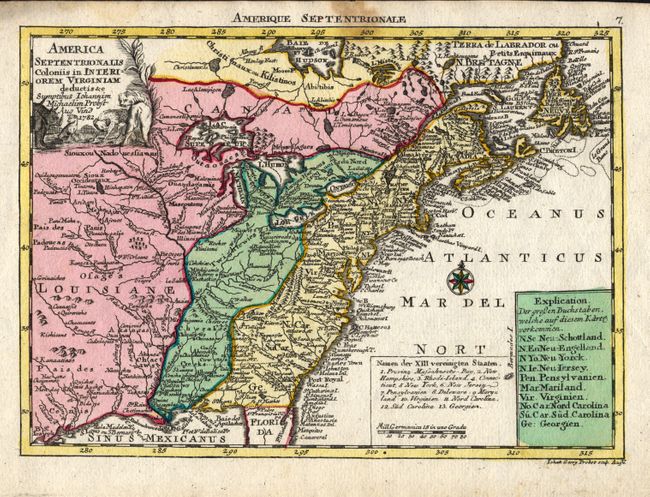
Auction 116, Lot 131
Subject: Eastern United States
Probst, Johann Michael
America Septentrionalis Coloniis in Interiorem Virginiam deductis &c, 1782
Size: 9.5 x 6.8 inches (24.1 x 17.3 cm)
Estimate: $700 - $800
Sold for: $375
Closed on 9/20/2006
Auction 116, Lot 132
Subject: Eastern United States
Bonne, Rigobert
[Lot of 2] Les Etats Unis de l'Amerique Septentrionale, Partie Occidentale [together with] … Partie Orientale, 1787
Size: 9 x 14 inches (22.9 x 35.6 cm)
Estimate: $400 - $500
Sold for: $400
Closed on 9/20/2006
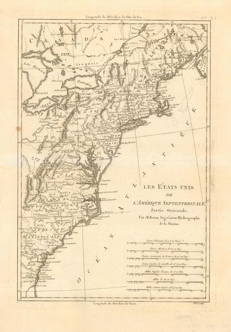
Auction 116, Lot 133
Subject: Eastern United States
Crevecoeur, Michel Guillaume De
[Lot of 2] Carte de la Partie Septentrionale des Etats-Unis [and] Carte de la Partie Meridionale des Etats-Unis, 1801
Size: 19.8 x 14 inches (50.3 x 35.6 cm)
Estimate: $500 - $600
Sold for: $400
Closed on 9/20/2006
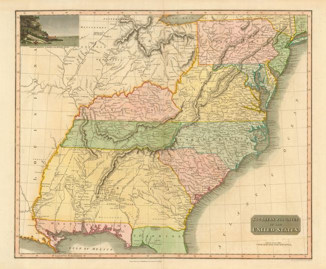
Auction 116, Lot 134
Subject: Eastern United States
Thomson, John
Southern Provinces of the United States, 1817
Size: 23.3 x 19.5 inches (59.2 x 49.5 cm)
Estimate: $700 - $800
Sold for: $500
Closed on 9/20/2006
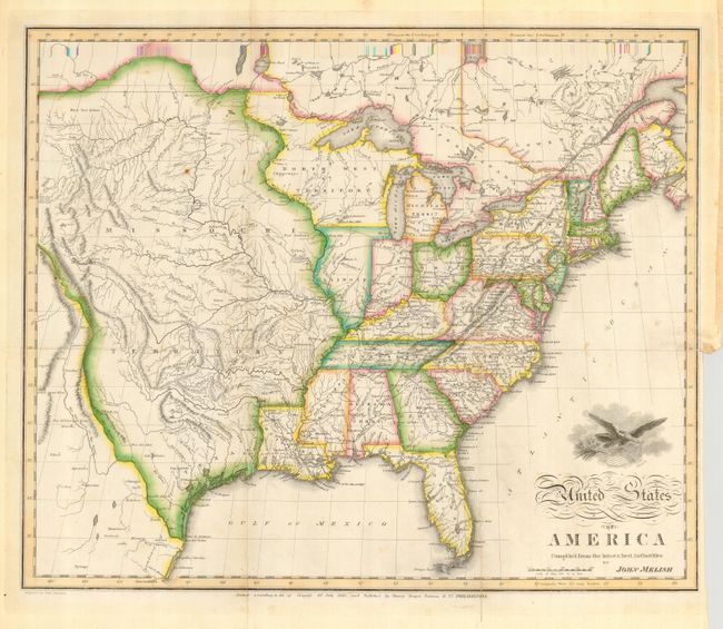
Auction 116, Lot 135
Subject: Eastern United States
Melish, John
United States of America Compiled from the latest & best Authorities, 1818
Size: 19.8 x 16 inches (50.3 x 40.6 cm)
Estimate: $1,400 - $1,800
Sold for: $1,800
Closed on 9/20/2006
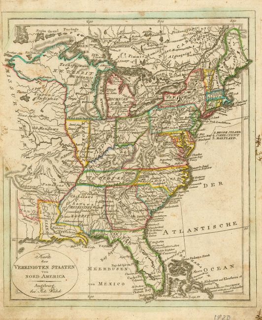
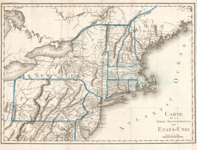
Auction 116, Lot 136
Subject: Eastern United States
Walch, Johannes
Karte der Vereinigten Staaten von Nord America, 1820
Size: 8 x 9.3 inches (20.3 x 23.6 cm)
Estimate: $275 - $325
Sold for: $200
Closed on 9/20/2006
Auction 116, Lot 137
Subject: Eastern United States
Maas, Jacob
United States of North America, 1829
Size: 19 x 16 inches (48.3 x 40.6 cm)
Estimate: $800 - $1,200
Sold for: $600
Closed on 9/20/2006
Auction 116, Lot 138
Subject: Eastern United States
Fisher & Sons
States of America, 1840
Size: 9 x 7 inches (22.9 x 17.8 cm)
Estimate: $300 - $350
Sold for: $300
Closed on 9/20/2006
Auction 116, Lot 139
Subject: Eastern United States
Mitchell, Samuel Augustus
[Lot of 2] Mitchell's Travellers Guide Through the United States A Map of the Roads, Distances, Steam Boat & Canal Routes... [and] Accompaniment to the map, 1841
Size: 21.5 x 17.5 inches (54.6 x 44.5 cm)
Estimate: $900 - $1,000
Sold for: $600
Closed on 9/20/2006
Auction 116, Lot 140
Subject: Eastern United States
Phelps & Ensign
Phelps & Ensign's Traveller's Guide and Map of the United States Containing the Roads…, 1843
Size: 39 x 28 inches (99.1 x 71.1 cm)
Estimate: $1,000 - $1,400
Sold for: $900
Closed on 9/20/2006
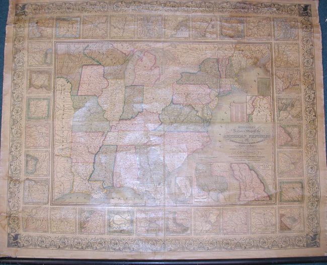
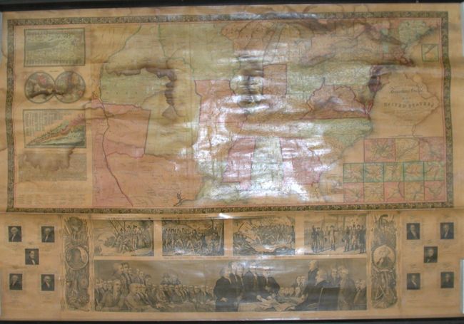
Auction 116, Lot 141
Subject: Eastern United States
Mitchell, Samuel Augustus
Mitchell's National Map of the American Republic or United States of North America, Together with Maps of the Vicinities of Thirty-Two of the Principal Cities and Towns in the Union, 1846
Size: 47 x 38 inches (119.4 x 96.5 cm)
Estimate: $1,000 - $1,400
Sold for: $950
Closed on 9/20/2006
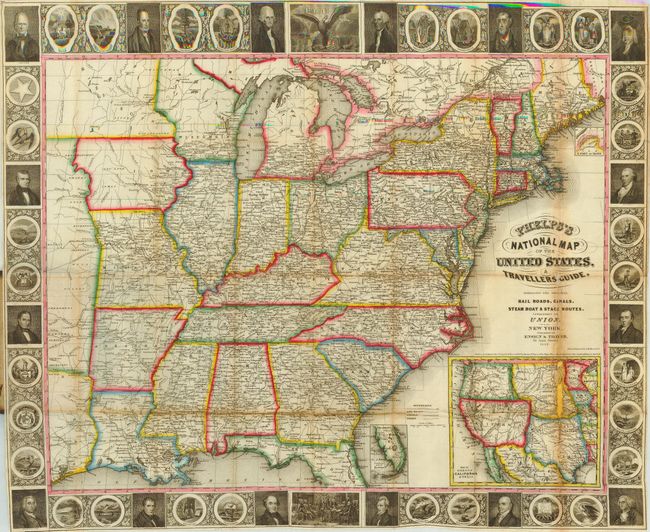
Auction 116, Lot 142
Subject: Eastern United States
Ensign, Thayer & Co.
Phelps's National Map of the United States, A Traveller's Guide, 1849
Size: 25 x 20 inches (63.5 x 50.8 cm)
Estimate: $600 - $800
Sold for: $500
Closed on 9/20/2006
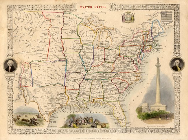
Auction 116, Lot 143
Subject: Eastern United States
Tallis, John
United States, 1850
Size: 13.5 x 9.5 inches (34.3 x 24.1 cm)
Estimate: $200 - $300
Sold for: $275
Closed on 9/20/2006
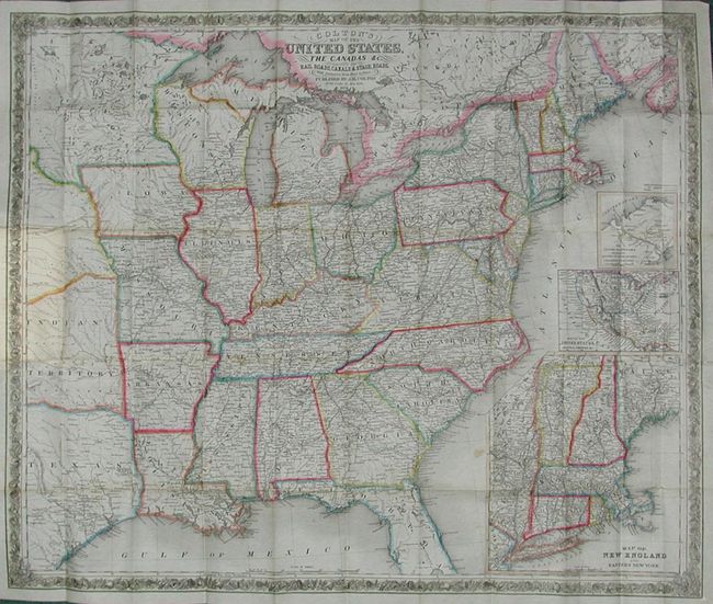
Auction 116, Lot 144
Subject: Eastern United States
Colton, Joseph Hutchins
Colton's Map of the United States, the Canadas &c. Showing the Rail Roads, Canals & Stage Roads: With Distances from Place to Place, 1851
Size: 30 x 25 inches (76.2 x 63.5 cm)
Estimate: $500 - $600
Sold for: $475
Closed on 9/20/2006
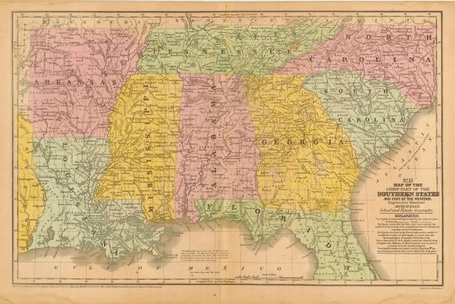
Auction 116, Lot 145
Subject: Eastern United States
Mitchell, Samuel Augustus
[Lot of 2] Map of the Chief Part of the Southern States and Part of the Western [and] Map of the New England or Eastern States, 1852-53
Size: 16.5 x 10.5 inches (41.9 x 26.7 cm)
Estimate: $80 - $100
Sold for: $50
Closed on 9/20/2006
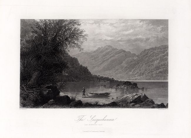
Auction 116, Lot 146
Subject: Eastern United States
Cassell & Galpin
[Lot of 8 - Views], 1872
Size: 9 x 5.4 inches (22.9 x 13.7 cm)
Estimate: $140 - $180
Sold for: $100
Closed on 9/20/2006
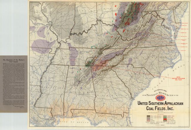
Auction 116, Lot 147
Subject: Eastern United States
Matthews-Northrup Co
Map Showing Some of the Natural Resources of the United Southern Appalachian Coal Fields, Inc., 1910
Size: 26.8 x 21.8 inches (68.1 x 55.4 cm)
Estimate: $80 - $120
Sold for: $40
Closed on 9/20/2006
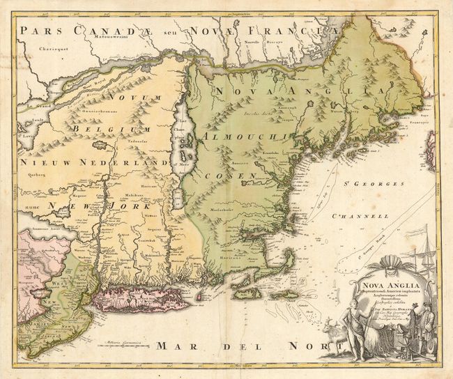
Auction 116, Lot 148
Subject: Colonial New England and Mid-Atlantic
Homann, Johann Baptist
Nova Anglia Septentrionali Americae implantata Anglorumque coloniis florentissima, 1724
Size: 23 x 19.2 inches (58.4 x 48.8 cm)
Estimate: $1,200 - $1,300
Sold for: $900
Closed on 9/20/2006
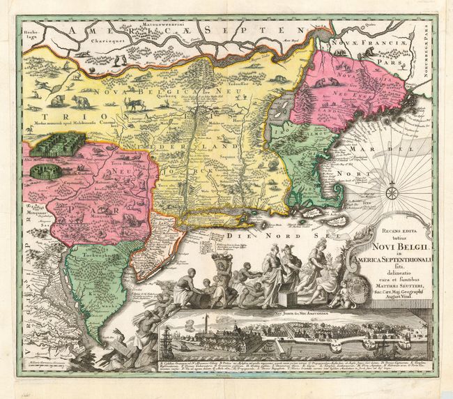
Auction 116, Lot 149
Subject: Colonial New England and Mid-Atlantic
Seutter, Matthias
Recens Edita totius Novi Belgii, in America Septentrionali siti, delineatio cura et Sumtibus, 1730
Size: 23 x 19.6 inches (58.4 x 49.8 cm)
Estimate: $3,500 - $4,500
Sold for: $2,500
Closed on 9/20/2006
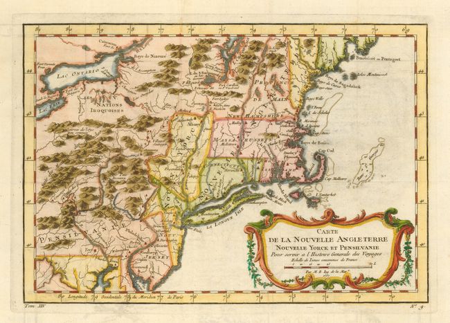
Auction 116, Lot 150
Subject: Colonial New England and Mid-Atlantic
Bellin, Jacques Nicolas
Carte de la Nouvelle Angleterre, Nouvelle Yorck et Pensilvanie, 1757
Size: 11.8 x 8 inches (30 x 20.3 cm)
Estimate: $400 - $475
Sold for: $350
Closed on 9/20/2006
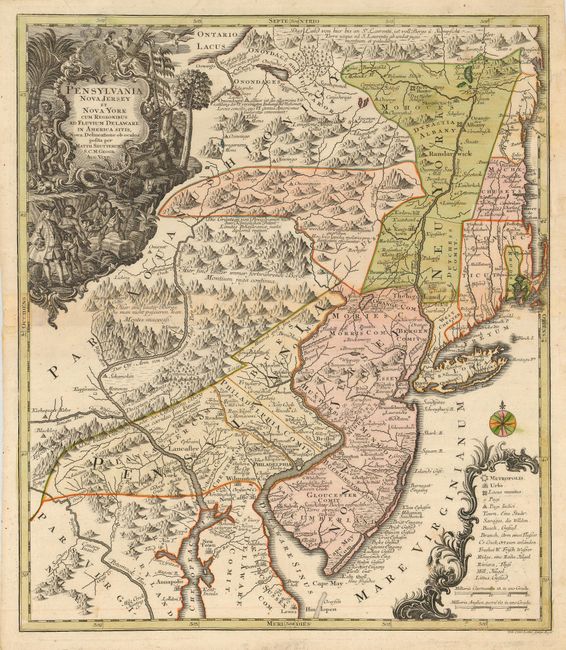
Auction 116, Lot 151
Subject: Colonial Mid Atlantic and New England
Seutter/Lotter
Pensylvania Nova Jersey et Nova York cum Regionibus ad Fluvium Delaware in America Sitis…, 1750
Size: 19.5 x 22.5 inches (49.5 x 57.2 cm)
Estimate: $2,000 - $2,500
Sold for: $2,100
Closed on 9/20/2006
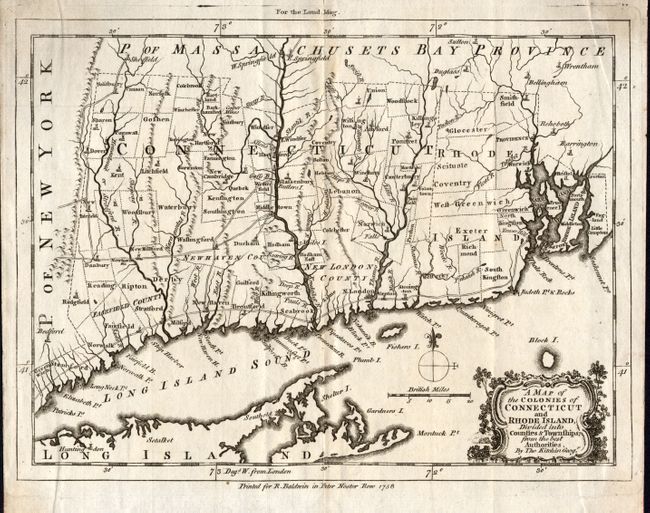
Auction 116, Lot 152
Subject: Colonial New England
Kitchin, Thomas
A Map of the Colonies of Connecticut and Rhode Island, Divided into Counties & Townships, from the best Authorities, 1758
Size: 8.5 x 6.5 inches (21.6 x 16.5 cm)
Estimate: $275 - $325
Sold for: $350
Closed on 9/20/2006
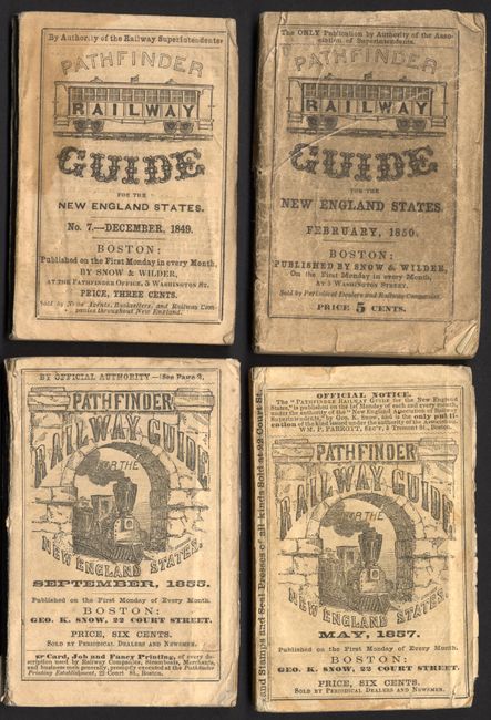
Auction 116, Lot 153
Subject: United States - New England
[Lot of 4] Pathfinder Guide for the New England States…, 1849-1857
Size: 2.8 x 4.3 inches (7.1 x 10.9 cm)
Estimate: $600 - $800
Sold for: $650
Closed on 9/20/2006
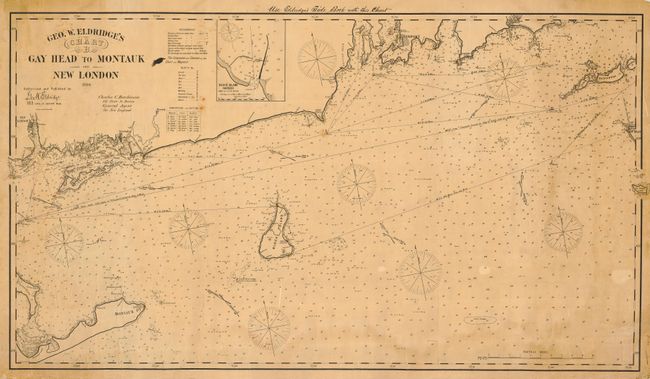
Auction 116, Lot 154
Subject: United States - New England
Eldridge, George
Geo. W. Eldridge's Chart B, Gay Head to Montauk and New London…, 1894
Size: 47.5 x 27 inches (120.7 x 68.6 cm)
Estimate: $600 - $700
Sold for: $450
Closed on 9/20/2006
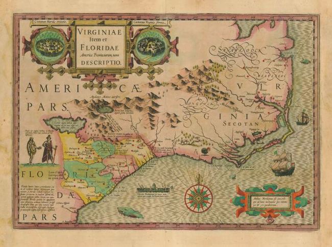
Auction 116, Lot 155
Subject: Colonial Southeast
Hondius, Jodocus
Virginiae Item et Floridae Americae Provinciarum, nova Descriptio, 1613
Size: 19 x 13.4 inches (48.3 x 34 cm)
Estimate: $2,750 - $3,500
Unsold
Closed on 9/20/2006
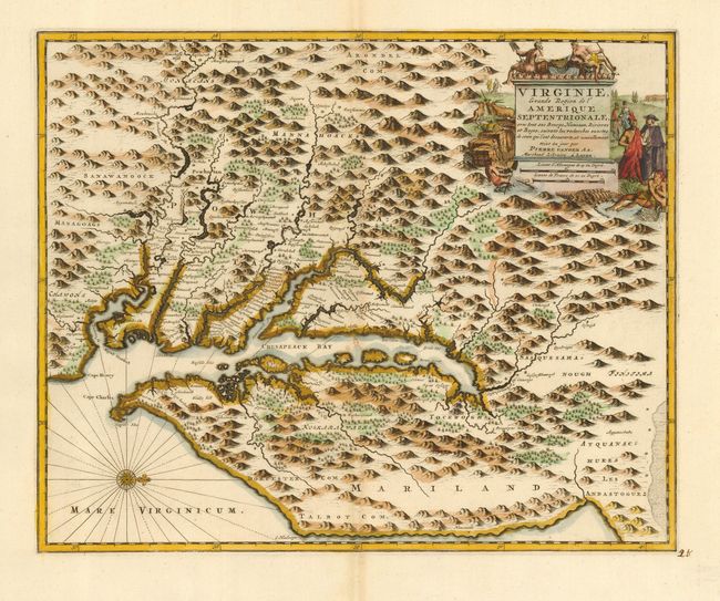
Auction 116, Lot 156
Subject: Colonial Mid Atlantic
Aa, Pieter van der
Virginie, Grande Region de l'Amerique Septentrionale, avec tous ses Bourgs, Hameaux, Rivieres et Bayes, Suivant les Recherches Exactes de ceux qui l'ont Decouverte…, 1729
Size: 14 x 11.3 inches (35.6 x 28.7 cm)
Estimate: $2,400 - $3,000
Sold for: $1,800
Closed on 9/20/2006
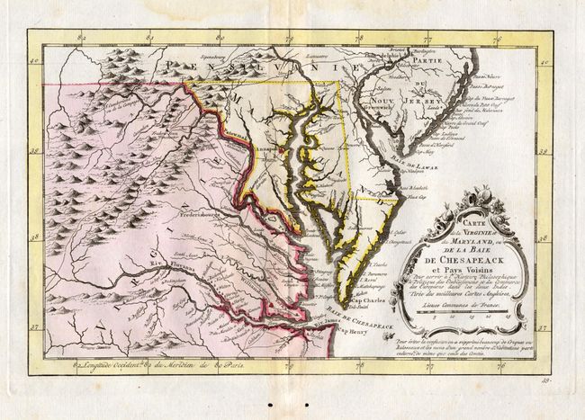
Auction 116, Lot 157
Subject: Colonial Mid Atlantic
Bellin, Jacques Nicolas
Carte de la Virginie et du Maryland, ou de la Baie de Chesapeack et Pays Voisins…, 1757
Size: 11.2 x 7.4 inches (28.4 x 18.8 cm)
Estimate: $300 - $350
Sold for: $375
Closed on 9/20/2006
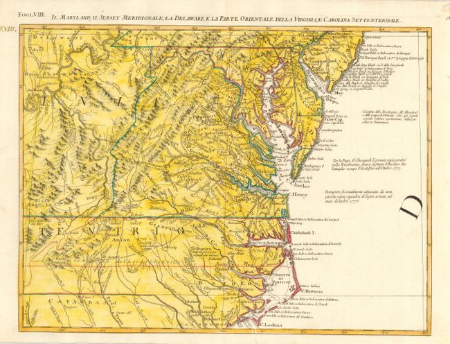
Auction 116, Lot 158
Subject: Colonial Mid Atlantic
Zatta, Antonio
Il Maryland, Il Jersey Meridionale, la Delaware, e la Parte Orientale della Virginia, e Carolina Settentrionale, 1778
Size: 16.8 x 12.5 inches (42.7 x 31.8 cm)
Estimate: $500 - $600
Sold for: $375
Closed on 9/20/2006
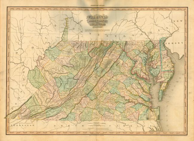
Auction 116, Lot 159
Subject: Mid-Atlantic United States
Tanner, Henry Schenck
Virginia, Maryland and Delaware, 1820
Size: 28.5 x 20 inches (72.4 x 50.8 cm)
Estimate: $800 - $1,000
Sold for: $650
Closed on 9/20/2006
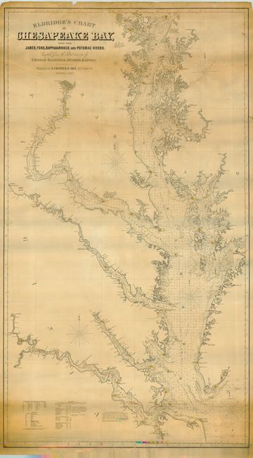
Auction 116, Lot 160
Subject: Mid-Atlantic United States
Eldridge, George
Eldridge's Chart of Chesapeake Bay with the James, York, Rappahannock and Potomac Rivers, 1883
Size: 32 x 56 inches (81.3 x 142.2 cm)
Estimate: $2,000 - $2,400
Sold for: $1,500
Closed on 9/20/2006
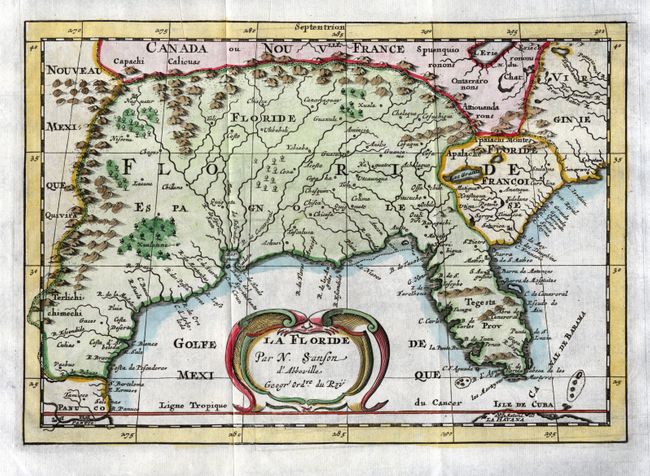
Auction 116, Lot 161
Subject: Colonial South
Sanson, Nicolas
La Floride, 1699
Size: 9.8 x 7 inches (24.9 x 17.8 cm)
Estimate: $600 - $700
Sold for: $550
Closed on 9/20/2006
238 lots
Page 1 of 5