Subject: United States
Period: 1846 (circa)
Publication: Smith's School Geography
Color: Hand Color
Size:
17.8 x 10.5 inches
45.2 x 26.7 cm
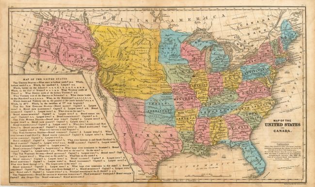
This interesting school atlas map has full original hand coloring to delineate the early territorial borders. Each state/territory is labeled with their population. The territories of Washington and Oregon extend to the Continental Divide. The entire Southwest is part of Mexico and is mostly covered by a large panel that is a teacher's aid with geographical questions. A huge Nebraska Territory extends between the Continental Divide and Minnesota and is bounded by Canada and Texas. Indian Territory does not have a panhandle, as that region is part of Texas. While the copyright date is 1839, the map shows an oversized Texas with the stovepipe panhandle and the lesson block at the left indicates Texas is a state; thus the circa date of 1846. Text on verso. Published for Smith by Daniel Burgess. Drawn and engraved by Stiles, Sherman & Smith.
References:
Condition: B
Dark impression with good original coloring. Some scattered foxing or toning. Several small binding stitch holes along centerfold that are mostly evident when held to the light.