Subject: Eastern United States
Period: 1801 (published)
Publication: Voyage dans la Haute Pennsylvanie…
Color: Hand Color
Size:
19.8 x 14 inches
50.3 x 35.6 cm
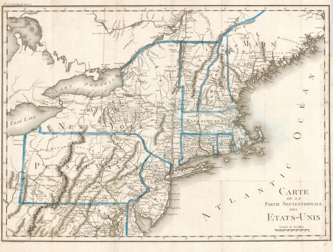
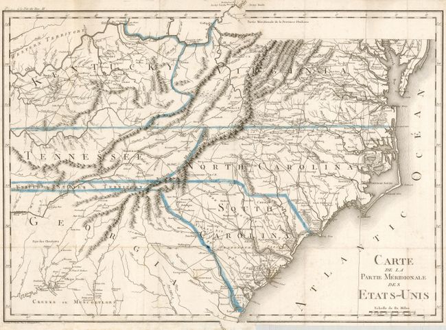
Fine matched pair of maps that describe the United States at the turn of the 18th Century. The southern sheet extends from Savanna to the Chesapeake Bay and east to show Kentucky, Tennessee and the Western Territory above the Ohio River. A thin strip of land extending westward between Georgia and Tennessee is called United States Territory. This region originally belonged to South Carolina but was ceded back to the United States in 1787. The northern sheet extends from the northern reaches of Chesapeake Bay to Maine and eastward to show most of Lake Erie. Both are filled with a remarkable number of place names and details including a well developed road system in the nascent nation. A large amount of information on Indian tribes and villages is included. The maps are from Crevecoeur's three volume work Voyage dans la Haute Pennsylvanie. Crevecoeur was a French immigrant to the United States who gain notoriety describing the emerging American national character in his Letters of an American Farmer, 1782. Rarely seen pair of maps engraved by Tardieu in Paris.
References:
Condition: B
Good impression with original coloring. Issued folding, now pressed flat. Both with a little occasional surface soiling, and binding trim, else very good.