Subject: Colonial United States
Period: 1730 (circa)
Publication: Atlas Nouveau, Contenant Toutes les Parties du Monde
Color: Hand Color
Size:
23.8 x 17.5 inches
60.5 x 44.5 cm
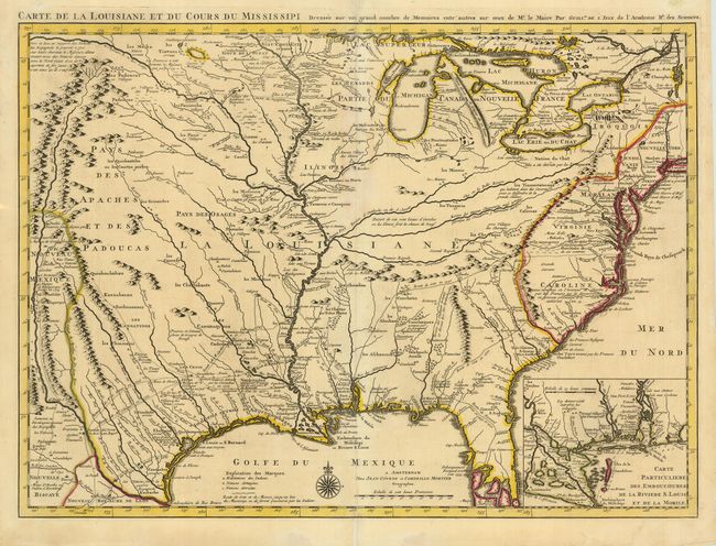
This is the updated version of Delisle's influential map of the French possession of Louisiana that drew together the cartographic work of the previous half century and had a tremendous impact on the history of cartography. When originally published in 1718, it was the first detailed map of the Gulf region and the Mississippi, and the first to show the explorations of De Soto, Cavelier, Tonty, Moscoso and Denis. The name Texas made its first appeared in print on this map, with the legend Mission de los Teijas, that was established in 1716. There is an inset of the Mississippi Delta and Mobile Bay. This is the Covens & Mortier issue, revised to include the newly founded settlement of New Orleans.
References: Cumming (SE) #208; Tooley (Amer) p.22, #45; cf. Wheat (TMW) #99; cf. Martin & Martin #19.
Condition: A
Fine impression and original outline color. Tissue repairs on minor fold separations. Margins slightly trimmed, but still ample.