Filtered by Category:Canada(Show All Categories)
Showing results for:Auction 116
Catalog Archive
19 lots
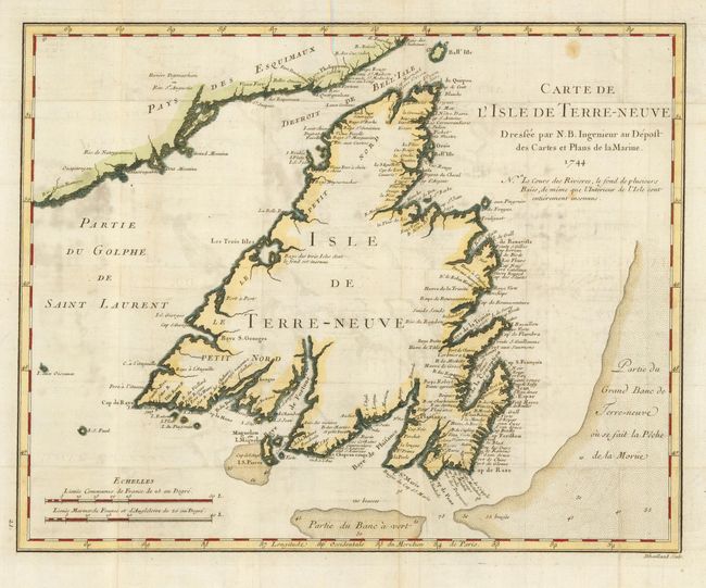
Auction 116, Lot 101
Subject: Canada
Bellin, Jacques Nicolas
Carte de l'Isle de Terre-Neuve, 1744
Size: 14.2 x 11.3 inches (36.1 x 28.7 cm)
Estimate: $140 - $180
Sold for: $100
Closed on 9/20/2006
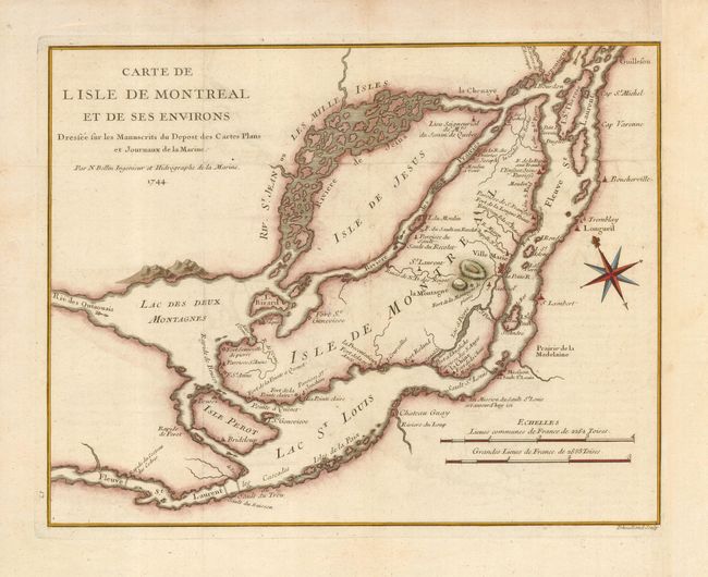
Auction 116, Lot 102
Subject: Canada, Montreal
Bellin, Jacques Nicolas
Carte de l'Isle de Montreal et de ses Environs Dressee sur les Manuscrits de Depost des Cartes Plans et Journaux de la Marine, 1744
Size: 12.3 x 9.5 inches (31.2 x 24.1 cm)
Estimate: $350 - $400
Sold for: $300
Closed on 9/20/2006
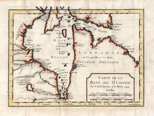
Auction 116, Lot 103
Subject: Canada
Bellin, Jacques Nicolas
Carte de la Baye de Hudson…, 1744
Size: 11.5 x 8.3 inches (29.2 x 21.1 cm)
Estimate: $120 - $160
Sold for: $90
Closed on 9/20/2006
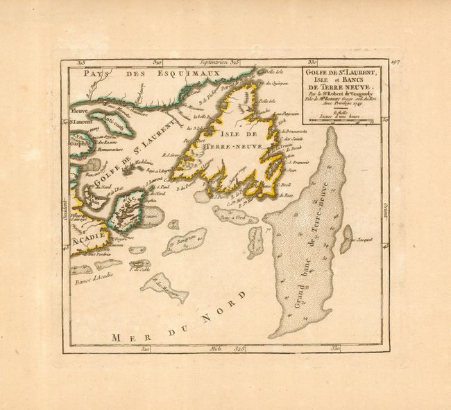
Auction 116, Lot 104
Subject: Canada
Robert de Vaugondy
Golfe de St. Laurent, Isle et Bancs de Terre Neuve, 1749
Size: 7 x 6.3 inches (17.8 x 16 cm)
Estimate: $100 - $150
Sold for: $110
Closed on 9/20/2006
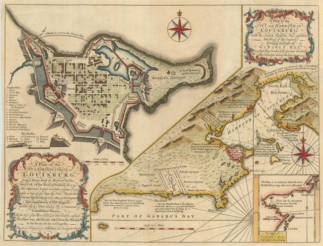
Auction 116, Lot 105
Subject: Canada
Gridley, Richard (Lt. Col.)
A Plan of the City & Fortifications of Louisburg… [on sheet with] A Plan of the City and Harbour of Louisburg…, 1758
Size: 14 x 10.5 inches (35.6 x 26.7 cm)
Estimate: $300 - $350
Sold for: $300
Closed on 9/20/2006
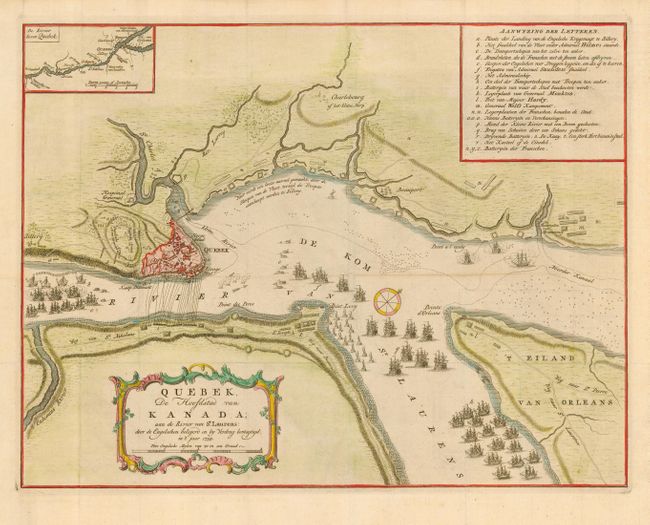
Auction 116, Lot 106
Subject: Canada, Quebec
Tirion, Isaac
Quebek, de Hoofdstad van Kanada; aan de Rivier van St. Laurens…, 1759
Size: 17 x 13 inches (43.2 x 33 cm)
Estimate: $250 - $300
Sold for: $350
Closed on 9/20/2006
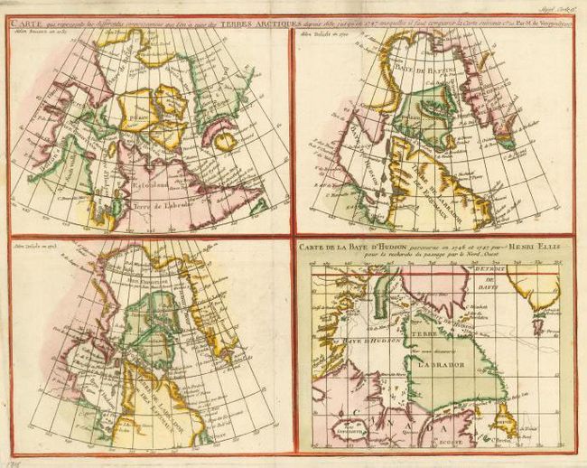
Auction 116, Lot 107
Subject: Canada - Hudson Bay
Robert de Vaugondy, Didier
Carte qui represente les differentes connoissances que l'on a eues des Terres Arctiques depuis 1650, jusqu ' en 1747…, 1773
Size: 14.8 x 11.5 inches (37.6 x 29.2 cm)
Estimate: $150 - $200
Unsold
Closed on 9/20/2006
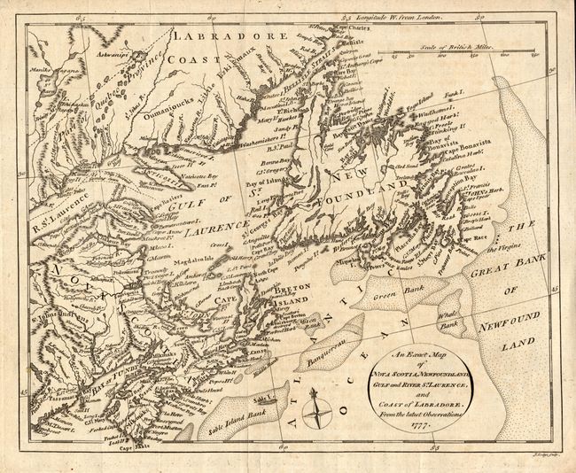
Auction 116, Lot 108
Subject: Canada
Russell, John C.
An Exact Map of Nova Scotia, Newfoundland, Gulf and River St. Laurence, and Coast of Labrador, from the latest Observations, 1777
Size: 10 x 8.3 inches (25.4 x 21.1 cm)
Estimate: $120 - $140
Sold for: $110
Closed on 9/20/2006
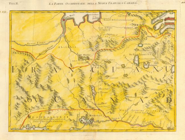
Auction 116, Lot 109
Subject: Canada
Zatta, Antonio
La Parte Occidentale della Nuova Francia o Canada, 1778
Size: 16.5 x 12 inches (41.9 x 30.5 cm)
Estimate: $200 - $250
Sold for: $150
Closed on 9/20/2006
Auction 116, Lot 110
Subject: Canada
Bonne/Lattre
Partie de l'Amerique Septentrionale qui comprend le Canada, la Louisiane, le Labrador, le Groenland, la Nouvelle Angleterre, la Floride &c., 1783
Size: 17 x 11.7 inches (43.2 x 29.7 cm)
Estimate: $250 - $325
Sold for: $180
Closed on 9/20/2006
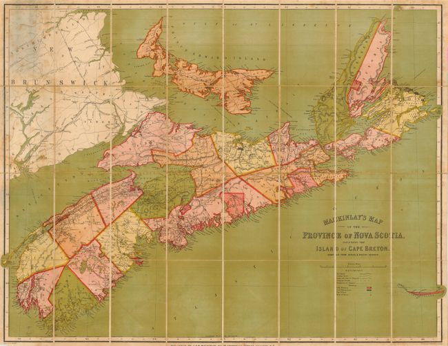
Auction 116, Lot 111
Subject: Canada
Mackinlay, A.
Mackinlay's Map of the Province of Nova Scotia, Including the Island of Cape Breton. Compiled from Actual & Recent Surveys, 1865
Size: 39 x 31 inches (99.1 x 78.7 cm)
Estimate: $350 - $450
Sold for: $300
Closed on 9/20/2006
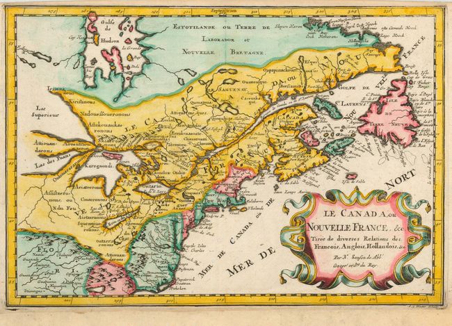
Auction 116, Lot 112
Subject: Colonial United States and Canada
Sanson, Nicolas
Le Canada, ou Nouvelle France, &c Tiree de diverses Relations des Francois, Anglois, Hollandois, &c., 1683
Size: 12 x 8 inches (30.5 x 20.3 cm)
Estimate: $550 - $650
Sold for: $550
Closed on 9/20/2006
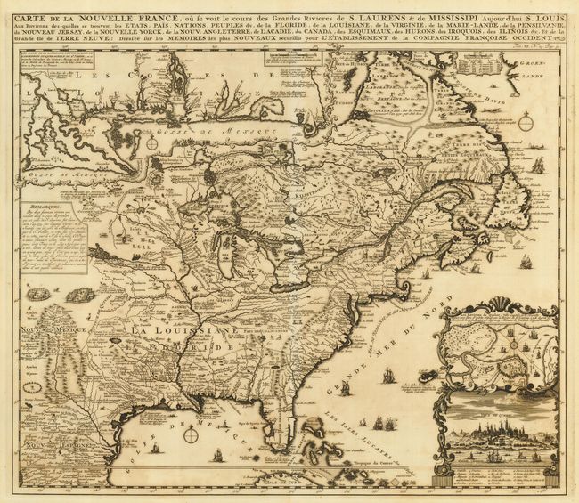
Auction 116, Lot 113
Subject: Colonial United States and Canada
Chatelain, Henry Abraham
Carte de la Nouvelle France, ou se voit le cours des Grandes Rivieres de S. Laurens & de Mississipi Aujour d'hui S. Louis, Aux Environs des-quelles se trouvent les Etats, Pais, Nations, Peuples &c., 1719
Size: 19 x 16.5 inches (48.3 x 41.9 cm)
Estimate: $2,400 - $2,750
Sold for: $2,400
Closed on 9/20/2006
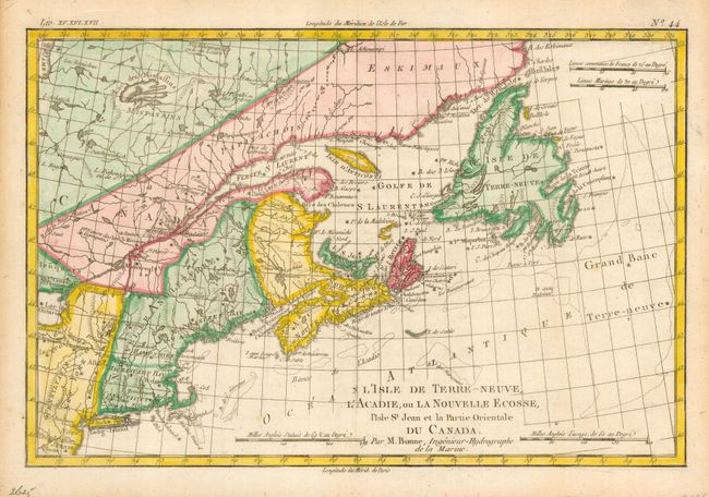
Auction 116, Lot 114
Subject: Colonial United States and Canada
Bonne, Rigobert
L'Isle de Terre-Neuve, L'Acadie, ou la Nouvelle Ecosse, l'Isle St Jean et la Partie Orientale du Canada, 1775
Size: 12.6 x 8.5 inches (32 x 21.6 cm)
Estimate: $200 - $250
Sold for: $160
Closed on 9/20/2006
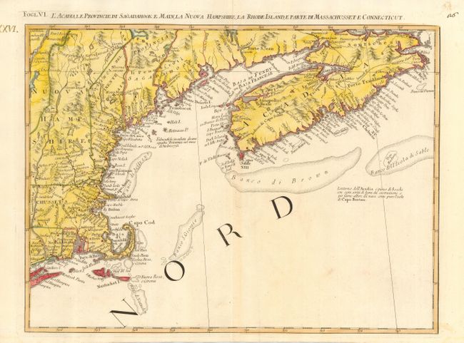
Auction 116, Lot 115
Subject: Colonial United States and Canada
Zatta, Antonio
L'Acadia, le Provincie di Sagadahook e Main, la Nuova Hampshire, la Rhode Island, e Parte di Massachusset e Connecticut, 1778
Size: 16.7 x 12.5 inches (42.4 x 31.8 cm)
Estimate: $300 - $400
Sold for: $400
Closed on 9/20/2006
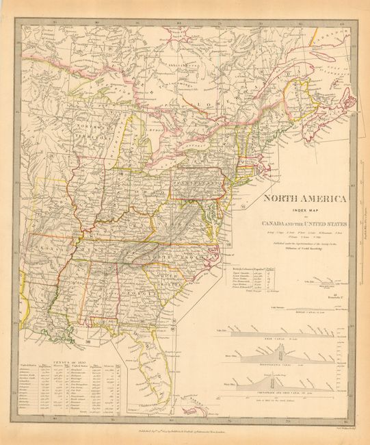
Auction 116, Lot 116
Subject: Canada & United States
SDUK Society for the Diffusion of Useful Knowledge
[Lot of 15 - Set Including Index and North America I through XIV], 1833-40
Size: 12 x 15 inches (30.5 x 38.1 cm)
Estimate: $800 - $1,000
Sold for: $850
Closed on 9/20/2006
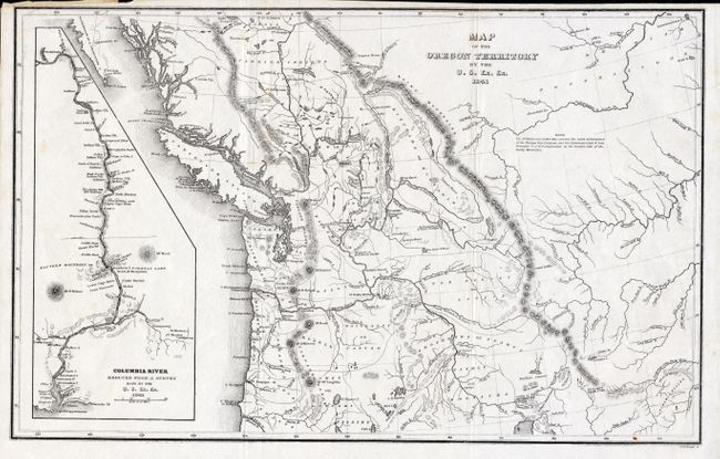
Auction 116, Lot 117
Subject: Northwestern United States and Canada
Wilkes, Charles
Map of the Oregon Territory by the U.S. Ex. Ex., 1841
Size: 13 x 8.5 inches (33 x 21.6 cm)
Estimate: $250 - $300
Sold for: $180
Closed on 9/20/2006
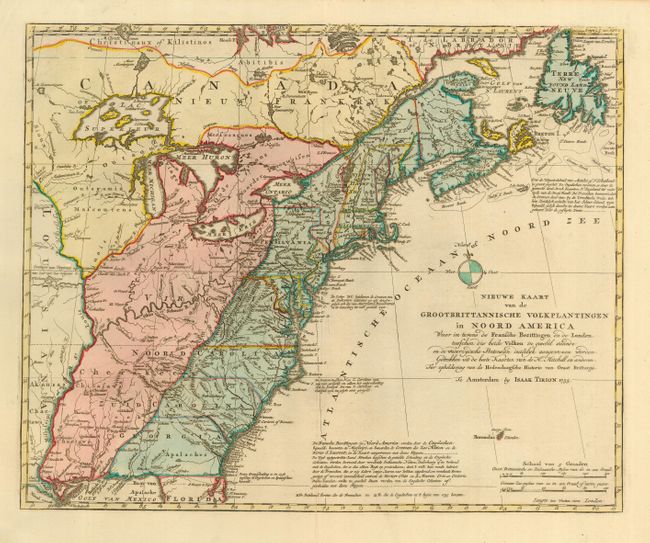
Auction 116, Lot 129
Subject: Colonial United States
Tirion, Isaac
Nieuwe Kaart van de Grootbrittannische Volkplantingen in Noord America, 1755
Size: 17.5 x 14 inches (44.5 x 35.6 cm)
Estimate: $850 - $950
Sold for: $700
Closed on 9/20/2006
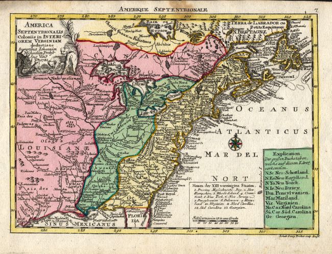
Auction 116, Lot 131
Subject: Eastern United States
Probst, Johann Michael
America Septentrionalis Coloniis in Interiorem Virginiam deductis &c, 1782
Size: 9.5 x 6.8 inches (24.1 x 17.3 cm)
Estimate: $700 - $800
Sold for: $375
Closed on 9/20/2006
19 lots