Subject: Eastern United States
Period: 1850 (circa)
Publication: Illustrated Atlas and Modern History of the World
Color: Hand Color
Size:
13.5 x 9.5 inches
34.3 x 24.1 cm
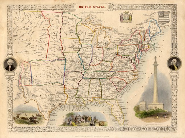
Terrific edition of this map features some interesting and unusual boundaries. The large Western Territory lies above a shortened Texas and stretches between New Mexico and the western boundaries of Missouri and Arkansas. The New Mexico or Santa Fe region lies east of the Rio Grande with Mexico to the west. A huge Missouri Territory occupies much of the Great Plains region, as it extends from an oddly shaped Nebraska and off the map to the west. Nebraska stretches from the Canadian border to the Western Territory as a thin strip of land lying against Minnesota and Iowa to the east. This beautifully engraved map is surrounded by a decorative border with portraits of Washington and Franklin. Within the map are vignettes of a buffalo hunt, Penn's treaty with the Indians, Washington's Monument in Baltimore, and two U.S. seals.
References:
Condition: B
Fine impression, original outline coloring, very good margins for this issue. A little surface soil or light toning in the area of New Mexico, else very good.