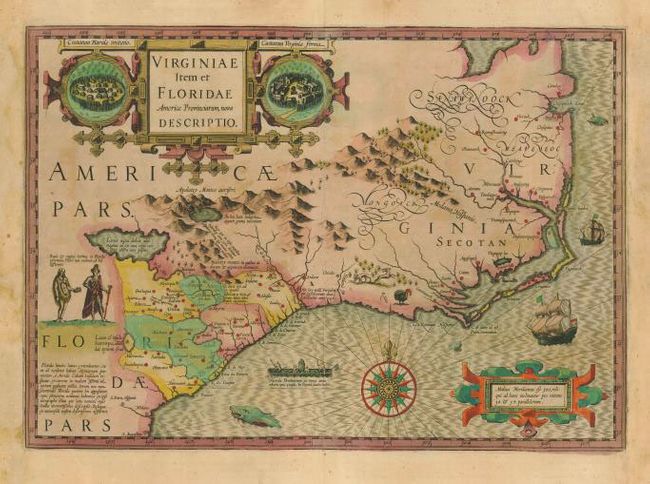
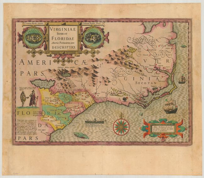
Subject: Colonial Southeast
Period: 1613 (published)
Publication: Gerardi Mercatoris Atlas sive Cosmographicae
Color: Hand Color
Size:
19 x 13.4 inches
48.3 x 34 cm
Superb map compiled from John White's map of Virginia and Jacques le Moyne's map of Florida as interpreted by Theodore de Bry. Largely due to the enormous success of this atlas, Le Moyne's erroneous depiction of a large inland lake from which the R. de May (St. John's River) flows in a southeasterly direction was popularized. Chesapeake Bay, here called Chesepioock Sinus, and the area south towards C.S. Romano Hispanis are shown in their White delineations. The Indian villages of Paquiwok, Croatoan, and Wococon are named in the Outer Banks and several others are located along the Albemarle and Pamlico Sounds. The map is extensively decorated with depictions of Indian villages incorporated in the title cartouche, a Floridian king and queen and Virginian natives in a canoe (after De Bry), wildlife including a wild turkey, ships, sea monsters and a superb compass rose. French text on verso.
References: Burden #151; Cumming (SE) #26; Williams & Johnson #3.
Condition: B
Lovely old color with slight oxidation and minor toning, else very good. Some paper restoration in blank margins, not affecting map.