Filtered by Category:United States(Show All Categories)
Showing results for:Auction 114
Catalog Archive
184 lots
Page 1 of 4
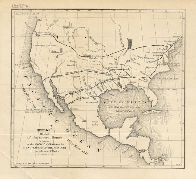
Auction 114, Lot 100
Subject: North America
U.S. Government
Mills' Map of the several Routes Proposed to the Pacific Ocean from the Head Waters of the Missouri, to the Isthmus of Darien, 1848
Size: 9 x 8.3 inches (22.9 x 21.1 cm)
Estimate: $200 - $300
Sold for: $60
Closed on 3/1/2006
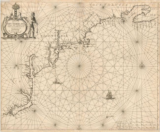
Auction 114, Lot 114
Subject: Colonial United States and Canada
Jacobsz, Anthonie
Pascaerte van Nieu Nederlant, Virginies, Nieu Engelant en Nova Francia, 1650
Size: 21 x 16.8 inches (53.3 x 42.7 cm)
Estimate: $2,100 - $2,300
Sold for: $7,000
Closed on 3/1/2006
Auction 114, Lot 115
Subject: Colonial United States and Canada
Duval, Pierre
Canada, 1672
Size: 4.8 x 3.8 inches (12.2 x 9.7 cm)
Estimate: $550 - $600
Sold for: $475
Closed on 3/1/2006
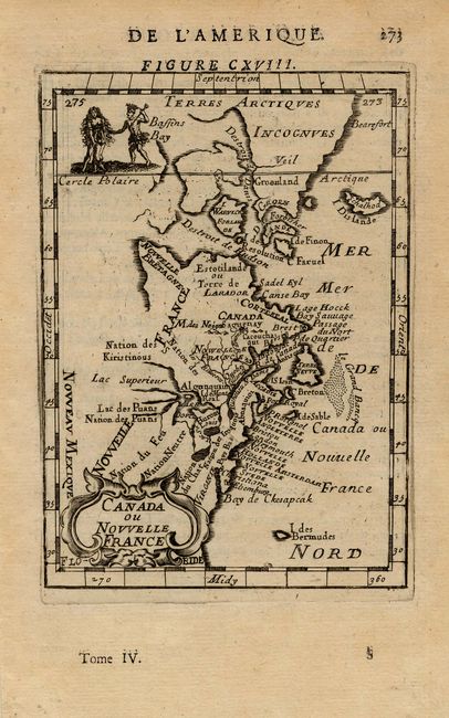
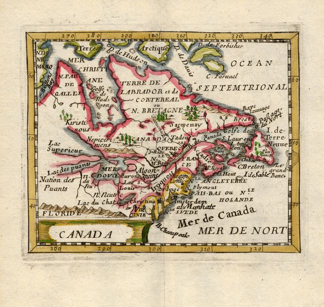
Auction 114, Lot 116
Subject: Canada and Colonial New England
Mallet, Alain Manesson
Canada ou Nouvelle France, 1683
Size: 4 x 6 inches (10.2 x 15.2 cm)
Estimate: $200 - $250
Sold for: $210
Closed on 3/1/2006
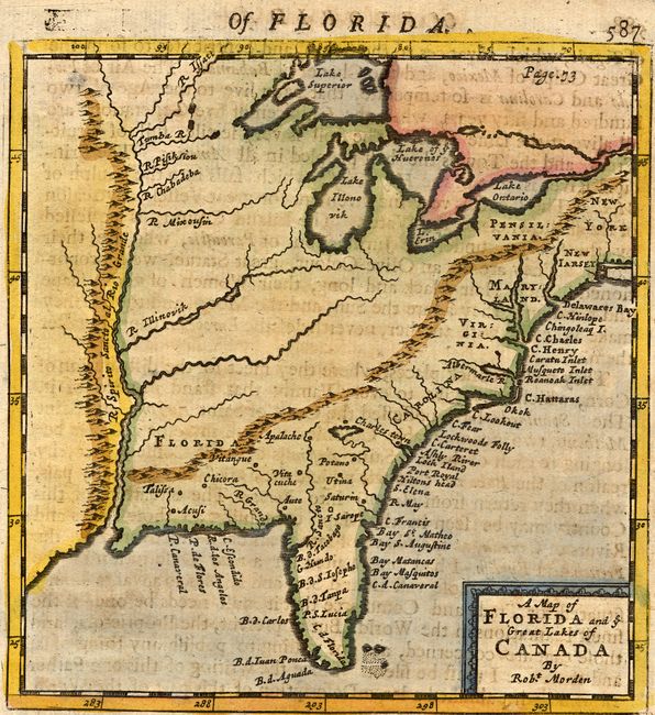
Auction 114, Lot 117
Subject: Colonial United States and Canada
Morden, Robert
A map of Florida and ye Great Lakes of Canada, 1693
Size: 5 x 5.2 inches (12.7 x 13.2 cm)
Estimate: $400 - $450
Sold for: $700
Closed on 3/1/2006
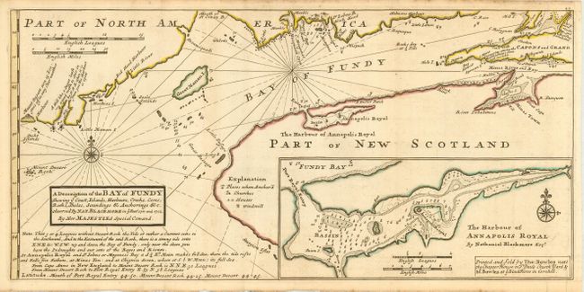
Auction 114, Lot 118
Subject: Canada and Maine
Moll, Herman
A Description of the Bay of Fundy Showing ye Coast, Islands, Harbours, Creeks, Coves, Rocks, Sholes, Soundings & Anchorings &c., 1745
Size: 17 x 8.2 inches (43.2 x 20.8 cm)
Estimate: $325 - $375
Sold for: $250
Closed on 3/1/2006
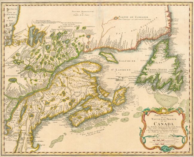
Auction 114, Lot 119
Subject: Canada and Colonial New England
Homann Heirs
Partie Orientale de la Nouvelle France ou du Canada, 1755
Size: 21.3 x 17 inches (54.1 x 43.2 cm)
Estimate: $700 - $750
Sold for: $650
Closed on 3/1/2006
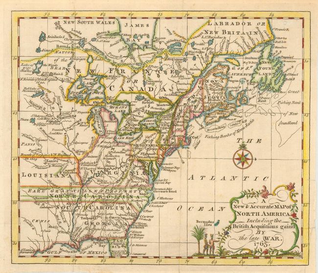
Auction 114, Lot 120
Subject: Colonial United States and Canada
Entick, John
A New & Accurate Map of North America Including the British Acquisitions gain'd By the late War, 1763
Size: 9 x 7.6 inches (22.9 x 19.3 cm)
Estimate: $375 - $450
Sold for: $500
Closed on 3/1/2006
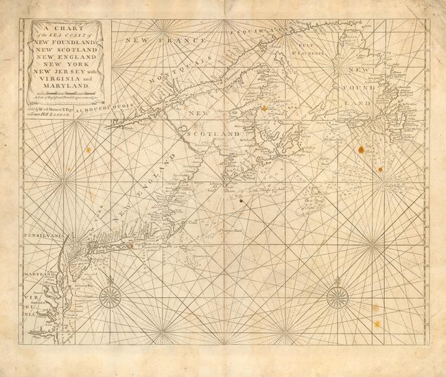
Auction 114, Lot 121
Subject: Colonial United States and Canada
Thornton, John
A Chart of the Sea Coast of New Foundland New Scotland New England New York New Jersey with Virginia and Maryland, 1770
Size: 23 x 17.8 inches (58.4 x 45.2 cm)
Estimate: $1,500 - $1,600
Sold for: $975
Closed on 3/1/2006
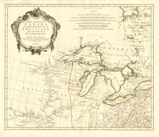
Auction 114, Lot 122
Subject: Colonial Great Lakes
D'Anville/Santini
Partie Occidentale du Canada et Septentrionale de la Louisiane avec une partie de la Pensilvanie, 1775
Size: 22.5 x 19 inches (57.2 x 48.3 cm)
Estimate: $1,000 - $1,200
Sold for: $1,100
Closed on 3/1/2006
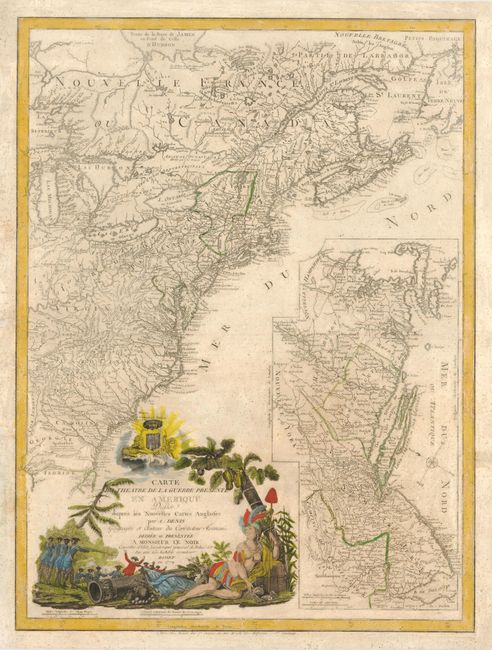
Auction 114, Lot 123
Subject: Colonial United States and Canada
Denis, Louis
Carte du Theatre de la Guerre Presente en Amerique Dressee d'apres les Nouvelles Cartes Anglaises, 1779
Size: 19.5 x 26 inches (49.5 x 66 cm)
Estimate: $3,000 - $4,000
Unsold
Closed on 3/1/2006
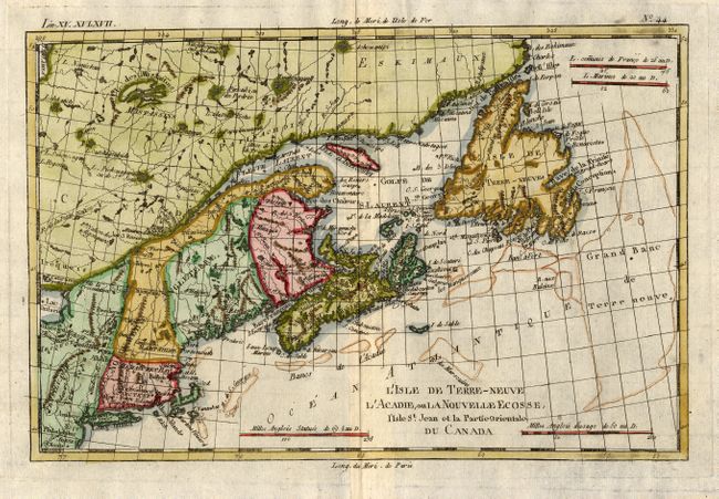
Auction 114, Lot 124
Subject: Canada and New England
Bonne, Rigobert
L'Isle de Terre-Neuve, L'Acadie, ou la Nouvelle Ecosse, l'Isle St Jean et la Partie Orientale du Canada, 1783
Size: 12.5 x 8.2 inches (31.8 x 20.8 cm)
Estimate: $200 - $250
Sold for: $170
Closed on 3/1/2006
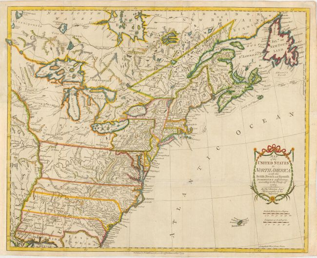
Auction 114, Lot 125
Subject: United States and Canada
Kitchin, Thomas
Map of the United States in North America: with the British, French and Spanish Dominions adjoining, according to the Treaty of 1783, 1783
Size: 20 x 16 inches (50.8 x 40.6 cm)
Estimate: $1,200 - $1,500
Sold for: $1,600
Closed on 3/1/2006
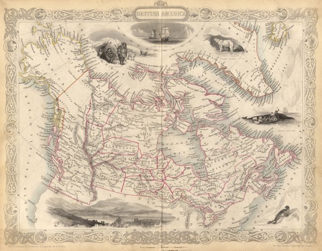
Auction 114, Lot 126
Subject: Canada and Alaska
Tallis, John
British America, 1850
Size: 12.8 x 9.8 inches (32.5 x 24.9 cm)
Estimate: $150 - $200
Sold for: $190
Closed on 3/1/2006
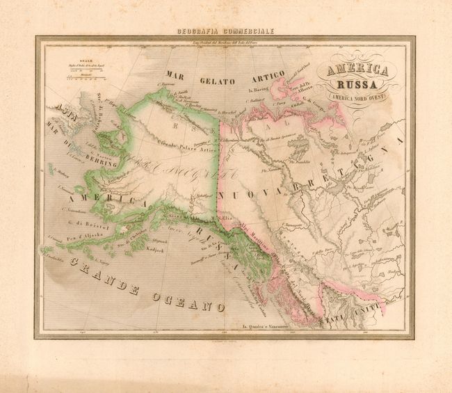
Auction 114, Lot 127
Subject: Canada and Alaska
Marmocchi, Francesco
America Russia America Nord Ouest, 1858
Size: 13.3 x 10.5 inches (33.8 x 26.7 cm)
Estimate: $150 - $250
Sold for: $100
Closed on 3/1/2006
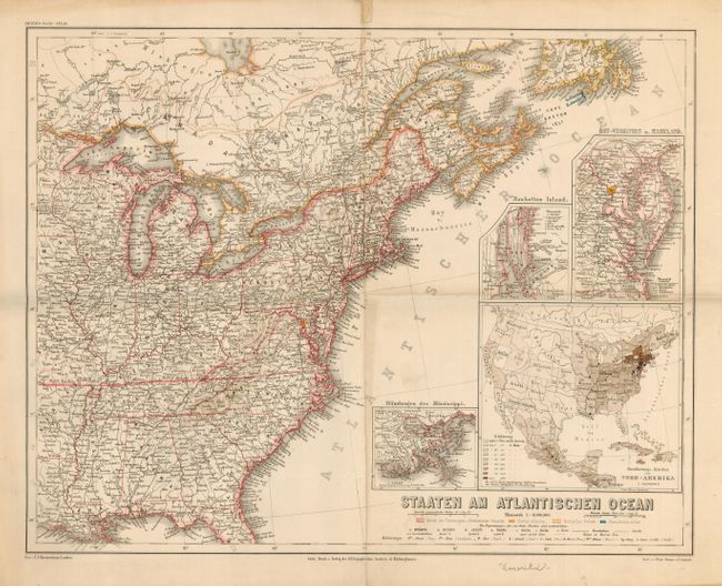
Auction 114, Lot 128
Subject: Eastern United States and Canada
Meyer, Joseph
Staaten Am Atlantischen Ocean, 1865
Size: 17 x 13.2 inches (43.2 x 33.5 cm)
Estimate: $80 - $100
Sold for: $60
Closed on 3/1/2006
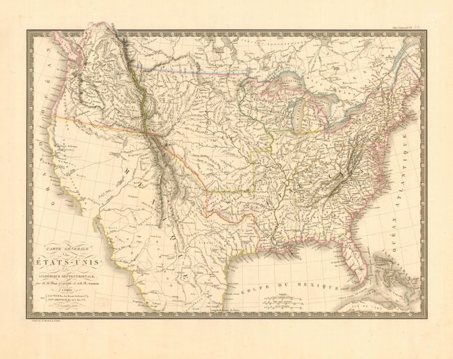
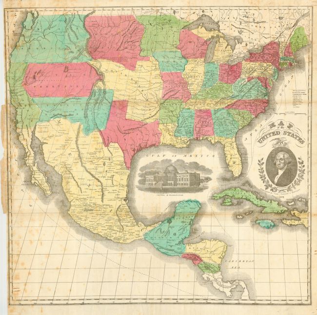
Auction 114, Lot 129
Subject: United States
Brue, Adrien Hubert
Carte Generale des Etats-Unis de l'Amerique Septentrionale, 1820
Size: 19.8 x 14.3 inches (50.3 x 36.3 cm)
Estimate: $600 - $700
Unsold
Closed on 3/1/2006
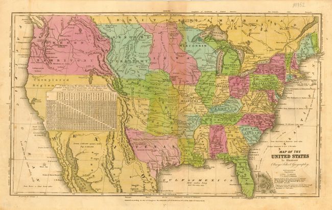
Auction 114, Lot 130
Subject: United States
Olney, Jesse
Map of the United States to Illustrate Olney's School Geography, 1840
Size: 16.5 x 10 inches (41.9 x 25.4 cm)
Estimate: $140 - $180
Sold for: $325
Closed on 3/1/2006
Auction 114, Lot 131
Subject: United States
Hayward, George
The United States from the Latest Authorities, 1849
Size: 41 x 24 inches (104.1 x 61 cm)
Estimate: $300 - $350
Sold for: $375
Closed on 3/1/2006
Auction 114, Lot 132
Subject: United States
Smith, Roswell C.
Map of the United States and Canada, 1853
Size: 17.6 x 10.5 inches (44.7 x 26.7 cm)
Estimate: $90 - $110
Sold for: $180
Closed on 3/1/2006
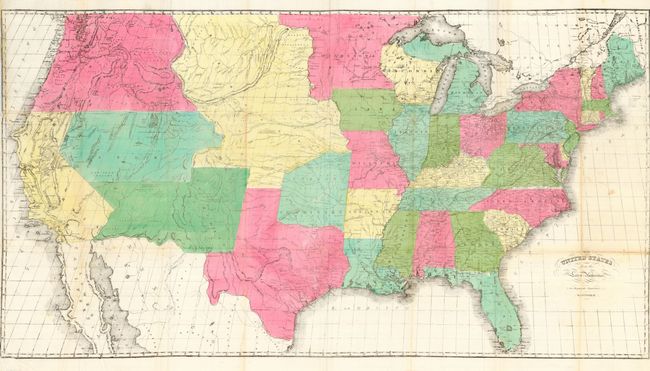
Auction 114, Lot 133
Subject: United States
Case, Tiffany & Company
Map of the United States, 1854
Size: 23.5 x 24 inches (59.7 x 61 cm)
Estimate: $400 - $500
Sold for: $550
Closed on 3/1/2006
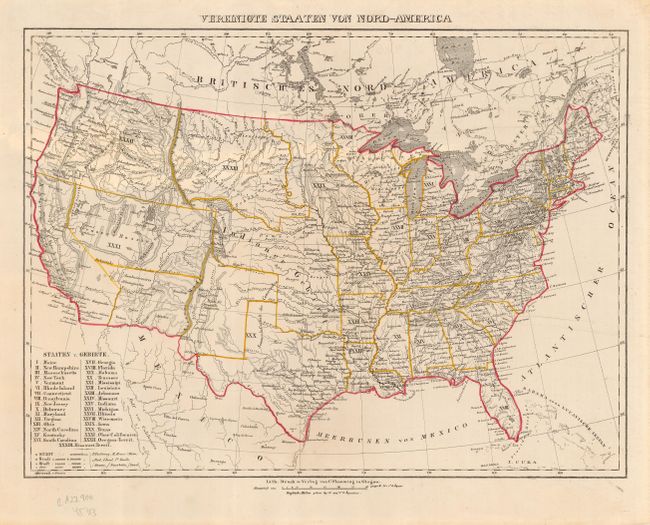
Auction 114, Lot 134
Subject: United States
Flemming, Carl
Vereinigte Staaten von Nord-America, 1855
Size: 16.2 x 12 inches (41.1 x 30.5 cm)
Estimate: $200 - $240
Sold for: $150
Closed on 3/1/2006
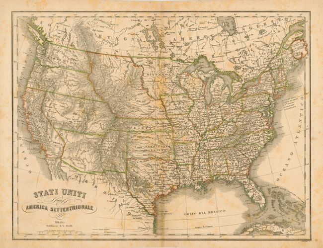
Auction 114, Lot 135
Subject: United States
Civelli, G.
Stati Uniti dell'America Settentrionale, 1858
Size: 15.3 x 11.8 inches (38.9 x 30 cm)
Estimate: $180 - $220
Sold for: $100
Closed on 3/1/2006
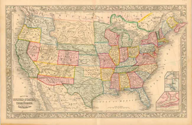
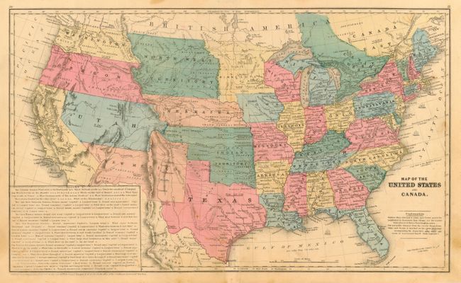
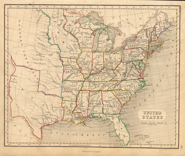
Auction 114, Lot 136
Subject: United States
Mitchell, Samuel Augustus
Map of the United States, and Territories. Together with Canada &c., 1860
Size: 21 x 13.3 inches (53.3 x 33.8 cm)
Estimate: $300 - $400
Sold for: $350
Closed on 3/1/2006
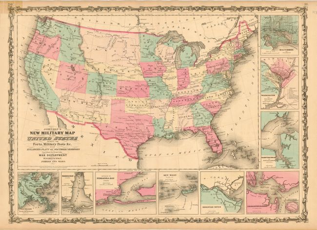
Auction 114, Lot 137
Subject: United States
Johnson & Ward
Johnson's New Military Map of the United States Showing the Forts, Military Posts &c. all the Military Divisions with Enlarged Plans of Southern Harbors…, 1861
Size: 23.5 x 17 inches (59.7 x 43.2 cm)
Estimate: $180 - $200
Sold for: $210
Closed on 3/1/2006
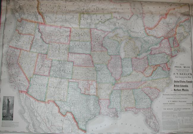
Auction 114, Lot 138
Subject: United States
Neely, F.T.
Neely's New Reversible Historical Chart, Political Map and United States Map Combined, 1893
Size: 66 x 44 inches (167.6 x 111.8 cm)
Estimate: $400 - $600
Sold for: $600
Closed on 3/1/2006
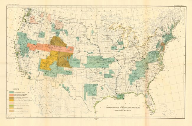
Auction 114, Lot 139
Subject: United States
U.S. Geological Survey (USGS)
Map Showing Progress of Triangulation Topography and Astronomical Location, 1893
Size: 28 x 17.5 inches (71.1 x 44.5 cm)
Estimate: $70 - $100
Sold for: $300
Closed on 3/1/2006
Auction 114, Lot 140
Subject: United States
Various
[Lot of 7 - United States], 1795-1840
Size: See Description
Estimate: $250 - $350
Sold for: $375
Closed on 3/1/2006
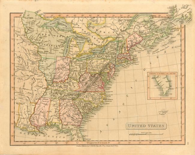
Auction 114, Lot 141
Subject: United States
Cassell & Galpin
[Lot of 6 - U.S. Cities], 1872
Size: 9 x 5.5 inches (22.9 x 14 cm)
Estimate: $140 - $180
Sold for: $70
Closed on 3/1/2006
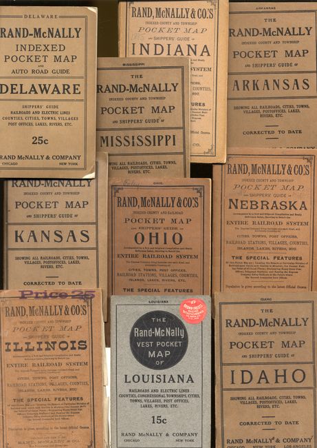
Auction 114, Lot 142
Subject: United States
Rand McNally & Co.
[Lot of 9 - State Pocket Maps], 1885-1919
Size: See Description
Estimate: $600 - $700
Sold for: $475
Closed on 3/1/2006
Auction 114, Lot 143
Subject: United States - Eastern
Brown, Thomas
A New and Accurate Map of the United States of America, &c. from the best Authorities, 1790
Size: 13.3 x 10.8 inches (33.8 x 27.4 cm)
Estimate: $700 - $800
Sold for: $600
Closed on 3/1/2006
Auction 114, Lot 144
Subject: United States - Eastern
Walch, Johannes
Die Vereinigten Staaten von Noord-Amerika, 1795
Size: 8.7 x 7.4 inches (22.1 x 18.8 cm)
Estimate: $275 - $325
Sold for: $275
Closed on 3/1/2006
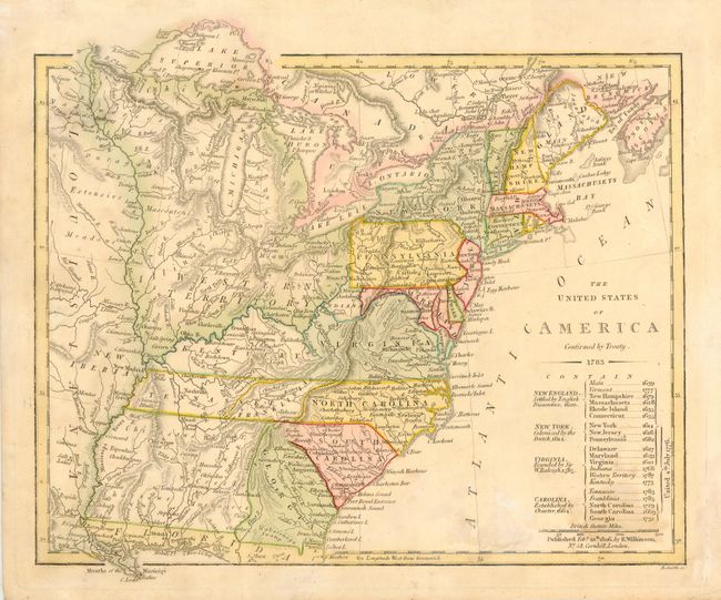
Auction 114, Lot 145
Subject: United States - Eastern
Wilkinson, Robert
The United States of America Confirmed by Treaty 1783, 1806
Size: 11 x 9.3 inches (27.9 x 23.6 cm)
Estimate: $450 - $500
Sold for: $450
Closed on 3/1/2006
Auction 114, Lot 146
Subject: United States - Eastern
Smith, Charles
United States, 1820
Size: 13.8 x 10.5 inches (35.1 x 26.7 cm)
Estimate: $275 - $325
Sold for: $200
Closed on 3/1/2006
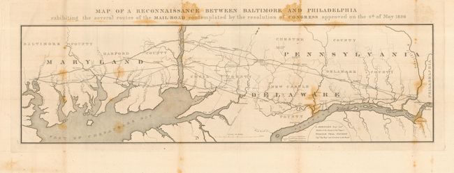
Auction 114, Lot 147
Subject: United States - Eastern
U.S. Corps of Engineers
Map of a Reconnaissance Between Baltimore and Philadelphia exhibiting the several routes of the Mail Road contemplated by the resolution of Congress approved on the 4th of May 1826, 1826
Size: 31 x 10 inches (78.7 x 25.4 cm)
Estimate: $220 - $275
Sold for: $160
Closed on 3/1/2006
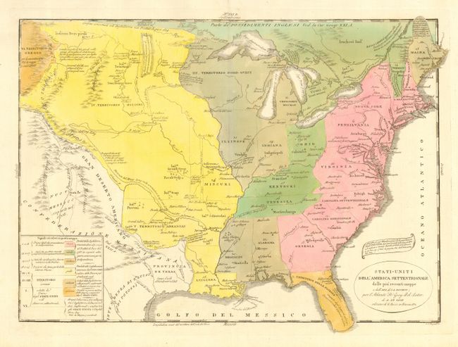
Auction 114, Lot 148
Subject: United States - Eastern
Le Sage
Stati-Uniti dell'America Settentrionale dalle piu recenti mappe…, 1832
Size: 18 x 13.5 inches (45.7 x 34.3 cm)
Estimate: $400 - $450
Unsold
Closed on 3/1/2006
Auction 114, Lot 149
Subject: United States - Eastern
Teesdale, Henry
United States, 1834
Size: 16.2 x 13 inches (41.1 x 33 cm)
Estimate: $180 - $220
Sold for: $190
Closed on 3/1/2006
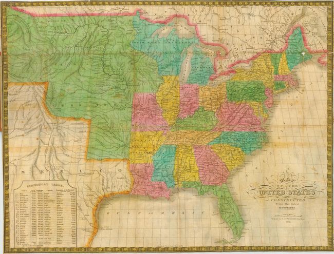
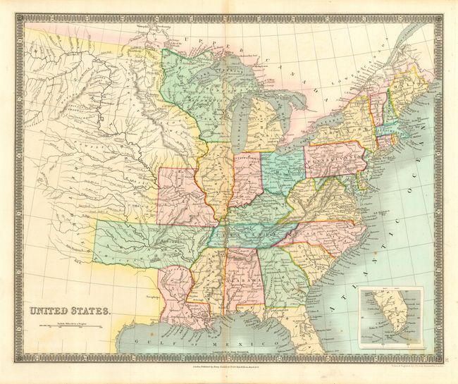
Auction 114, Lot 150
Subject: United States - Eastern
Williams, C. S.
Map of the United States Constructed from the Latest Authorities, 1834
Size: 22 x 16.2 inches (55.9 x 41.1 cm)
Estimate: $1,000 - $1,200
Sold for: $750
Closed on 3/1/2006
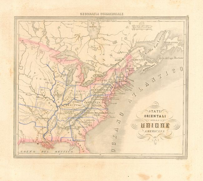
Auction 114, Lot 151
Subject: United States - Eastern
Marmocchi, Francesco
Stati Orientali della Unione Americana, 1858
Size: 13.3 x 10.5 inches (33.8 x 26.7 cm)
Estimate: $150 - $200
Unsold
Closed on 3/1/2006
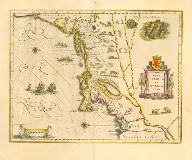
Auction 114, Lot 152
Subject: Colonial New England
Blaeu, Willem
Nova Belgica et Anglia Nova, 1640
Size: 19.7 x 15.2 inches (50 x 38.6 cm)
Estimate: $3,000 - $3,500
Sold for: $2,750
Closed on 3/1/2006
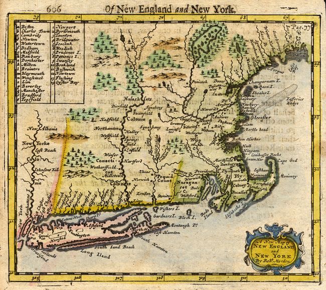
Auction 114, Lot 153
Subject: Colonial New England
Morden, Robert
A New Map of New England and New York, 1693
Size: 5.7 x 5 inches (14.5 x 12.7 cm)
Estimate: $350 - $450
Sold for: $700
Closed on 3/1/2006
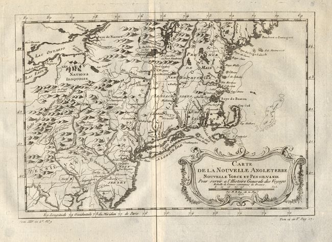
Auction 114, Lot 154
Subject: Colonial New England and Mid-Atlantic
Bellin, Jacques Nicolas
Carte de la Nouvelle Angleterre, Nouvelle Yorck et Pensilvanie, 1757
Size: 11 x 7.5 inches (27.9 x 19.1 cm)
Estimate: $325 - $375
Sold for: $240
Closed on 3/1/2006
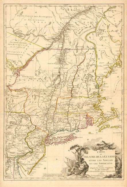
Auction 114, Lot 155
Subject: Colonial Northeast
Brion de la Tour, Louis
Carte du Theatre de la Guerre Entre les Anglais et les Americains: Dressee d'apres les Cartes Anglaises les plus modernes, 1777
Size: 20 x 29.3 inches (50.8 x 74.4 cm)
Estimate: $4,000 - $5,000
Sold for: $3,250
Closed on 3/1/2006
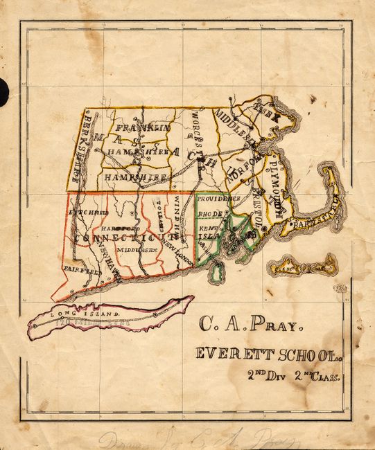
Auction 114, Lot 156
Subject: New England
[Manuscript School Map], 1815
Size: 8.5 x 10.3 inches (21.6 x 26.2 cm)
Estimate: $120 - $180
Unsold
Closed on 3/1/2006
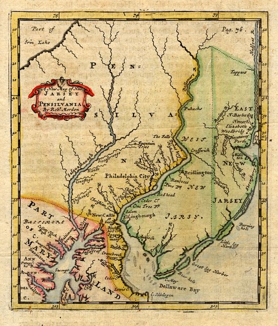
Auction 114, Lot 157
Subject: Colonial Mid Atlantic
Morden, Robert
A New Map of New Jarsey and Pensilvania, 1693
Size: 4.8 x 5.6 inches (12.2 x 14.2 cm)
Estimate: $450 - $550
Sold for: $550
Closed on 3/1/2006
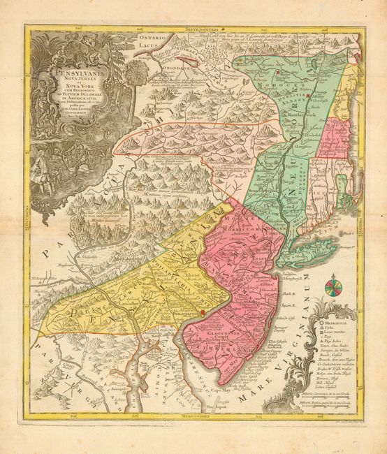
Auction 114, Lot 158
Subject: Colonial Mid Atlantic
Seutter/Lotter
Pensylvania Nova Jersey et Nova York cum Regionibus ad Fluvium Delaware in America Sitis…, 1750
Size: 19.5 x 22.5 inches (49.5 x 57.2 cm)
Estimate: $2,400 - $2,750
Sold for: $1,800
Closed on 3/1/2006
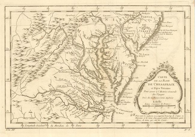
Auction 114, Lot 159
Subject: Colonial Mid Atlantic
Bellin, Jacques Nicolas
Carte de la Baye de Chesapeack et Pays Voisins, 1773
Size: 11.4 x 7.5 inches (29 x 19.1 cm)
Estimate: $325 - $375
Sold for: $325
Closed on 3/1/2006
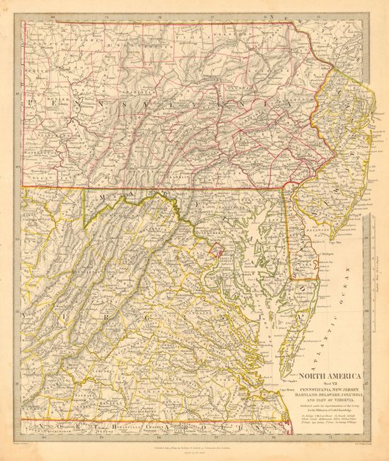
Auction 114, Lot 160
Subject: United States - Mid-Atlantic
SDUK Society for the Diffusion of Useful Knowledge
North America Sheet VII - Pennsylvania, New Jersey, Maryland, Delaware, Columbia and part of Virginia, 1833
Size: 12.3 x 14.7 inches (31.2 x 37.3 cm)
Estimate: $75 - $100
Sold for: $55
Closed on 3/1/2006
Auction 114, Lot 161
Subject: Colonial South
Keulen, Gerard van
Les Costes de la Louisiane de Plus la Baye de l'Ascension Jusques a celle de St. Joseph…, 1719
Size: 11 x 5 inches (27.9 x 12.7 cm)
Estimate: $275 - $325
Sold for: $800
Closed on 3/1/2006
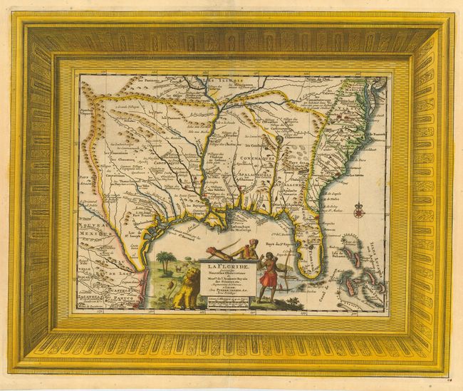
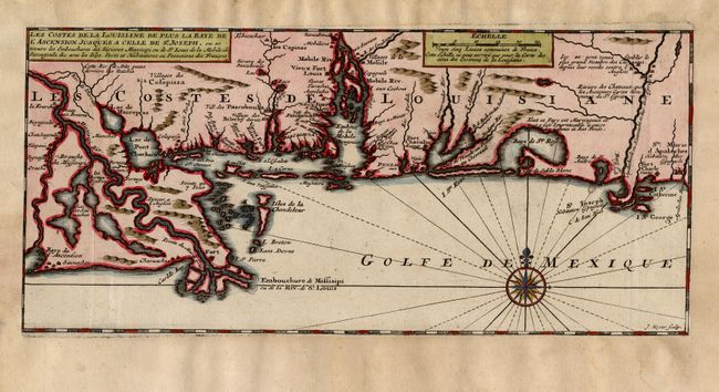
Auction 114, Lot 162
Subject: Colonial South
Aa, Pieter van der
La Floride, Suivant les Nouvelles Observations…, 1729
Size: 16 x 13.2 inches (40.6 x 33.5 cm)
Estimate: $2,000 - $2,300
Sold for: $1,900
Closed on 3/1/2006
184 lots
Page 1 of 4