Subject: United States
Period: 1820 (dated)
Publication: Atlas Universel de Geographie…
Color: Hand Color
Size:
19.8 x 14.3 inches
50.3 x 36.3 cm
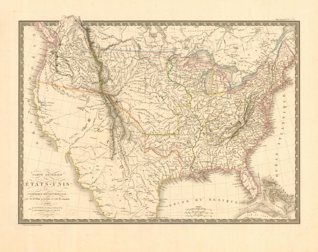
Very uncommon and finely engraved map covering the United States with most of Mexico and a bit of Canada. The United States are shown with their claims into British Columbia (District de la Colombia) and Mexico still controls all of Texas and the Southwest, most of which is blank with only conjectural topography shown. The western territories include Michigan Territory, North West Territory (encompassing present-day Wisconsin and Minnesota), a large Arkansas Territory and loosely formed districts in the part of Louisiana Territory that would eventually become Missouri; Howard, St. Louis, Girardeau, and Laurence.
References:
Condition: A
Some soil and light foxing in blank margins. Bottom fold separated, not affecting map.