Subject: United States - Eastern
Period: 1790 (circa)
Publication: General Atlas
Color: Hand Color
Size:
13.3 x 10.8 inches
33.8 x 27.4 cm
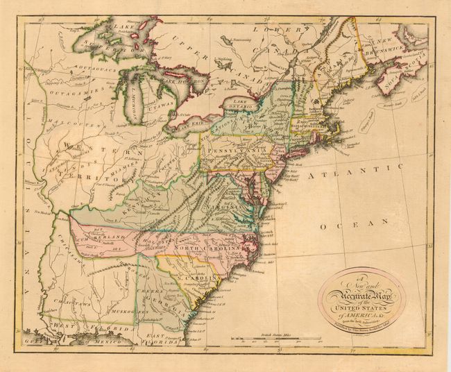
A very scarce little map published in the first general atlas published in Scotland. The map covers the region from the eastern seaboard to the Mississippi River. Western Territory takes in all the area west of the Ohio River with several Indian tribes located within it. Kentucky occupies a loosely organized region west of Virginia. In present-day Tennessee are the North Carolina land grants of Cumberland and Holston. An unnamed territory in the region of Mississippi and Alabama is the tribal territory of the Chicasaws, Cherokees, Chactaws and Muskogees. Main [sic] is noted as belonging to Massachusetts Bay. Not listed in McCorkle or any other reference we consulted.
References:
Condition: A
Original color and good impression printed on hand laid paper with a nice watermark. Lightly toned with a bit of minor surface soil. Couple of repaired tears in margins.