Subject: Colonial Great Lakes
Period: 1775 (dated)
Publication: Atlas Universel
Color: Hand Color
Size:
22.5 x 19 inches
57.2 x 48.3 cm
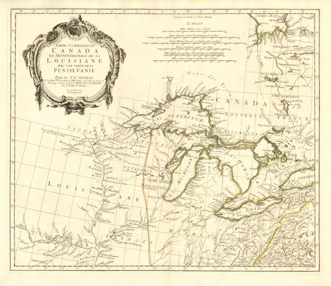
Very fine and uncommon map of the Great Lakes and upper Mississippi River region based on D'Anville's influential map of North America (1746). The map extends from the upper Mississippi River valley east to include most of Lake Ontario, north to James Bay and southeast to Philadelphia. Chicagon (Chicago) is named along with other early settlements, numerous French forts, and Indian villages. The map includes a fine depiction of the Missouri River to Kansez including Ft. d'Orleans. D’Anville influenced not only French, but also all contemporary geographers in the second half of the 18th century. According to Tooley "His representation of the Great Lakes is superior to that of his contemporary, John Mitchell." Second state published in 1776-84.
References: Kershaw #978; Tooley (Amer) p. 317.
Condition: A
Fine impression and original outline color. Small tear in bottom blank margin, closed with archival tape.