Subject: Canada and Maine
Period: 1745 (circa)
Publication: Atlas Minor
Color: Hand Color
Size:
17 x 8.2 inches
43.2 x 20.8 cm
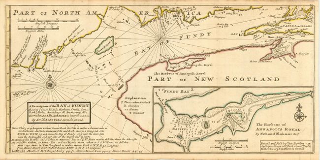
Fascinating map covering part of the coast of Maine, New Brunswick and Nova Scotia. Identified off the Maine coast are Mount Desart Rock, Great Manan I., Machias and the mouth of the St. Croix River. The map is filled with interesting notations to assist the navigator, such as "Mount Desart seen 15 leagues off in very clear weather" and "A hill like a Sugar Loafe, a good mark to steer in by N.N.E. when it is N. from you the Harbour is open." Large inset of "The Harbour of Annapolis Royal" in Nova Scotia. The description of the Bay of Fundy is as observed by Nat. Blackmore in the years 1711 and 1712. Two compass roses and two distance scales. Third state with Moll's imprint replaced with the Imprint of Thomas Bowles as publisher.
References: Kershaw #763; Phillips (A) 574-54.
Condition: A
Very nice impression on a sheet of hand laid paper with original margins and large fleur-de-lys watermark. A hint of toning, mostly along fold, still very good.