Subject: United States - Eastern
Period: 1834 (dated)
Publication: A New General Atlas of the World
Color: Hand Color
Size:
16.2 x 13 inches
41.1 x 33 cm
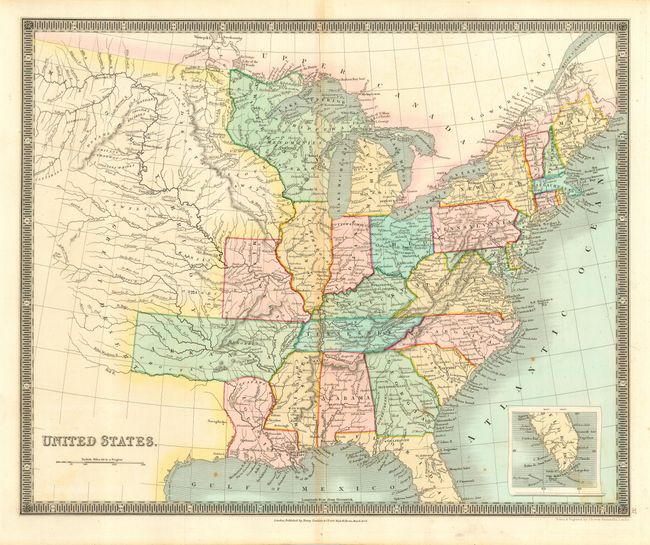
This map features a large Arkansas Territory that extends into today's Oklahoma. The map extends well into the West, here labeled the Great Desert and Missouri Territory, as distinct from the state of Missouri that is also shown. The Northwest Territory covers all of Wisconsin and northern Minnesota. The map is filled with information and locates many Indian tribes, forts, early settlements and topography. Inset on the same scale shows the southern half of Florida. Well engraved with fine detail throughout. Decorative keyboard-style border.
References:
Condition: B
Fine coloring and beautiful, dark impression. A little centerfold toning and a couple spots, else very good.