Subject: Colonial United States and Canada
Period: 1650 (circa)
Publication:
Color: Black & White
Size:
21 x 16.8 inches
53.3 x 42.7 cm
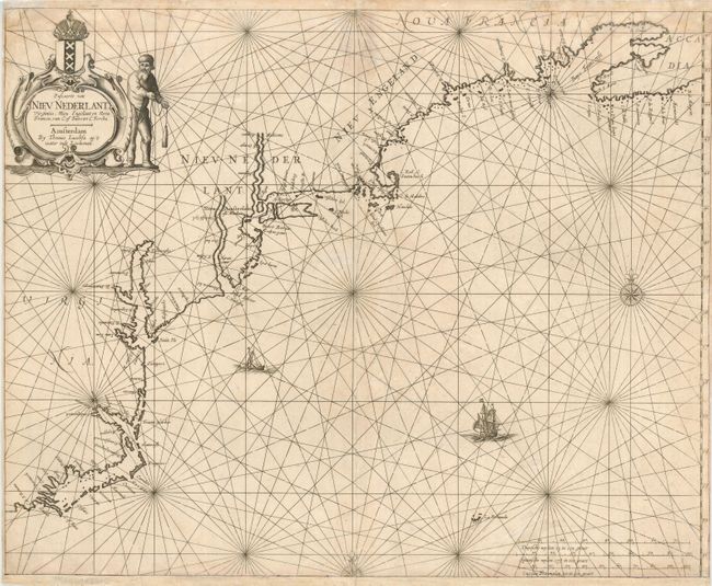
Rare sea chart of the coast of North America from the outer banks of North Carolina to Nova Scotia. The chart follows the outline and nomenclature of Jansson's Nova Anglia Novum Belgium (1636) with the notable exception of the Delaware River. Here Jacobsz introduces several new place names (F. Nassau among others), laying a Dutch claim to the river that the Swedish had recently colonized. The cartouche is embellished with the cartographer's family symbol of a sailor holding a lead and line, and the official coat of arms of the Dutch West India Company. According to Burden, this may be the first Dutch sea chart of the New Netherlands as he believes it was issued prior to Colom's chart of 1656, which has also been attributed as such. This is the first state with a single cartouche and unembellished scales.
References: Burden #297.
Condition: B
Trimmed to neatline at bottom and remargined with facsimile of neatline. Very close side margins as is often the case with sea charts. Some light damp stains at top. Short fold separations with imperfect repairs.