Subject: United States
Period: 1858 (circa)
Publication: Atlante geografico
Color: Hand Color
Size:
15.3 x 11.8 inches
38.9 x 30 cm
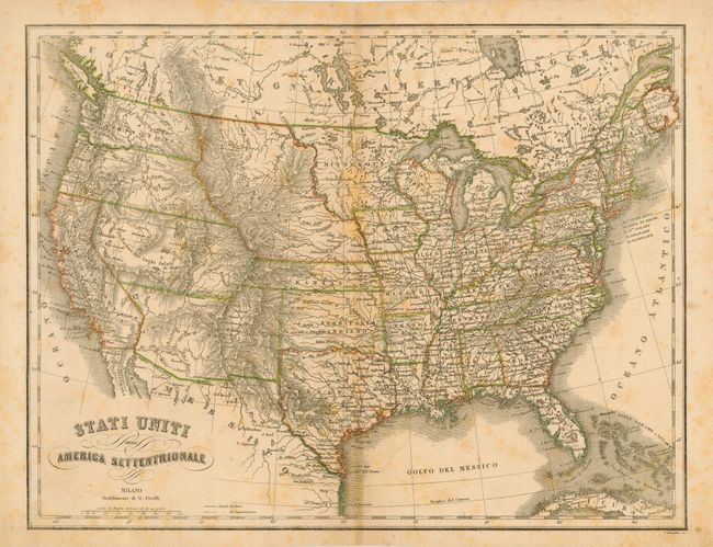
A scarce Italian produced map of the United States during a time of very interesting territorial borders just before the onset of the Civil War. Here Minnesota includes most of present day North and South Dakota. Nebraska and Kansas Territories fill the entire plains region with Nebraska extending all the way to the Canadian boundary. Washington and Oregon both extend eastward to the Rocky Mountains. Utah and New Mexico are both shown in their largest configurations. No sign yet of Arizona, Nevada, Colorado, Idaho, Wyoming, Montana or the Dakotas. Several exploration routes are shown, including those of Fremont. Engraved by P. Bezzera.
References:
Condition: B
Nice impression with original outline color. Scattered foxing and toned along centerfold. Short centerfold split at top, closed on verso with archival tape.