Subject: France, Atlas
Period: 1854 (published)
Publication:
Color: Hand Color
Size:
14.8 x 21.3 inches
37.6 x 54.1 cm
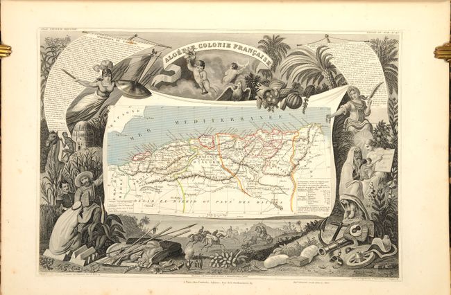
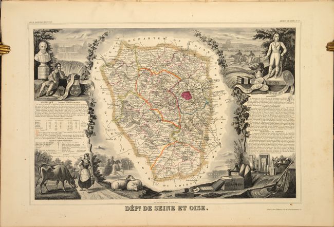
Victor Levasseur's "Atlas National Illustre" and "Atlas Universel Illustre" are among the last decorative atlases published. The maps are all lavishly illustrated with scenes of the countryside, products and activities indigenous to the region.
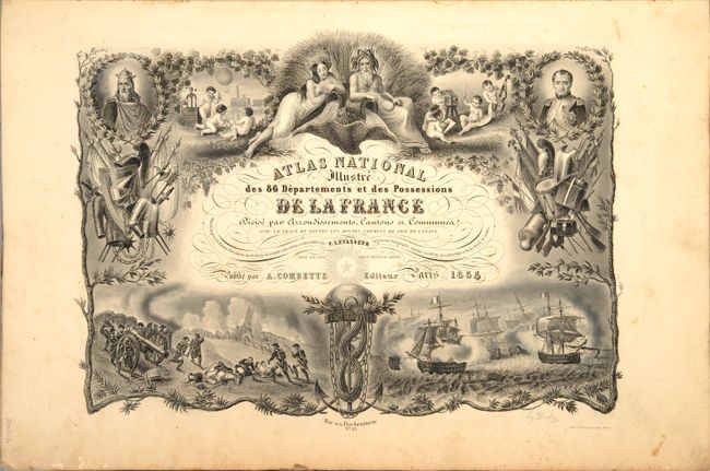
This was one of the last decorative atlases ever produced. The finely engraved title page, which sets the stage for the beautiful maps to follow, is made up of several vignettes depicting famous land and sea battles, a portrait of Napoleon I, cherubs practicing the arts and sciences, and more. In addition to the 83 (of 86) individual French departments, the atlas contains maps of the continents, Oceania and French colonies for a total of 95 of the 99 called for maps (missing department maps of Landes, Pyrenes, and Seine, as well as the world map at the rear of the volume).
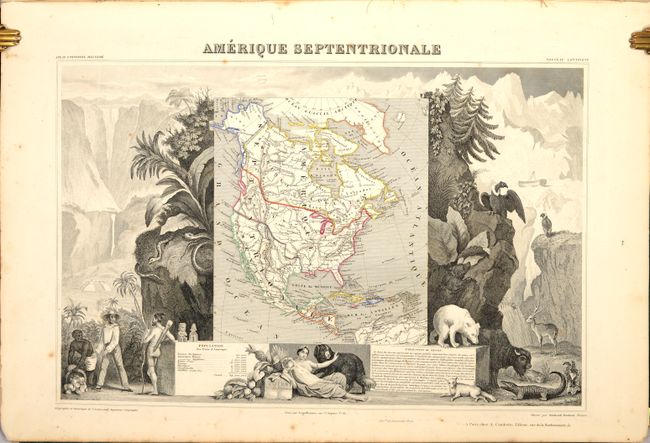
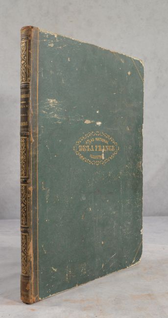
The map of North America shows Mexico in control of Texas and the Southwest with Mexico's northern border drawn according to the Treaty of 1819 (here misprinted as 1810). The United States' claims into present-day British Columbia reflect James Polk's expansionist policies (France was an ally to the U.S. and supported their position in the Fifty-four Forty or Fight dispute). The map is surrounded by beautifully engraved scenes of North and Central America including local animals, a ship stranded in the polar sea, and a Mayan temple. Five maps show the French colonial possessions of the time and a double-page map at the back of the atlas illustrates France as a whole (Nouvelle Carte de la France). The department maps have lovely decorated borders that relate to the region, including statistical information, regional products, famous local people, and places of interest. Hardbound in original quarter leather over green boards with gilt title on front cover and spine.
References:
Condition: B+
The maps are mostly very good in contemporary outline color with some scattered foxing. A couple of the maps have moderate foxing (Aisne, Seine River). Rear hinge is starting. Covers are scuffed and worn.