Subject: New York City, New York
Period: 1938 (published)
Publication:
Color: Printed Color
Size:
26 x 12.1 inches
66 x 30.7 cm
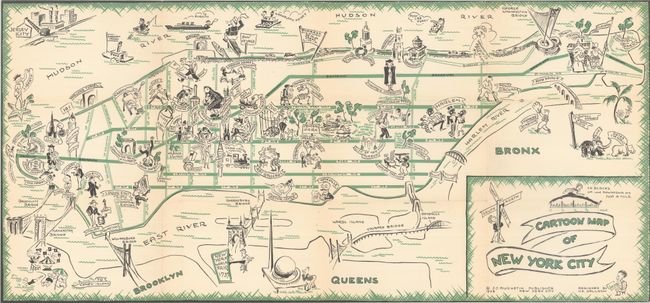
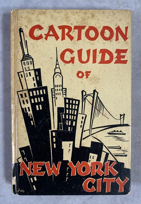
Created by Henry E. Salloch, this delightful tourist map of New York City extends to include parts of Brooklyn, Queens and the Bronx. The common tourist sites are depicted pictorially, such as the Empire State Building, Central Park, Coney Island, Yankee Stadium, the site of the 1939 World's Fair, and the Bronx Zoo (with Alice the elephant and Peter the Great the hippo). Only major streets are shown, printed in green, making the city appear inviting and easily navigable. The tunnels and bridges surrounding Manhattan are also illustrated and named to assist the traveler in reaching the boroughs. The map is still housed in the rear pocked of Nils Hogner and Guy Scott's Cartoon Guide of New York City, published by J. J. Augustin. 12mo, hardbound in pictorial boards.
Henry E. Salloch (1908-85) was a German artist who fled Nazi Germany and immigrated to the United States in 1937, shortly before creating this map.
References:
Condition: A
Condition code is for the folding map, which is clean and bright. Text is tight with a hint of pleasant light toning. Covers are foxed and soiled and the spine backing is nearly detached.