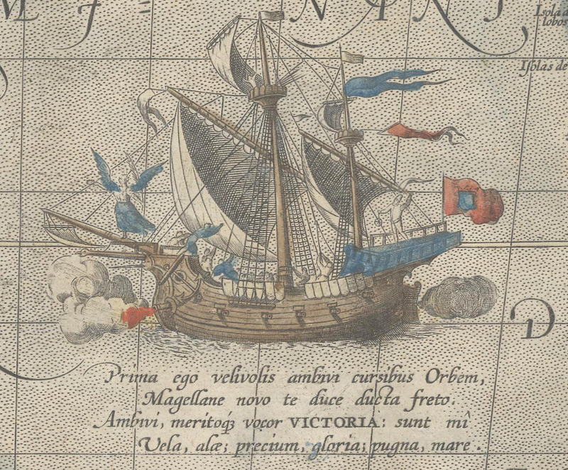
Ortelius’ map of the Pacific Ocean includes an engraving of Magellan’s ship, Victoria. Abraham Ortelius, Maris Pacifici, 1589.
Mapping Magellan
by Eliane Dotson
Explorers have always been a critical component in the history of cartography. As information of their voyages is disseminated, their discoveries and their names make their way onto maps. When we peruse the names of oceans, continents, cities, and islands, we often come across nomenclature that either directly references an explorer or was influenced by one. The evolution of mapping was not linear, so traces of one expedition can appear and disappear on maps over time, become intermixed with another expedition, or become obsolete altogether. In this article we will retrace the route of Ferdinand Magellan’s extraordinary circumnavigation of the world, identifying maps that showcase the places that were discovered along the way.
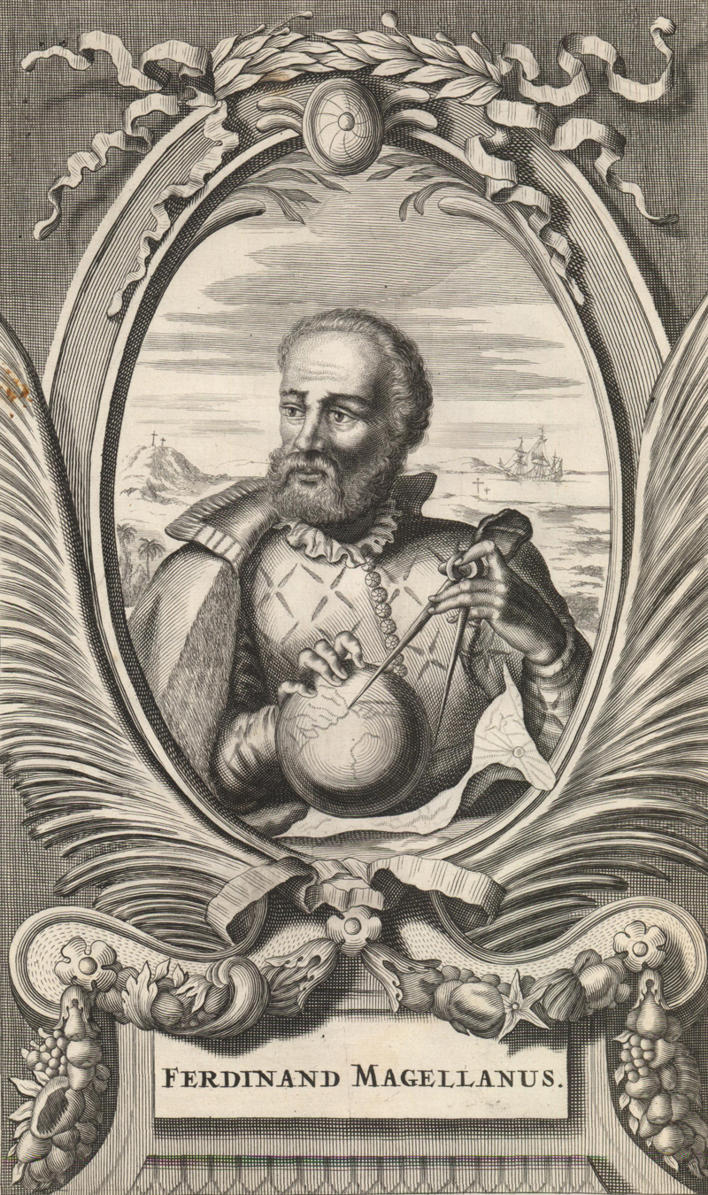
Ferdinand Magellan was born in Sabrosa, Portugal on 4 February 1480 into a family of minor Portuguese nobility. During his youth he served as a page for Queen Eleanor and consort for King John II. At age 25 Magellan enlisted in the Indian voyage of the first Portuguese viceroy in the East, Francisco de Almeida. He remained in the East for 8 years traveling between India, Malaysia and the Maluku Islands, working his way up the ranks. He was back in Portugal in 1512, only to return to the seas in 1513 on an expedition to Morocco. He returned to Portugal permanently wounded with a limp and accused of illegally trading with the Moors. Yet Magellan’s journeys and the potential for wealth as a trader in the Spice Islands had made an impression on him.
After receiving a letter from a friend in the Moluccas, Francisco Serrão, indicating that the islands were likely more easily accessed via the West, Magellan became determined to find a westward passage to the East Indies. He proposed such voyages to King Manuel I of Portugal, but had fallen into disfavor with the king, who repeatedly denied his requests and indicated that Magellan would no longer have employment in his country’s service.
Magellan renounced his nationality and moved to Sevilla, Spain in 1517, turning his focus to King Charles V. Spain had great interest in finding a western route to the East Indies due to the Treaty of Tordesillas of 1494, which granted Portugal control of all lands and trade to the east of a boundary line set at 370 leagues west of the Cape Verde Islands. This meant that Portugal maintained control of the eastern sea route around the cape of Africa to reach the East Indies. In order for Spain to access the lucrative spice trade, it would have to travel west. Charles V agreed to the venture and in September 1519 Magellan set sail with an armada of 5 ships, around 270 men, and 2 years’ worth of provisions. The voyage was financed primarily by the Spanish crown, with a private investor and merchant, Cristóbal de Haro, providing the remaining funds.
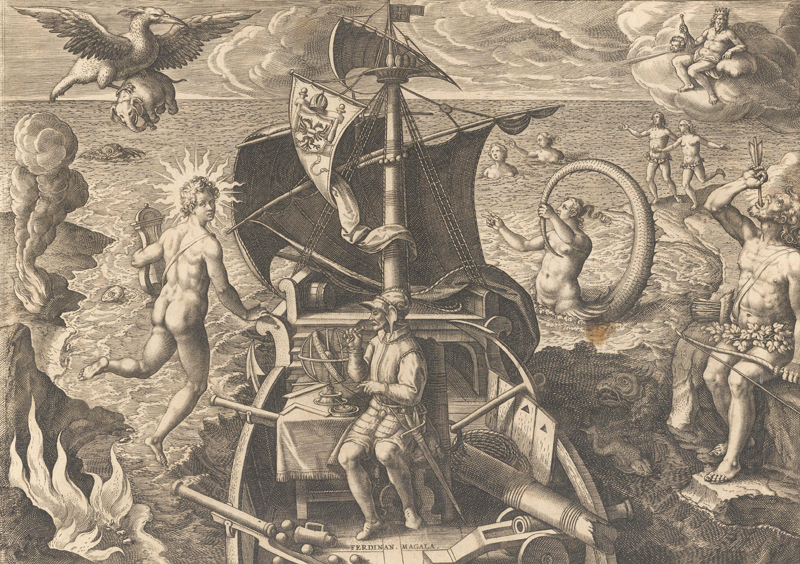
Joannes Stradanus’ engraving depicts Magellan on his ship, sailing through the strait named after him. A literal Tierra del Fuego is shown to his south, and his ship is surrounded by fantastical creatures. Joannes Stradanus, Ferdinandes Magalanes Lusitanus, circa 1592.
After crossing the Atlantic Ocean, Magellan first made landfall in November near Recife, Brazil and then continued down the coast to Río de la Plata and then to a harbor he named “Port St. Julien.” As it was already March 1520 and the weather conditions were deteriorating, Magellan decided to winter in Port St. Julien. In April, Magellan sent one of his ships, Santiago, captained by Juan Serrano, to explore further south. Serrano discovered a well-protected estuary that had a supply of natural resources, including wood, fish and penguins. He named the river Santa Cruz. Upon his return north to rejoin the rest of the fleet, the Santiago was caught in a storm and ran aground on a sandbar. Two survivors trekked north by land to alert Magellan, who sent a search party to rescue the remaining crew members. Unfortunately, the ship could not be salvaged and its supplies were lost. The remaining 4 ships spent the rest of the winter at Santa Cruz.
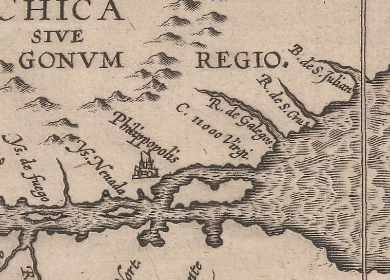
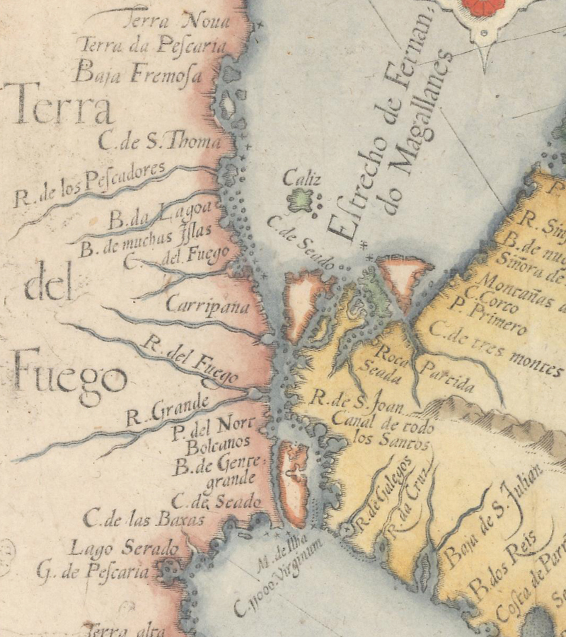
Wytfliet’s map shows “B. de S. Julian,” “R. de S. Cruz,” and “C. 11000 Virgi.” along the southeastern tip of South America. Cornelis Wytfliet, Chica sive Patagonica et Australis Terra, 1597.
Finally in October 1520, the fleet continued its journey southward. On October 21, they came to a headland, which they named "Cape Virgenes," with a large bay just past it. Although they were unaware at the time, they had just reached what would come to be known as the Strait of Magellan. As the ships passed through the strait, they encountered an island (possibly Isabel Island or Dawson Island) bisecting it and Magellan instructed one of the ships, San Antonio, to sail along the opposite side of the island to explore. The San Antonio never found its way back to the other 3 ships. Instead, there was a mutiny aboard and the pilot, Estêvão Gomes, turned the ship around and sailed back to Spain, arriving in May 1521 with 55 survivors. While waiting for the San Antonio to return, Magellan sent Gonzalo de Espinosa on a small ship to continue westward. After less than a week Espinosa rejoined Magellan and announced that he had reached the end of the strait and a vast ocean.
Magellan originally named the strait the "Estrecho de Todos los Santos" because the fleet traveled through it on All Saints' Day (November 1). Although this nomenclature made its way onto a few maps, it was uncommon, as the strait was soon renamed in honor of Magellan.
Although the strait is named “Estrecho de Fernando Magallanes” on this map, a remnant of the original name, “Canal de todo los Santos” appears along the coast. Linschoten/Langeren, Delineatio Omnium Orarum Totius Australis partis Americae, circa 1596.
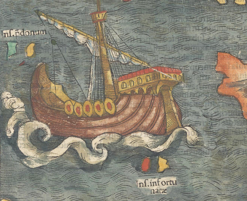
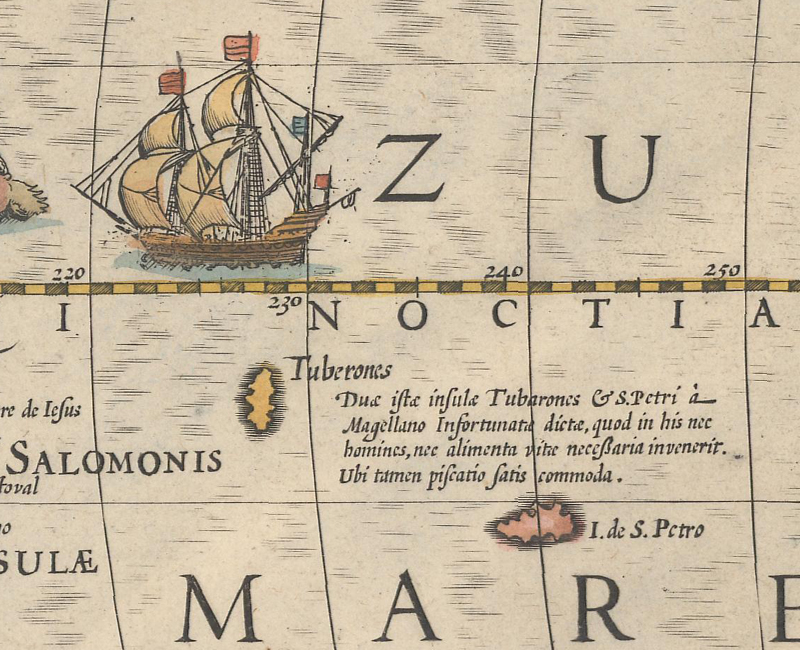
Magellan reached the ocean on November 28 and named it "Mar Pacifico" due to its calm waters at the time. The remaining 3 ships initially sailed north along the Chilean coast, and then shifted their course west-north-west. As a result, they did not sight any land until 24 January 1521, when they encountered a small, uninhabited island around which they were not able to anchor. Magellan named the island “San Pablo” as they had reached it on the day of Saint Paul the Apostle’s conversion. Several days later they came across another uninhabited island, which they named “Isla de los Tiburones” as they were able to catch sharks there. The two islands were likely Puka-Puka in the Tuamotu Archipelago and Caroline Island of Kiribati, which Magellan called the “Islas Infortunatas” (unfortunate islands).
Munster features Magellan’s ship Victoria adjacent to two small islands labeled “Ins. Infortunate” on his map of the western hemisphere. Sebastian Munster, Novae Insulae, XVII Nova Tabula, 1540.
Hondius’ map shows “Tuberones” and “I. de S. Petro” alongside a note about Magellan naming the islands “Infortunatae” due to their being uninhabited and without a food supply. Jodocus Hondius, America, 1628.
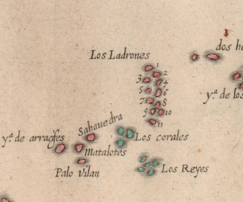
After more than three months crossing the Pacific, the three ships reached their first inhabited island on 6 March 1521. They reportedly encountered natives from the island of Guam who attempted to steal items off their ship, earning the island the name “Isla de los Ladrones” (Island of Thieves).
This map of Southeast Asia identifies a group of islands to the east named “Los Ladrones.” Antonio de Herrera y Tordesillas, Descripcion de las Indias del Poniente, 1622.
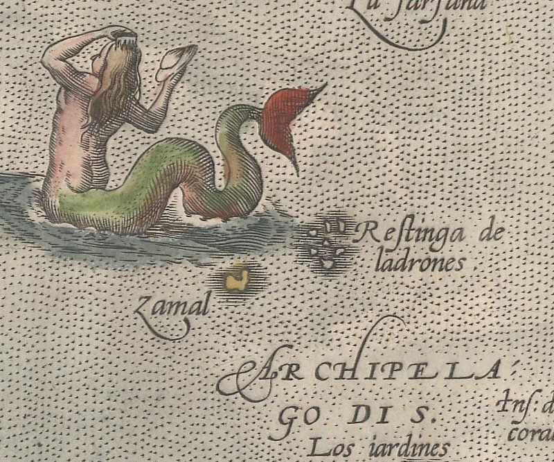
Ortelius’ map of Southeast Asia includes a small group of islands identified as “Restinga de Ladrones” alongside a mermaid. Abraham Ortelius, Indiae Orientalis, Adiacientium Typus, 1592.
The fleet then headed for the Philippines, where they explored various islands from March 16 to May 1, including Homonhon, Limasawa, Cebu, and Mactan. Magellan named the archipelago “Las Islas de San Lázaro” (St. Lazarus’ Islands), having landed on Homonhon on the feast day of Saint Lazarus of Bethany (March 17). Magellan was a man of faith and resolved to convert the local natives to Christianity, succeeding in doing so in part by befriending the leaders of several islands. After converting Rajah Humabon of the island of Cebu and gaining his support, an order was issued to neighboring islands to provide supplies to Magellan’s ships and to convert to Christianity. Datu Lapulapu, a chief on the island of Mactan, refused the order, prompting Magellan to assemble a small force of his own men to compel the Mactan natives to obey. The Battle of Mactan was fought on 27 April 1521 and resulted in the Mactan warriors overpowering the Spanish force and killing Magellan.
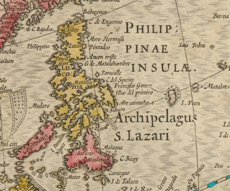
Hondius’ map of Asia shows Magellan’s name for the Philippines: “Archipelagus S. Lazari.” Jodocus Hondius, Asiae Nova Descriptio, 1608.
There were too few surviving crew members of Magellan’s fleet to sail the remaining 3 ships, so Concepcion was set on fire. Gonzalo de Espinosa was made captain of the Trinidad and Juan Sebastián Elcano was made captain of the Victoria. After spending several months exploring Southeast Asia, the ships landed on the island of Tidore in the Moluccas where they gained the leader’s allegiance to Spain and established a trading post. Although ready to return home to Spain, the Trinidad required repairs before being sea-worthy. It was decided that Elcano and the Victoria would sail west back to Spain, and Espinosa and the Trinidad would remain a few weeks on Tidore for repairs before heading back to Spain. Before the Trinidad was ready to sail, Espinosa was alerted that a Portuguese armada was heading east from Malacca to apprehend them, and therefore decided to head east across the Pacific as soon as his ship was repaired. Unfortunately, the Trinidad was unable to make it across the Pacific and returned to the Moluccas, where it was captured by the Portuguese and destroyed by a storm while anchored.
Juan Sebastián Elcano successfully returned to Spain on the Victoria, arriving on 6 September 1522 with only 18 of the original crew members. His return voyage was not uneventful, as numerous crewmen died of starvation due to insufficient provisions, and over a dozen others were detained by the Portuguese during a stop in Cape Verde to resupply. Twelve of those captured in Cape Verde were returned to Spain over the next year. In addition, 5 of the crew from the Trinidad, including Espinosa, eventually made their way back to Spain.
Although news of Magellan’s voyage was disseminated as early as 1523, his discoveries weren’t consistently depicted on maps until many years later. Maximilianus Transylvanus, who was related to Cristóbal de Haro, one of the key sponsors of the voyage, published De Moluccis Insulis (1523), an account based on interviews with the survivors of the Victoria. One of the most complete sources of information on the voyage came from the Italian scholar Antonio Pigafetta, who accompanied Magellan on the voyage as his secretary and kept a meticulous journal. Pigafetta was one of the few who survived the complete circumnavigation and he published a French translation of his journal, Le Voyage et Navigation Faict par les Espaignolz es Isles de Mollucques, in France in 1525 (as his account was censored in Spain).
The first reference to Magellan’s expedition on a printed map was on Oronce Fine’s 1531 double-cordiform world map. The Strait of Magellan is shown but not labeled, and the waters in the South Pacific are named “Mare Magellanicum.”
Oronce Fine, Nova, et Integra Universi Orbis Descriptio, 1531.
The first printed map to label the strait in Magellan's name was Giovanni Battista Ramusio’s 1534 map of the western hemisphere, La Carte Universale della Terra Ferma, known in only a handful of examples. However, it was Sebastian Munster who popularized the name on his maps of the world and western hemisphere, first published in 1540.
The strait is labeled “Fretum Magaliani” on Munster’s map of the world. Sebastian Munster, General Tafel Begreifend der Gantzen Undern Weldt Beschreibung, 1548.
Although Magellan himself didn’t complete the journey around the world, his expedition is credited as the first circumnavigation of the globe. The track of his ships began appearing on maps as early as 1535 (on an anonymous set of globe gores found in a library in Stuttgart), and continued to be celebrated on maps for more than four centuries.
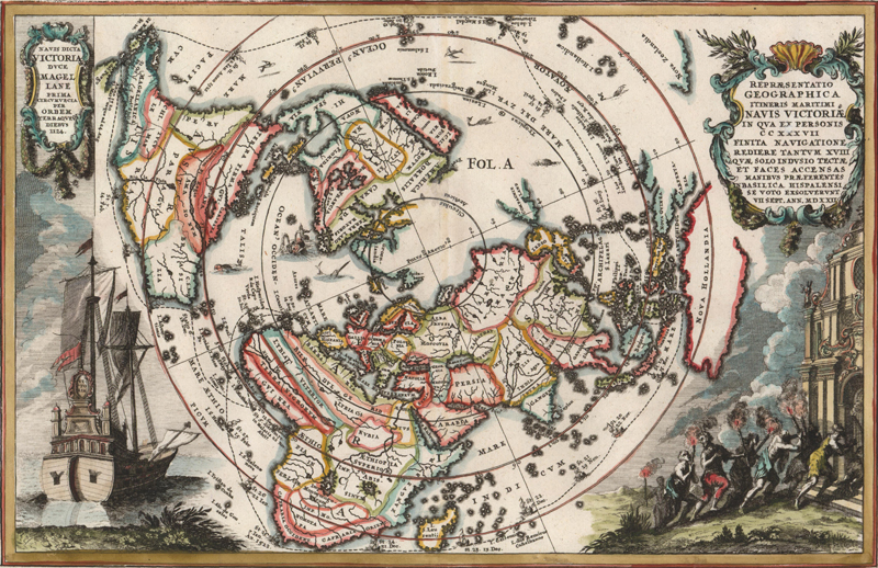
This map follows the entire route of the circumnavigation, noting the dates when the fleet arrived in various locations. At left is a large vignette of the Victoria. Heinrich Scherer, Repraesentatio Geographica Itineris Maritimi Navis Victoriae, circa 1700.
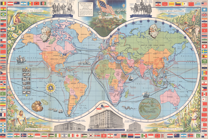
This promotional map for a spice company emphasizes exploration and discovery, marking the tracks of Magellan, Columbus, Vasco da Gama, and Drake. McCormick & Company, McCormick’s Map of the World, 1955.
Despite insurmountable odds and a challenging voyage, Magellan’s expedition brought Europeans an incredible wealth of knowledge. The southern tip of South America was navigable; there was a westward passage to Asia; and the Pacific Ocean was vaster than they had imagined. The surviving crew of the Victoria even recognized the need for an international date line upon arriving in Cape Verde, as they discovered that they had arrived a day later than their records had indicated. As with every early expedition, there were many perils, including encounters with enemies, mutinies, scurvy, starvation, and illness. Four of the five ships were destroyed and more than 180 lives were lost. Yet their accomplishments have earned a place in history, commemorated on maps.
REFERENCES
Burden, Philip D., The Mapping of North America – A List of Printed Maps 1511-1670, Raleigh Publications, Rickmansworth, 1996.
Hooker, Brian, “Discovered but not Revealed – Magellan’s ‘Unfortunate Islands,’” Mercator’s World, Volume 7 Number 6, November/December 2002.
Shirley, Rodney, The Mapping of the World – Early Printed World Maps 1472-1700, The Holland Press Limited, London, 1987.
Suarez, Thomas, Early Mapping of the Pacific, Periplus Editions, Singapore, 2004.
Suarez, Thomas, “Early Mapping of the Pacific Ocean,” The Map Collector, Issue No. 22, March 1983.