Filtered by Category:United States(Show All Categories)
Showing results for:Auction 99
Catalog Archive
154 lots
Page 1 of 4
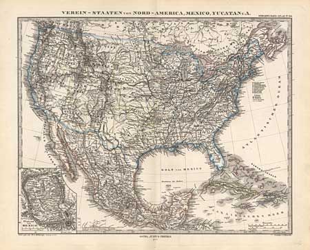
Auction 99, Lot 104
Subject: North America
Perthes, Justus
Verein-Staaten von Nord-America, Mexico, Yucatan U.A., 1877
Size: 15.6 x 12.2 inches (39.6 x 31 cm)
Estimate: $60 - $80
Sold for: $0
Closed on 6/12/2002
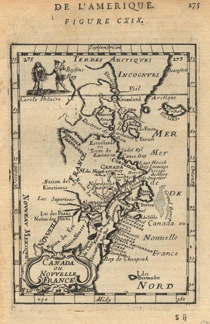
Auction 99, Lot 106
Subject: Colonial Canada and New England
Mallet, Alain Manesson
Canada ou Nouvelle France, 1683
Size: 4 x 5.5 inches (10.2 x 14 cm)
Estimate: $160 - $200
Sold for: $130
Closed on 6/12/2002
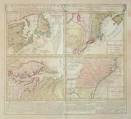
Auction 99, Lot 107
Subject: Colonial United States and Canada
Homann Heirs
Dominia Anglorum in America Septentrionali, 1730
Size: 21.7 x 19.8 inches (55.1 x 50.3 cm)
Estimate: $900 - $1,000
Sold for: $500
Closed on 6/12/2002
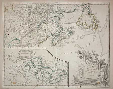
Auction 99, Lot 108
Subject: Colonial Canada and Great Lakes
Robert de Vaugondy
Partie de l'Amerique Septent? qui comprend la Nouvelle France ou le Canada, 1755
Size: 23.8 x 18.6 inches (60.5 x 47.2 cm)
Estimate: $600 - $650
Sold for: $425
Closed on 6/12/2002
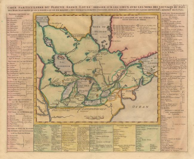
Auction 99, Lot 109
Subject: Colonial Canada and United States
Chatelain, Henry Abraham
Carte Particuliere du Fleuve Saint Louis Dressee sur les lieux avec les noms des sauvages du pais.., 1720
Size: 17.7 x 14.2 inches (45 x 36.1 cm)
Estimate: $800 - $900
Sold for: $900
Closed on 6/12/2002
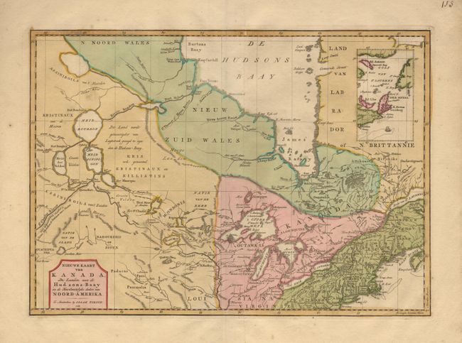
Auction 99, Lot 110
Subject: Colonial Canada and New England
Tirion, Isaac
Nieuwe Kaart van Kanada, de Landen aan de Hudsons-Baay en de Noordwestelyke deelen van Noord-Amerika, 1769
Size: 17 x 12 inches (43.2 x 30.5 cm)
Estimate: $425 - $475
Sold for: $350
Closed on 6/12/2002
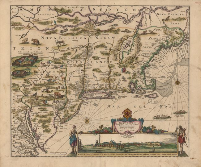
Auction 99, Lot 111
Subject: Colonial New England and Mid Atlantic
Danckerts, Justus
Novi Belgii Novaeque Angliae nec non Pennsylvaniae et Partis Virginiae Tabula, 1685
Size: 21.6 x 18.3 inches (54.9 x 46.5 cm)
Estimate: $4,000 - $5,000
Sold for: $5,500
Closed on 6/12/2002
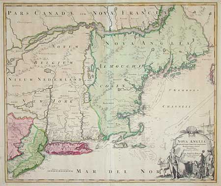
Auction 99, Lot 112
Subject: Colonial New England and Mid Atlantic
Homann, Johann Baptist
Nova Anglia Septentrionali Americae implantata Anglorumque coloniis florentissima, 1730
Size: 22.6 x 19 inches (57.4 x 48.3 cm)
Estimate: $1,200 - $1,300
Sold for: $1,000
Closed on 6/12/2002
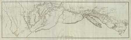
Auction 99, Lot 113
Subject: Colonial Mid Atlantic
Soules, Francois
[Road from Williamsburg to Boston], 1787
Size: 36 x 10.2 inches (91.4 x 25.9 cm)
Estimate: $500 - $600
Sold for: $550
Closed on 6/12/2002
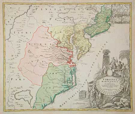
Auction 99, Lot 114
Subject: Colonial Southeast
Homann, Johann Baptist
Virginia Marylandia et Carolina in America Septentrionali Britannorum industria excultae, 1714
Size: 22.6 x 19 inches (57.4 x 48.3 cm)
Estimate: $1,500 - $1,900
Sold for: $1,300
Closed on 6/12/2002
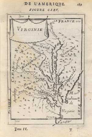
Auction 99, Lot 115
Subject: Colonial Virginia and Maryland
Mallet, Alain Manesson
Virginie, 1683
Size: 4.2 x 5.8 inches (10.7 x 14.7 cm)
Estimate: $200 - $240
Sold for: $180
Closed on 6/12/2002
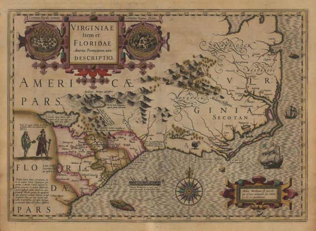
Auction 99, Lot 116
Subject: Colonial Southeast
Hondius, Jodocus
Virginiae Item et Floridae Americae Provinciarum, nova Descriptio, 1613
Size: 19 x 13.3 inches (48.3 x 33.8 cm)
Estimate: $2,200 - $2,500
Sold for: $2,100
Closed on 6/12/2002

Auction 99, Lot 117
Subject: Colonial Southeast
Jansson, Jan
Virginiae partis australis, et Floridae partis orientalis, interjacentiumq regionum Nova Descriptio, 1649
Size: 19.7 x 15.2 inches (50 x 38.6 cm)
Estimate: $1,900 - $2,000
Unsold
Closed on 6/12/2002
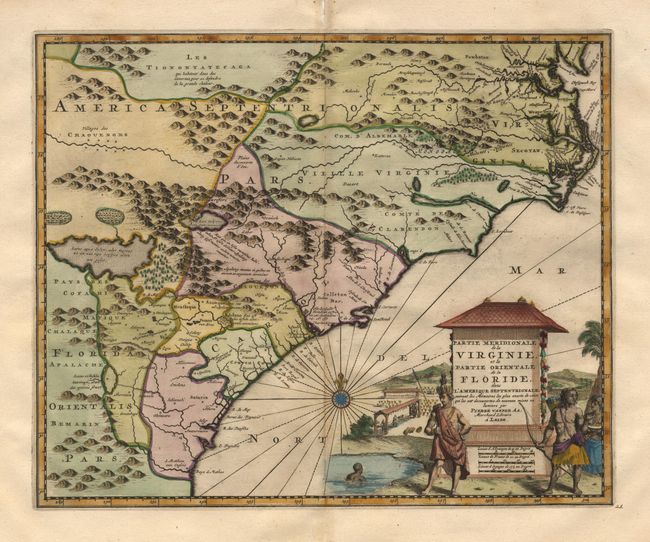
Auction 99, Lot 118
Subject: Colonial Southeast
Aa, Pieter van der
Partie Meridionale de la Virginie, et la Partie Orientale de la Floride dans l'Amerique Septentrionale, 1729
Size: 14 x 11.2 inches (35.6 x 28.4 cm)
Estimate: $1,600 - $1,800
Unsold
Closed on 6/12/2002
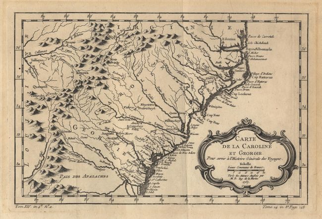
Auction 99, Lot 119
Subject: Colonial Southeast
Bellin, Jacques Nicolas
Carte de la Caroline et Georgie, 1757
Size: 11.2 x 7.4 inches (28.4 x 18.8 cm)
Estimate: $400 - $450
Unsold
Closed on 6/12/2002
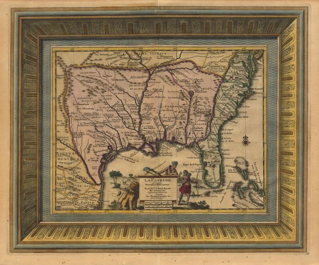
Auction 99, Lot 120
Subject: Colonial South
Aa, Pieter van der
La Floride, Suivant les Nouvelles Observations…, 1713
Size: 16 x 13.2 inches (40.6 x 33.5 cm)
Estimate: $1,600 - $1,800
Sold for: $1,800
Closed on 6/12/2002
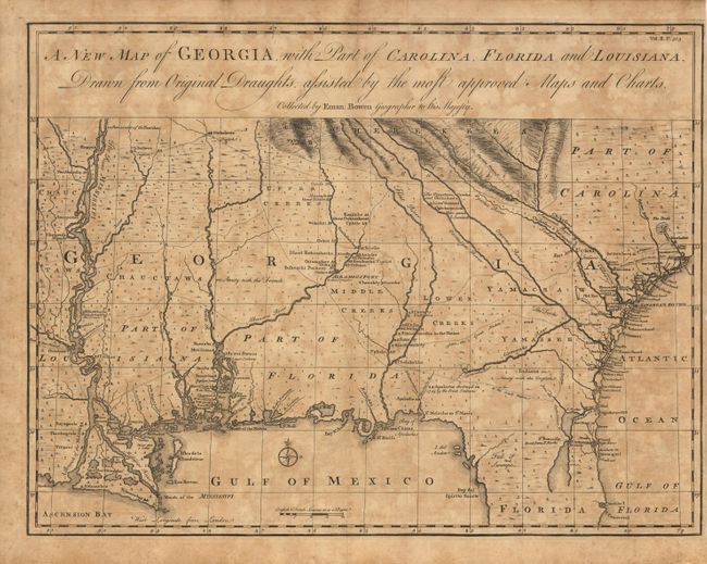
Auction 99, Lot 121
Subject: Colonial South
Bowen, Emanuel
A New Map of Georgia, with Part of Carolina, Florida and Louisiana, 1763
Size: 18.7 x 14.2 inches (47.5 x 36.1 cm)
Estimate: $2,300 - $2,750
Sold for: $2,400
Closed on 6/12/2002
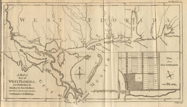
Auction 99, Lot 122
Subject: Colonial South
Lodge, John
A map of Part of West Florida from Pensacola to the Mouth of the Iberville River, with a View to shew the proper Spot for a Settlement on the Mississipi, 1772
Size: 13.3 x 7.4 inches (33.8 x 18.8 cm)
Estimate: $240 - $275
Sold for: $220
Closed on 6/12/2002
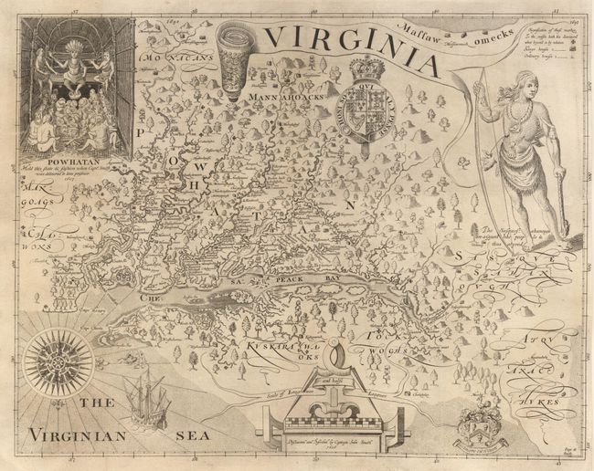
Auction 99, Lot 123
Subject: Colonial Virginia
Smith, John (Capt.)
Virginia, 1819
Size: 16 x 12.4 inches (40.6 x 31.5 cm)
Estimate: $500 - $600
Unsold
Closed on 6/12/2002
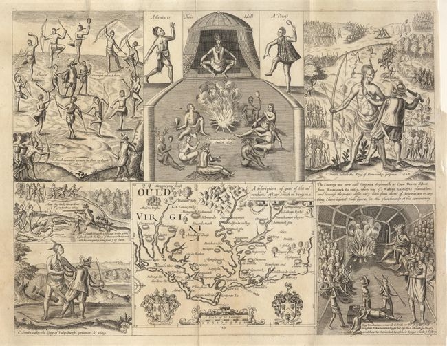
Auction 99, Lot 124
Subject: Colonial Carolinas
Smith, John (Capt.)
Ould Virginia. A description of part of the adventures of Cap. Smith in Virginia, 1819
Size: 14 x 10.8 inches (35.6 x 27.4 cm)
Estimate: $300 - $350
Sold for: $150
Closed on 6/12/2002
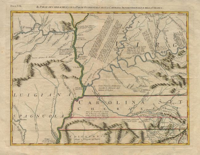
Auction 99, Lot 125
Subject: Colonial South
Zatta, Antonio
Il Paese de Cherachesi, con la Parte Occidentale della Carolina Settentrioanle, e della Virgina, 1778
Size: 16.5 x 12.2 inches (41.9 x 31 cm)
Estimate: $375 - $425
Sold for: $325
Closed on 6/12/2002

Auction 99, Lot 126
Subject: Colonial Mid West United States
Popple, Henry
[Sheet 5 - A Map of the British Empire in America…], 1733
Size: 26 x 19.2 inches (66 x 48.8 cm)
Estimate: $1,900 - $2,000
Unsold
Closed on 6/12/2002
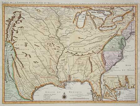
Auction 99, Lot 127
Subject: Colonial Louisiana Territory
Delisle/Covens & Mortier
Carte de la Louisiane et du Cours du Mississipi avec les Colonies Anglaises, 1730
Size: 23.7 x 17.2 inches (60.2 x 43.7 cm)
Estimate: $1,600 - $1,800
Sold for: $1,400
Closed on 6/12/2002
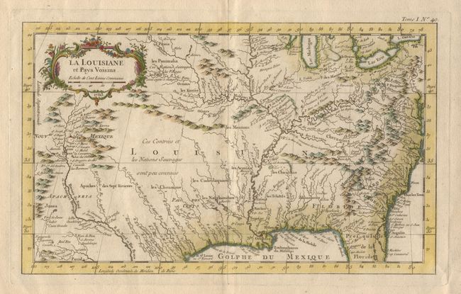
Auction 99, Lot 128
Subject: Colonial Louisiana Territory
Bellin, Jacques Nicolas
La Louisiane et Pays Voisins, 1763
Size: 13.5 x 8.2 inches (34.3 x 20.8 cm)
Estimate: $500 - $600
Sold for: $375
Closed on 6/12/2002
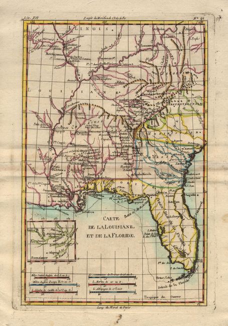
Auction 99, Lot 129
Subject: Colonial Louisiana Territory
Bonne, Rigobert
Carte de la Louisiane, et de la Floride, 1780
Size: 8.2 x 12.5 inches (20.8 x 31.8 cm)
Estimate: $200 - $250
Sold for: $190
Closed on 6/12/2002
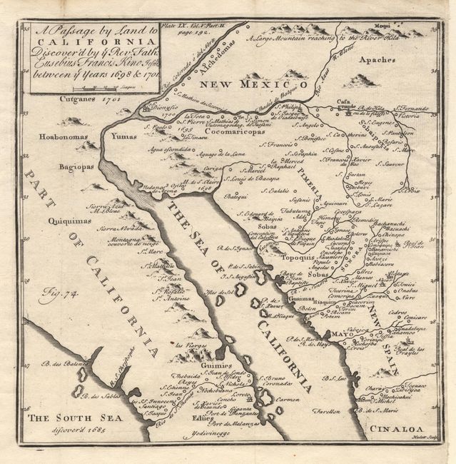
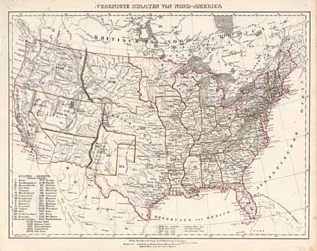
Auction 99, Lot 132
Subject: Southwest United States & Mexico
Kino, Eusebio Francisco, SJ
A Passage by Land to California, Discover'd by ye Rev. Father Eusebius Franicis Kino Jesuit between ye Years 1698 & 1701, 1731
Size: 7.6 x 7.6 inches (19.3 x 19.3 cm)
Estimate: $750 - $800
Sold for: $800
Closed on 6/12/2002
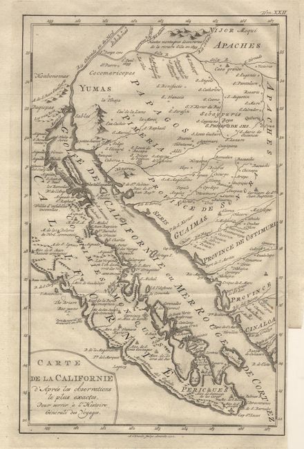
Auction 99, Lot 133
Subject: Southwest United States & Mexico
Venegas, Miguel (Padre)
Carte de la Californie d'Apres les observations le plus exactes, 1777
Size: 7.8 x 12.2 inches (19.8 x 31 cm)
Estimate: $500 - $600
Sold for: $650
Closed on 6/12/2002
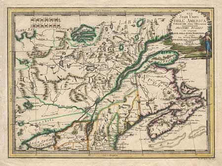
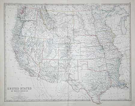
Auction 99, Lot 141
Subject: Canada and United States
Cassini, Giovanni Maria
Gli Stati Uniti dell'America Delineati sulle ultime Osservazioni - Secondo Foglio che comprende Parte Della Nuova Inghilterra ed inottre La Nuova Scozia…, 1797
Size: 18.6 x 13.5 inches (47.2 x 34.3 cm)
Estimate: $450 - $500
Sold for: $375
Closed on 6/12/2002
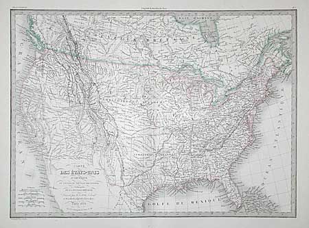
Auction 99, Lot 142
Subject: Canada & United States
Lapie, Alexander Emile & Pierre
Carte des Etats-Unis d'Amerique, du Canada, du Nouveau Brunswick et d'une partie de la Nouvelle Bretagne, 1854
Size: 21.5 x 15.6 inches (54.6 x 39.6 cm)
Estimate: $100 - $150
Sold for: $190
Closed on 6/12/2002
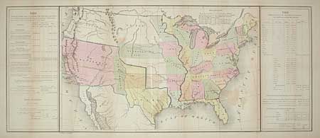
Auction 99, Lot 143
Subject: United States
Gilman, E.
[United States], 1849
Size: 33.2 x 13.6 inches (84.3 x 34.5 cm)
Estimate: $400 - $500
Sold for: $425
Closed on 6/12/2002
Auction 99, Lot 144
Subject: United States
Flemming, Carl
Vereinigte Staaten von Nord-America, 1850-55
Size: 16.2 x 12.2 inches (41.1 x 31 cm)
Estimate: $100 - $150
Sold for: $190
Closed on 6/12/2002
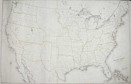
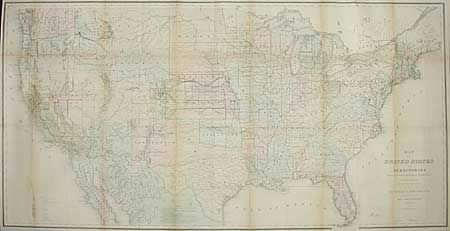
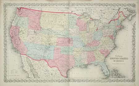
Auction 99, Lot 145
Subject: United States
Burr, David H.
Map of the United States Exhibiting the Several Collection Districts, 1856
Size: 49.3 x 31.2 inches (125.2 x 79.2 cm)
Estimate: $400 - $600
Sold for: $325
Closed on 6/12/2002
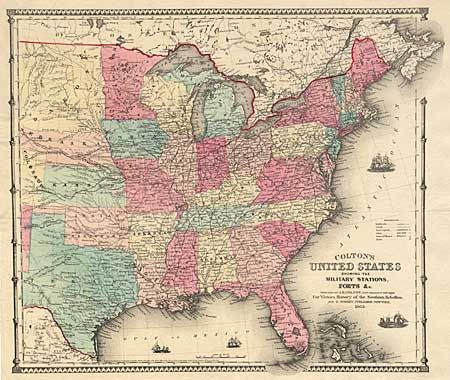
Auction 99, Lot 146
Subject: United States
Colton, Joseph Hutchins
Colton's United States Showing the Military Stations, Forts &c., 1862
Size: 17.2 x 14.5 inches (43.7 x 36.8 cm)
Estimate: $350 - $400
Sold for: $425
Closed on 6/12/2002
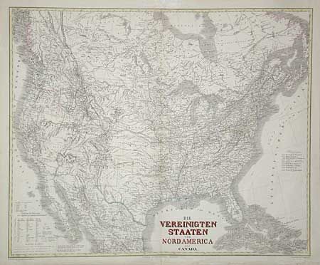
Auction 99, Lot 147
Subject: United States
Kiepert, Heinrich C.
Die Vereinigten Staaten von Nord America nebst Canada, 1868
Size: 25.2 x 20.8 inches (64 x 52.8 cm)
Estimate: $230 - $275
Sold for: $210
Closed on 6/12/2002
Auction 99, Lot 148
Subject: United States
General Land Office
Map of the United States and Territories Showing the extent of Public Surveys and other details constructed from the Plats and official sources of the General Land Office…, 1870
Size: 55.7 x 28.5 inches (141.5 x 72.4 cm)
Estimate: $350 - $400
Sold for: $350
Closed on 6/12/2002
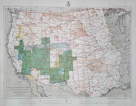
Auction 99, Lot 149
Subject: United States
U.S. Army
Progress Map of the U. S. Geographical Surveys West of the 100th Meridian…, 1882
Size: 22.2 x 16 inches (56.4 x 40.6 cm)
Estimate: $100 - $120
Sold for: $250
Closed on 6/12/2002
Auction 99, Lot 150
Subject: United States
Johnston, Keith
United States of North America [Eastern and Western Sheets], 1882
Size: 22.5 x 17.2 inches (57.2 x 43.7 cm)
Estimate: $120 - $150
Sold for: $75
Closed on 6/12/2002

Auction 99, Lot 151
Subject: United States
Colton, G.W. & C.B.
Colton's United States of America, 1883
Size: 25.5 x 16.1 inches (64.8 x 40.9 cm)
Estimate: $200 - $250
Sold for: $250
Closed on 6/12/2002
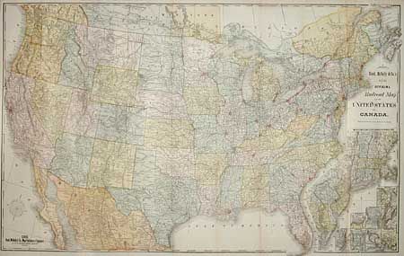
Auction 99, Lot 152
Subject: United States
Rand McNally & Co.
New Official Railroad map of the United States and Canada, 1885
Size: 42.5 x 26.5 inches (108 x 67.3 cm)
Estimate: $300 - $400
Sold for: $200
Closed on 6/12/2002
Auction 99, Lot 153
Subject: United States
Colton, Joseph Hutchins
[Lot of 3 Maps], 1855
Size: See Description
Estimate: $150 - $200
Sold for: $275
Closed on 6/12/2002
Auction 99, Lot 154
Subject: United States
Various
[Lot of 25 - Civil War], 1862-1890
Size: See Description
Estimate: $150 - $200
Sold for: $140
Closed on 6/12/2002
Auction 99, Lot 155
Subject: United States
Letts & Son
[Lot of 19 Maps], 1890
Size: 15.2 x 12.2 inches (38.6 x 31 cm)
Estimate: $120 - $150
Sold for: $150
Closed on 6/12/2002
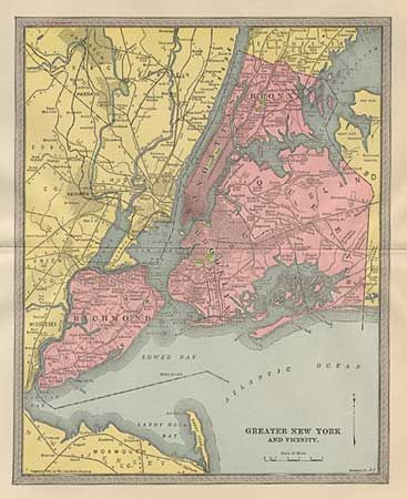
Auction 99, Lot 156
Subject: United States
Hammond Publishing Co.
[Lot of 17 City Plans], 1903
Size: 12.5 x 9.2 inches (31.8 x 23.4 cm)
Estimate: $100 - $130
Sold for: $160
Closed on 6/12/2002
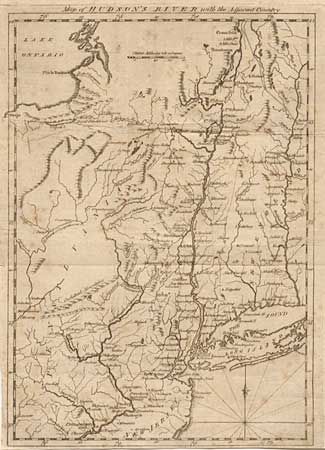
Auction 99, Lot 157
Subject: Northeastern United States
Scots Magazine
Map of Hudson's River with the Adjacent Country, 1778
Size: 8.1 x 11.5 inches (20.6 x 29.2 cm)
Estimate: $150 - $200
Sold for: $130
Closed on 6/12/2002
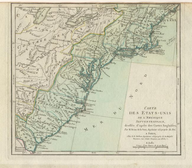
Auction 99, Lot 158
Subject: Eastern United States
Brion de la Tour, Louis
Carte des Etats-Unis de l'Amerique Septentrionale, dressee d'apres des Cartes Anglaises, 1793
Size: 10 x 9 inches (25.4 x 22.9 cm)
Estimate: $120 - $150
Sold for: $160
Closed on 6/12/2002
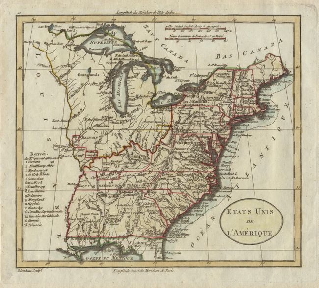
Auction 99, Lot 159
Subject: Eastern United States
Blondeau, Alexandre
Etats Unis de l'Amerique, 1798
Size: 8 x 7 inches (20.3 x 17.8 cm)
Estimate: $150 - $200
Sold for: $300
Closed on 6/12/2002
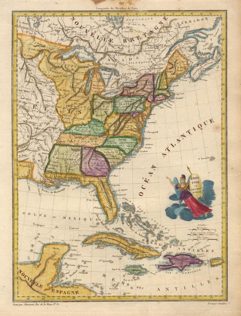
Auction 99, Lot 160
Subject: Eastern United States
Chamouin, Jean Baptiste Marie
Etats Unis et Grandes Antilles, 1805
Size: 8.7 x 11.7 inches (22.1 x 29.7 cm)
Estimate: $160 - $180
Sold for: $120
Closed on 6/12/2002
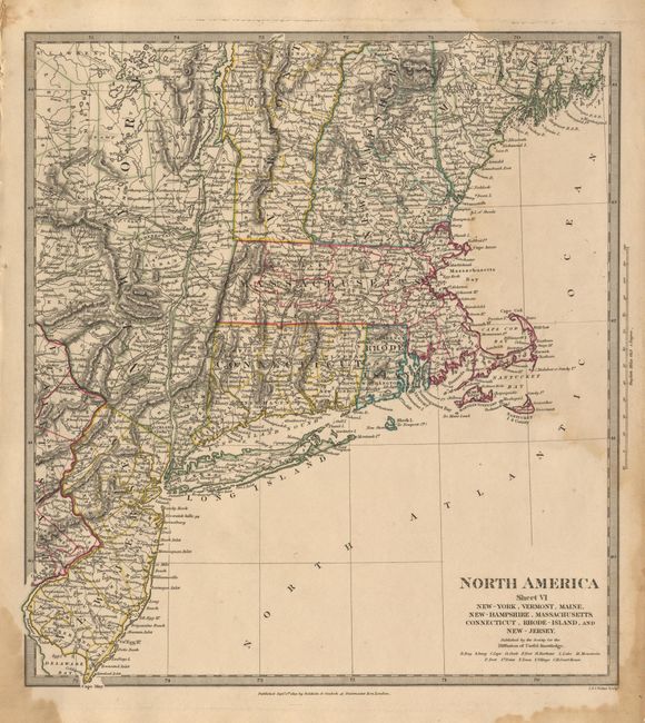
Auction 99, Lot 161
Subject: Eastern United States
SDUK Society for the Diffusion of Useful Knowledge
North America Sheet VI New-York, Vermont, Maine, New-Hampshire, Massachusetts, Connecticut, Rhode Island, and New Jersey, 1832
Size: 12.5 x 13.7 inches (31.8 x 34.8 cm)
Estimate: $50 - $60
Sold for: $65
Closed on 6/12/2002

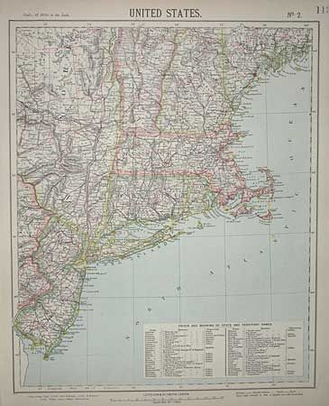
Auction 99, Lot 162
Subject: Eastern United States
Colton, Joseph Hutchins
[Lot of 4 maps], 1855
Size: See Description
Estimate: $120 - $160
Unsold
Closed on 6/12/2002
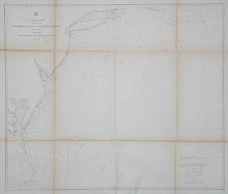
Auction 99, Lot 163
Subject: Eastern United States
U.S. Coast Survey
Atlantic Coast of the United States, Sheet No. II, Nantucket to Cape Hatteras, 1863
Size: 27 x 23 inches (68.6 x 58.4 cm)
Estimate: $40 - $60
Sold for: $25
Closed on 6/12/2002
154 lots
Page 1 of 4