Subject: Colonial Louisiana Territory
Period: 1763 (dated)
Publication: Le Petit Atlas Maritime
Color: Hand Color
Size:
13.5 x 8.2 inches
34.3 x 20.8 cm
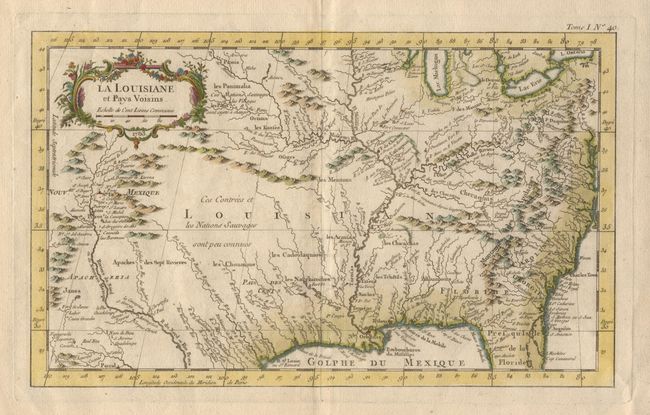
Attractive map of the central part of North America stretching from Nouveau Mexique to the Carolinas, and from the Great Lakes to the Gulf of Mexico. This map should not be confused with the much more common "Carte de la Louisiane et Pays Voisons" issued in the Histoire Generale de Voyages in 1757. This chart extends further west, is printed on better paper and is engraved by a better hand. The map shows many strategic forts and areas claimed by the French in the last year of the French and Indian War. Many Indian names, as well as early European settlements are located. The cartography is based on the work of Guillaume Delisle's great map that properly located the lower Mississippi River. Decorative title cartouche in rococo-style.
References: MCC 96, no. 877.
Condition: A+
Good impression with well applied later color on fine paper with large watermark. Full margins.