Subject: Colonial New England and Mid Atlantic
Period: 1685 (circa)
Publication:
Color: Hand Color
Size:
21.6 x 18.3 inches
54.9 x 46.5 cm
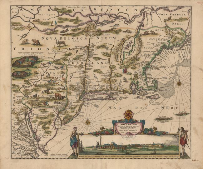
One of the most decorative colonial maps based on the celebrated Jansson/Visscher prototype. Geographically the map follows Jansson including the placement of nearly every colonial settlement along the coastline and rivers. It covers the region from Chesapeake Bay to Penobscot Bay. The land is fully engraved to show forests, mountains, rivers and lakes with most of the geography based on the work of Champlain. Charming depictions of tiny animals and an Indian village scene fill the interior, all derived from Blaeu's Nova Belgica… (1635). The most important feature of the map is the superb view of New Amsterdam below the title cartouche that was taken from the Visscher map. This view is one of the earliest views of New York City. This is the second state with Philadelphia added and the course of the Delaware River corrected.
References: McCorkle #680.2; Campbell: Jansson-Visscher Sequence, 9.
Condition: A
Minor stains in margins. Expert repair of centerfold and a short tear into bottom view.