Subject: Colonial Southeast
Period: 1757 (dated)
Publication: Histoire Generale des Voyages
Color: Black & White
Size:
11.2 x 7.4 inches
28.4 x 18.8 cm
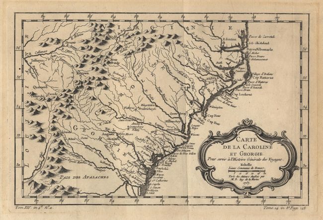
Delicately engraved map of the colonies from Albemarle Sound to the Alatamaha River, present-day Edenton, NC to Jekyll Island, GA. The map is largely based on the work of Emanuel Bowen. Depicts numerous English settlements along the coast and Indian villages throughout, including a number west of the Appalachian Mountains. There is more detail in the area west of the Blue Ridge than in many other maps of the period including an early attempt to show the course of the Tennessee River in western North Carolina. Decorative title cartouche.
References: Cumming #311; Portinaro & Knirsch p.243.
Condition: A
Fine sharp impression with negligible mat burn in margin and tape residue on verso.