Filtered by Category:United States(Show All Categories)
Showing results for:Auction 190
Catalog Archive
164 lots
Page 1 of 4
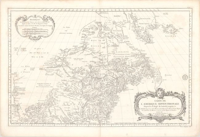
Auction 190, Lot 97
Subject: Colonial United States & Canada
Bellin, Jacques Nicolas
Carte de l'Amerique Septentrionale Depuis le 28 Degre de Latitude Jusqu'au 72, 1755
Size: 33.9 x 22 inches (86.1 x 55.9 cm)
Estimate: $1,600 - $1,900
Bellin's Important, Large Format Map of North America
Sold for: $1,600
Closed on 11/16/2022
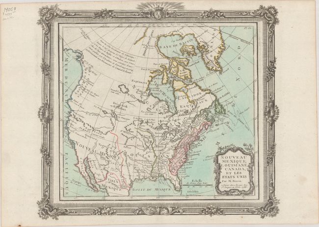
Auction 190, Lot 98
Subject: United States & Canada
Brion de la Tour/Desnos
Nouveau Mexique, Louisiane, Canada, et les Etats Unis, 1786
Size: 12.5 x 11.3 inches (31.8 x 28.7 cm)
Estimate: $200 - $230
Sold for: $120
Closed on 11/16/2022
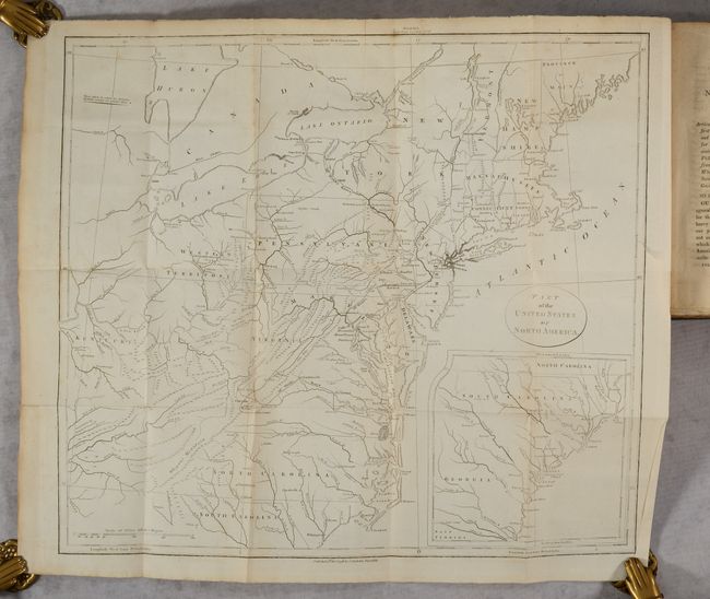
Auction 190, Lot 99
Subject: Exploration & Surveys, United States & Canada
Weld, Isaac
[2 Volumes] Travels Through the States of North America, and the Provinces of Upper and Lower Canada, During the Years 1795, 1796, and 1797, 1807
Size: 5.9 x 9.3 inches (15 x 23.6 cm)
Estimate: $700 - $850
Sold for: $500
Closed on 11/16/2022
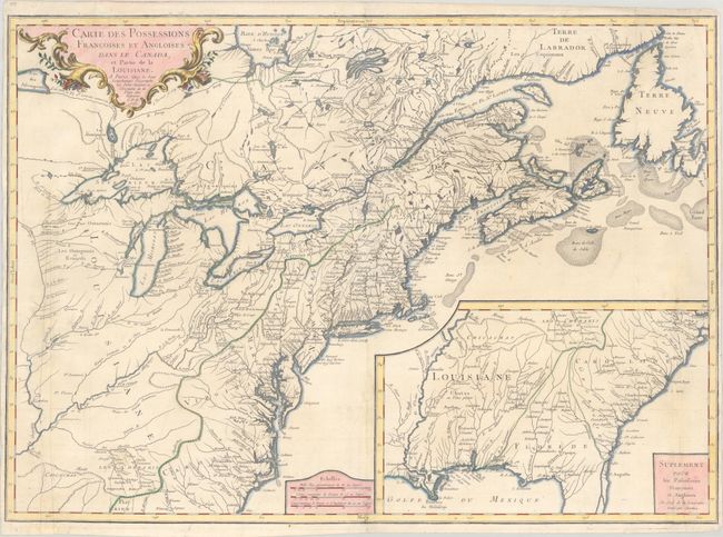
Auction 190, Lot 100
Subject: Colonial Eastern United States & Canada
Longchamp, S. G. (Sieur)
Carte des Possessions Francoises et Angloises dans le Canada, et Partie de la Louisiane, 1756
Size: 30.1 x 21.5 inches (76.5 x 54.6 cm)
Estimate: $1,400 - $1,700
First State of Longchamp's Map of the Theater of the French and Indian War
Sold for: $1,000
Closed on 11/16/2022
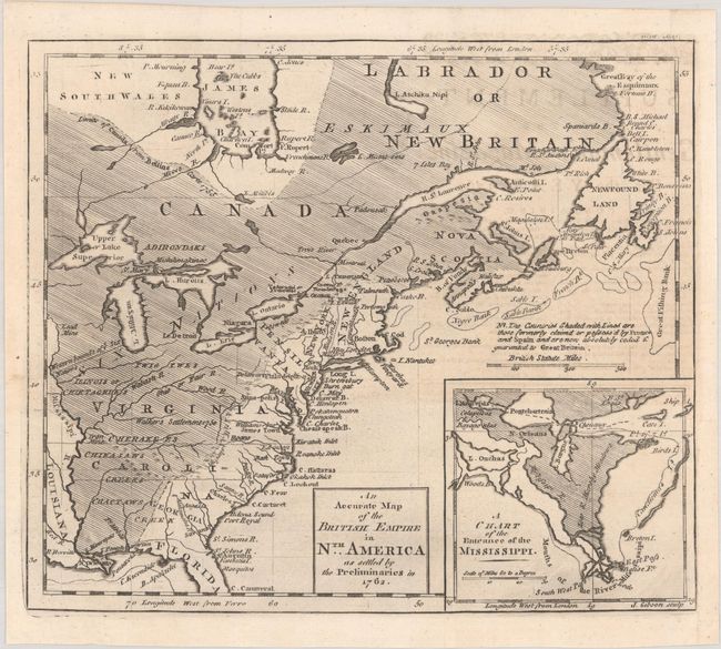
Auction 190, Lot 101
Subject: Colonial Eastern United States & Canada
Gibson, John
An Accurate Map of the British Empire in Nth. America as Settled by the Preliminaries in 1762, 1762
Size: 9.7 x 8.3 inches (24.6 x 21.1 cm)
Estimate: $350 - $425
Sold for: $250
Closed on 11/16/2022
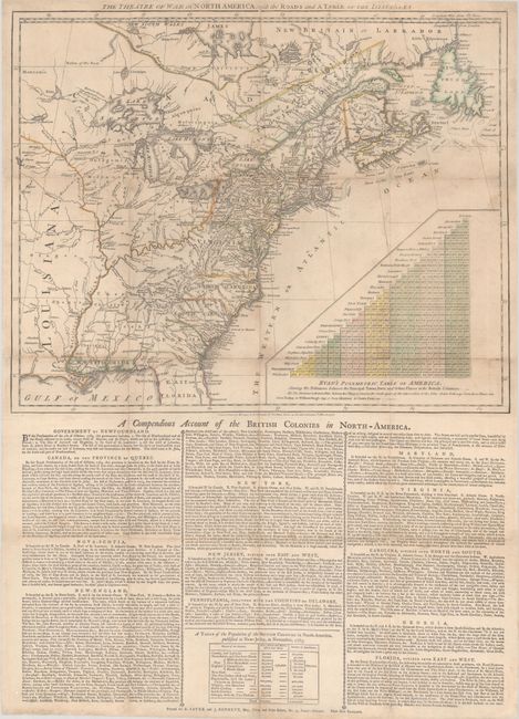
Auction 190, Lot 102
Subject: Colonial Eastern United States & Canada
Sayer & Bennett
The Theatre of War in North America, with the Roads and a Table of the Distances, 1776
Size: 20.1 x 16.1 inches (51.1 x 40.9 cm)
Estimate: $9,500 - $12,000
Early Broadside Informing British Readers of the Brewing War - First State
Sold for: $7,000
Closed on 11/16/2022
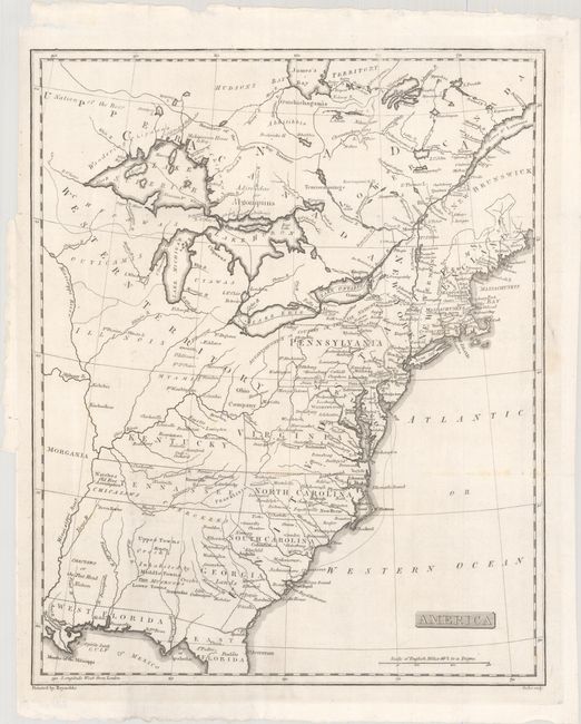
Auction 190, Lot 103
Subject: Eastern United States & Canada, Franklin
Rochefoucald Liancourt, Francois Alexander
America, 1805
Size: 12.9 x 15.9 inches (32.8 x 40.4 cm)
Estimate: $1,000 - $1,300
Features the Short-Lived State of Franklin
Sold for: $1,100
Closed on 11/16/2022
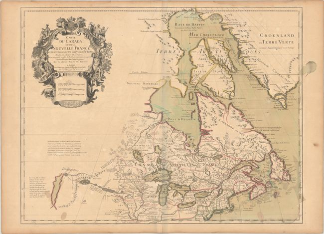
Auction 190, Lot 104
Subject: Colonial Northeastern United States & Canada, Great Lakes
Delisle, Guillaume
Carte du Canada ou de la Nouvelle France et des Decouvertes qui y ont ete Faites..., 1703
Size: 25.6 x 19.6 inches (65 x 49.8 cm)
Estimate: $2,000 - $2,300
Delisle's Seminal Map of Canada and the Great Lakes in Contemporary Color
Sold for: $1,100
Closed on 11/16/2022
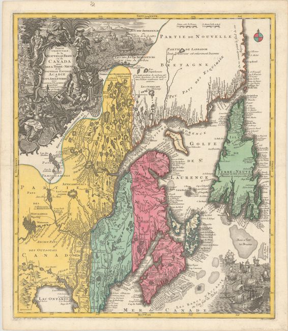
Auction 190, Lot 105
Subject: Colonial Northeastern United States & Canada
Seutter/Lotter
Partie Orientale de la Nouvelle France ou du Canada avec l'Isle de Terre-Neuve et de Nouvelle Ecosse, Acadie et Nouv. Angleterre…, 1756
Size: 19.5 x 22.7 inches (49.5 x 57.7 cm)
Estimate: $1,200 - $1,500
Sold for: $900
Closed on 11/16/2022
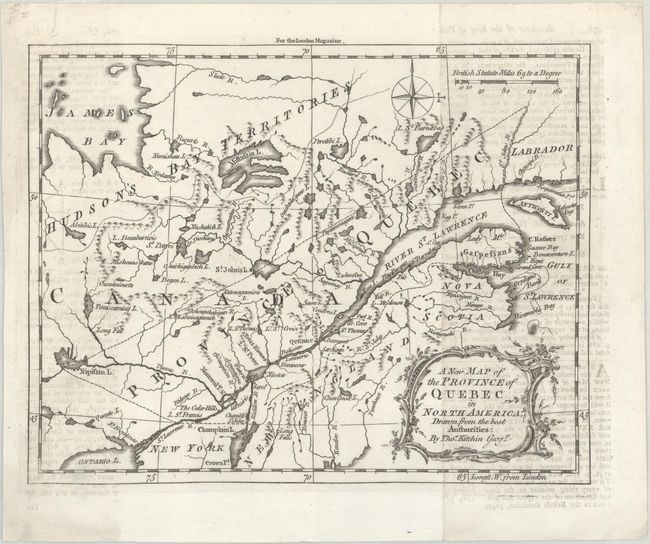
Auction 190, Lot 106
Subject: Colonial Northeastern United States & Canada
Kitchin, Thomas
A New Map of the Province of Quebec in North America; Drawn from the Best Authorities, 1764
Size: 8.6 x 6.8 inches (21.8 x 17.3 cm)
Estimate: $240 - $300
Unsold
Closed on 11/16/2022
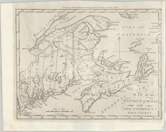
Auction 190, Lot 107
Subject: Northeastern United States & Canada
Morse, Jedidiah (Rev.)
A Map of the District of Maine with New Brunswick & Nova Scotia, 1796
Size: 9.1 x 6.9 inches (23.1 x 17.5 cm)
Estimate: $150 - $180
Sold for: $180
Closed on 11/16/2022
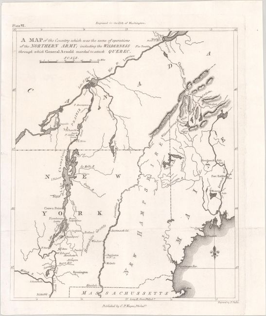
Auction 190, Lot 108
Subject: Northeastern United States & Canada
Marshall, John
A Map of the Country Which Was the Scene of Operations of the Northern Army; Including the Wilderness Through Which General Arnold Marched to Attack Quebec, 1807
Size: 8.6 x 10.3 inches (21.8 x 26.2 cm)
Estimate: $100 - $130
NO RESERVE
Sold for: $110
Closed on 11/16/2022
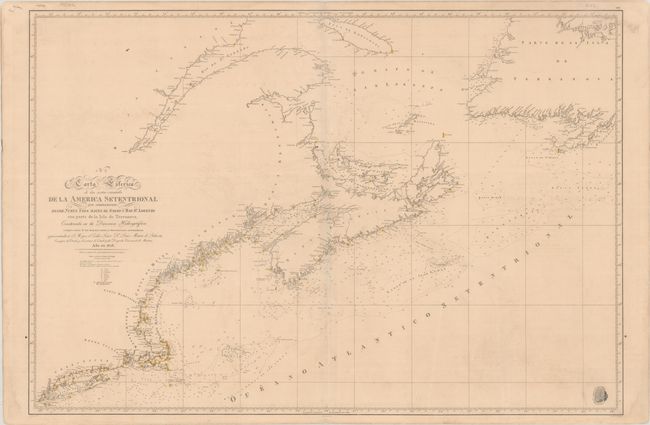
Auction 190, Lot 109
Subject: Northeastern United States & Canada
Direccion de Hidrografia
N. 2. Carta Esferica de las Costas Orientales de la America Setentrional qu Comprehende Desde Nueva York Hasta el Golfo y Rio St. Lorenzo... , 1828
Size: 36.4 x 24.8 inches (92.5 x 63 cm)
Estimate: $300 - $375
Sold for: $200
Closed on 11/16/2022
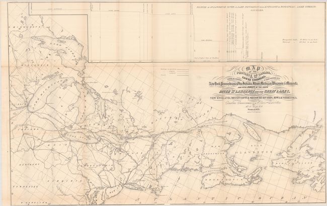
Auction 190, Lot 110
Subject: Northeastern United States & Canada
Keefer, Thomas C.
Map of the Province of Canada, and the Lower Colonies, Shewing the Connection by Steam Navigation with New York, Pennsylvania, Ohio, Indiana, Illinois, Michigan, Wisconsin & Minnesota..., 1855
Size: 38.9 x 25 inches (98.8 x 63.5 cm)
Estimate: $250 - $325
Map to Promote Canadian Trade via the St. Lawrence River
Sold for: $200
Closed on 11/16/2022
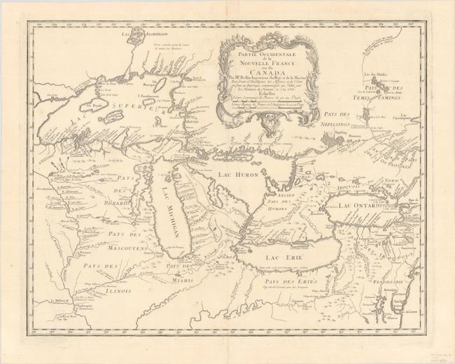
Auction 190, Lot 111
Subject: Colonial Great Lakes
Bellin/Homann Heirs
Partie Occidentale de la Nouvelle France ou du Canada, 1755
Size: 21.3 x 16.9 inches (54.1 x 42.9 cm)
Estimate: $1,600 - $1,900
Influential Map of the Great Lakes
Sold for: $2,100
Closed on 11/16/2022
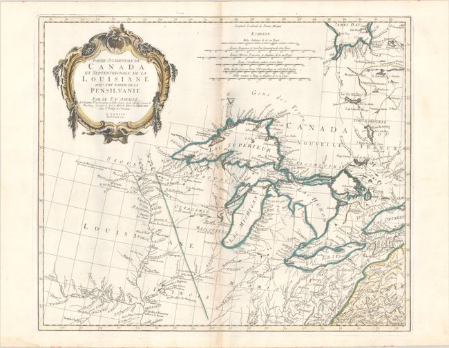
Auction 190, Lot 112
Subject: Colonial Central United States & Canada, Great Lakes
D'Anville/Santini
Partie Occidentale du Canada et Septentrionale de la Louisiane avec une Partie de la Pensilvanie, 1775
Size: 22.3 x 18.9 inches (56.6 x 48 cm)
Estimate: $900 - $1,100
Sold for: $650
Closed on 11/16/2022
Auction 190, Lot 113
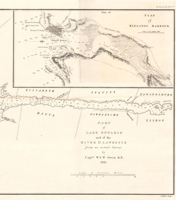
Subject: Lake Ontario & St. Lawrence River
Part of Lake Ontario and of the River St. Lawrence from an Actual Survey, 1816
Size: 23.6 x 9.5 inches (59.9 x 24.1 cm)
Estimate: $275 - $350
Sold for: $200
Closed on 11/16/2022
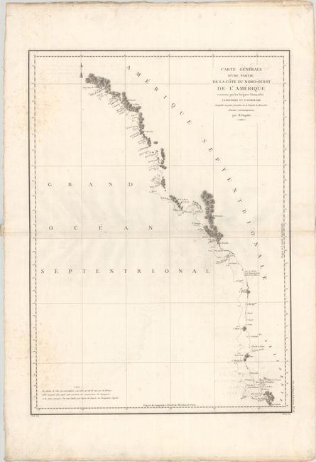
Auction 190, Lot 114
Subject: Western United States & Canada
La Perouse, Comte Jean F. Galoup, de
Carte Generale d'une Partie de la Cote du Nord-Ouest de l'Amerique Reconnue par les Fregates Francaises la Boussole et l'Astrolabe..., 1797
Size: 19.5 x 27.1 inches (49.5 x 68.8 cm)
Estimate: $240 - $300
Unsold
Closed on 11/16/2022
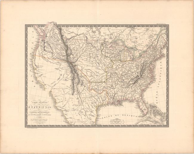
Auction 190, Lot 115
Subject: United States
Brue, Adrien Hubert
Carte Generale des Etats-Unis de l'Amerique Septentrionale, 1820
Size: 19.9 x 14.8 inches (50.5 x 37.6 cm)
Estimate: $350 - $425
Sold for: $250
Closed on 11/16/2022
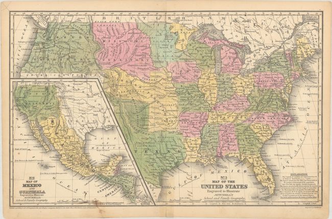
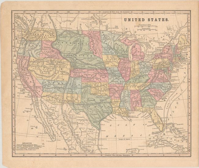
Auction 190, Lot 116
Subject: United States, Texas, Mexico
Mitchell, Samuel Augustus
No. 5 Map of the United States Engraved to Illustrate Mitchell's School and Family Geography, 1846
Size: 16.8 x 10.5 inches (42.7 x 26.7 cm)
Estimate: $200 - $230
Sold for: $150
Closed on 11/16/2022
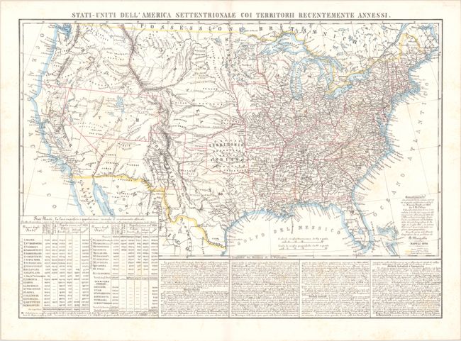
Auction 190, Lot 117
Subject: United States
Marzolla, Benedetto
Stati-Uniti dell' America Settentrionale coi Territorii Recentemente Annessi, 1854
Size: 24.3 x 17.2 inches (61.7 x 43.7 cm)
Estimate: $200 - $230
Sold for: $450
Closed on 11/16/2022
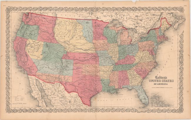
Auction 190, Lot 118
Subject: United States
Johnson & Browning
Colton's United States of America, 1859
Size: 26.5 x 15.6 inches (67.3 x 39.6 cm)
Estimate: $750 - $900
Scarce Map Featuring Colona
Sold for: $750
Closed on 11/16/2022
Auction 190, Lot 119
Subject: United States, Jefferson
Smith, Roswell C.
[Lot of 2] United States [and] Washington, Oregon, California, Utah, New Mexico, 1860
Size: See Description
Estimate: $300 - $375
Two Maps Showing the Ephemeral Territory of Jefferson
Sold for: $275
Closed on 11/16/2022
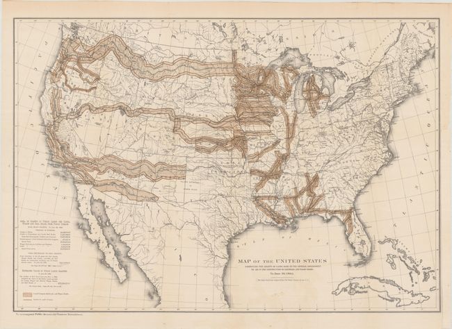
Auction 190, Lot 120
Subject: United States
Donaldson, Thomas
Map of the United States Exhibiting the Grants of Lands Made by the General Government to Aid in the Construction of Railroads and Wagon Roads..., 1883
Size: 28.5 x 19.8 inches (72.4 x 50.3 cm)
Estimate: $250 - $325
Sold for: $275
Closed on 11/16/2022
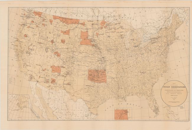
Auction 190, Lot 121
Subject: United States
[Lot of 4] Map Showing the Location of the Indian Reservations... [and] Map Showing Indian Reservations Within the Limits of the United States... [and] Map Showing Indian Reservations... [and] Linguistic Stocks of American Indians North of Mexico, 1884-1896
Size: See Description
Estimate: $250 - $325
Sold for: $500
Closed on 11/16/2022
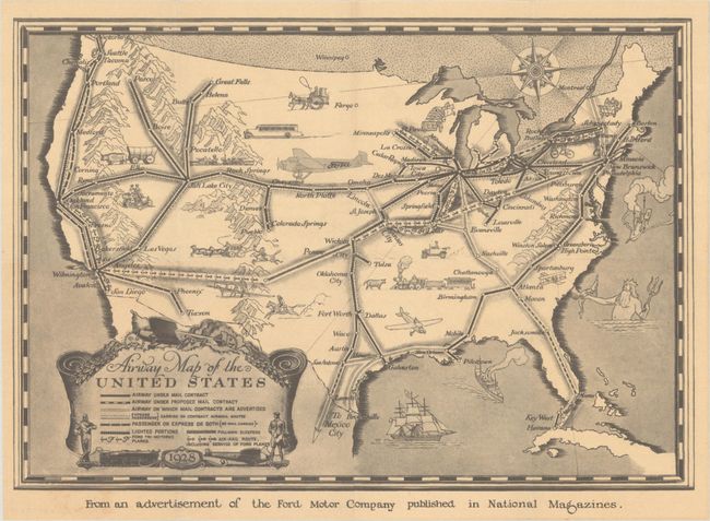
Auction 190, Lot 122
Subject: United States, Aviation
[Lot of 3] Airway Map of the United States [and] American Airlines System Map - Route of the Flagships [and] American Airlines System Map - America's Leading Airline, 1928-53
Size: See Description
Estimate: $200 - $230
Sold for: $600
Closed on 11/16/2022
Auction 190, Lot 123
Subject: United States
A Map of the United States Showing the Dates of the First Known Printing in the Several States, 1940
Size: 13.4 x 10.4 inches (34 x 26.4 cm)
Estimate: $140 - $170
Sold for: $100
Closed on 11/16/2022
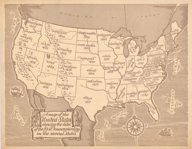
Auction 190, Lot 124
Subject: United States
Indians of the U.S.A., 1944
Size: 16 x 10 inches (40.6 x 25.4 cm)
Estimate: $190 - $220
Sold for: $140
Closed on 11/16/2022
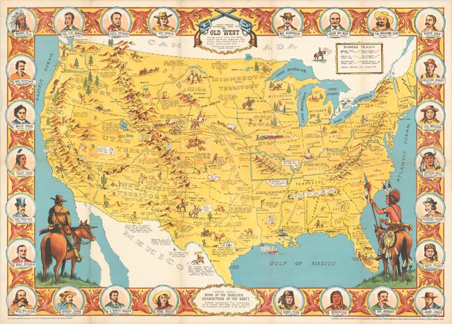
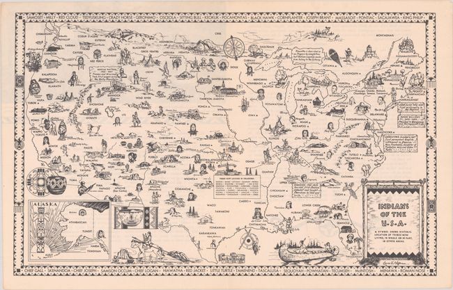
Auction 190, Lot 125
Subject: United States
Danny Arnold's Pictorial Map of the Old West Showing Pioneer Trails and Battles, Indian's Territories, Stagecoach Lines, Military Forts, Historical Data of the Frontier Period Around 1840, 1955
Size: 33.9 x 23.9 inches (86.1 x 60.7 cm)
Estimate: $240 - $300
Sold for: $180
Closed on 11/16/2022
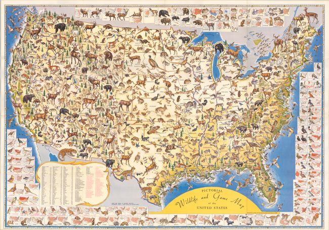
Auction 190, Lot 126
Subject: United States
Pictorial Wildlife and Game Map of the United States, 1956
Size: 26.8 x 18.9 inches (68.1 x 48 cm)
Estimate: $250 - $325
Sold for: $180
Closed on 11/16/2022
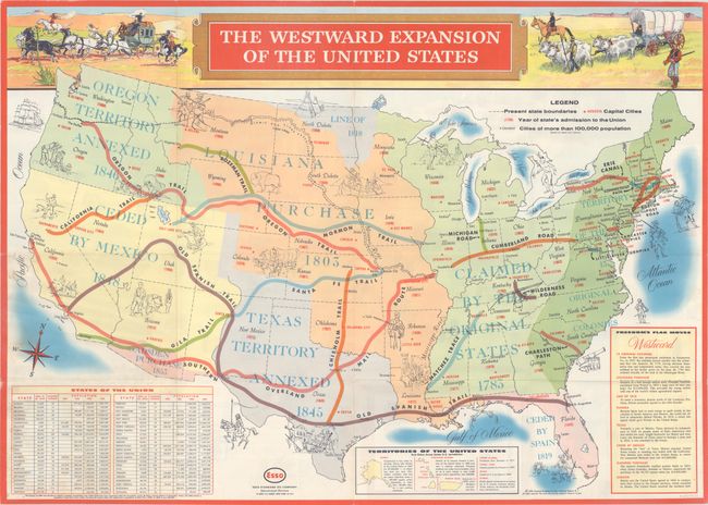
Auction 190, Lot 127
Subject: United States
[Lot of 2] Life in Colonial America and the Westward Expansion of the United States [and] Folklore and Legends of Our Country, 1958-60
Size: See Description
Estimate: $220 - $250
Sold for: $140
Closed on 11/16/2022
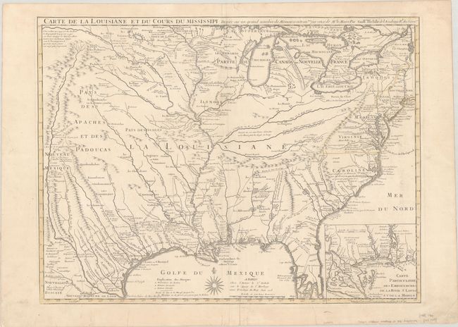
Auction 190, Lot 128
Subject: Colonial Eastern United States, Louisiana Territory
Delisle/Buache
Carte de la Louisiane et du Cours du Mississipi Dressee sur un Grand Nombre de Memoires Entrautres sur ceux de Mr. le Maire, 1745
Size: 25.4 x 19.1 inches (64.5 x 48.5 cm)
Estimate: $1,800 - $2,200
Buache Edition of Delisle's Influential Map of the Louisiana Territory
Sold for: $900
Closed on 11/16/2022
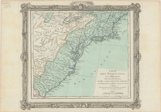
Auction 190, Lot 129
Subject: Eastern United States
Brion de la Tour/Desnos
Carte des Etats-Unis de l'Amerique Septentrionale, Dressee d'Apres des Cartes Anglaises, 1784
Size: 12.6 x 11.3 inches (32 x 28.7 cm)
Estimate: $250 - $325
Sold for: $180
Closed on 11/16/2022
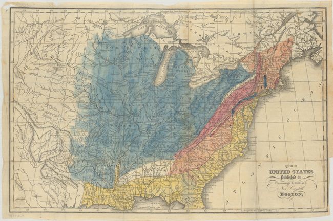
Auction 190, Lot 130
Subject: Eastern United States
Cummings & Hilliard
The United States, 1822
Size: 16.7 x 10.8 inches (42.4 x 27.4 cm)
Estimate: $350 - $425
Sold for: $180
Closed on 11/16/2022
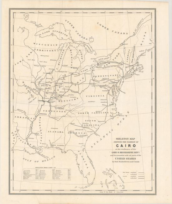
Auction 190, Lot 131
Subject: Eastern United States, Illinois
U.S. Government
Skeleton Map Shewing the Position of Cairo at the Confluence of the Ohio & Mississippi Rivs. and Its Connection with All Parts of the United States by Rail Roads Rivers and Canals, 1844
Size: 11.8 x 14.8 inches (30 x 37.6 cm)
Estimate: $150 - $180
Sold for: $100
Closed on 11/16/2022
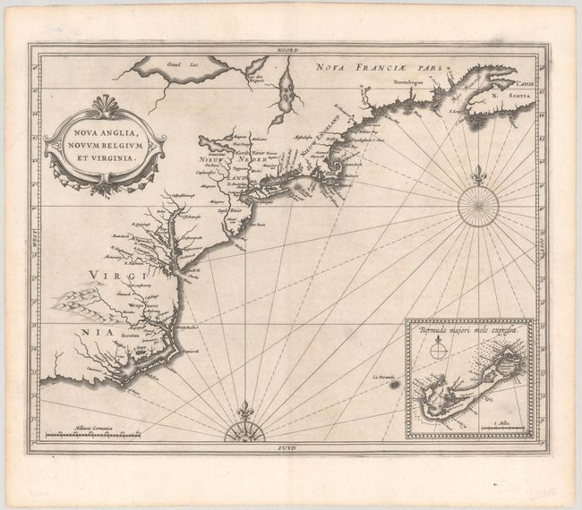
Auction 190, Lot 132
Subject: Colonial New England & Mid-Atlantic United States
Gerritsz/De Laet
Nova Anglia, Novum Belgium et Virginia, 1630
Size: 14 x 11 inches (35.6 x 27.9 cm)
Estimate: $6,000 - $7,500
A Critically Important Map in the Cartographic Evolution of North America
Unsold
Closed on 11/16/2022
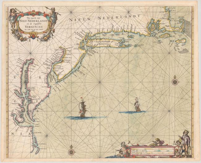
Auction 190, Lot 133
Subject: Colonial New England & Mid-Atlantic United States
Goos, Pieter
Pas Caerte van Nieu Nederlandt en de Engelsche Virginies Van Cabo Cod tot Cabo Canrick, 1666
Size: 20.9 x 16.9 inches (53.1 x 42.9 cm)
Estimate: $7,000 - $8,500
Goos' Gorgeous Chart of the Mid-Atlantic & New England
Unsold
Closed on 11/16/2022
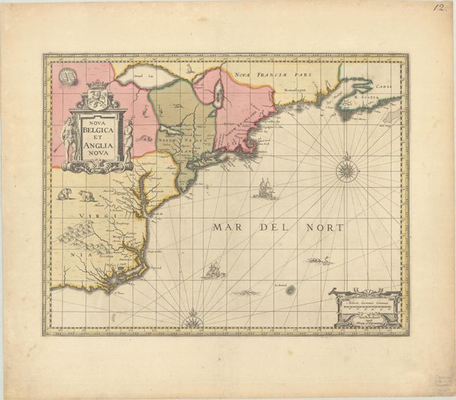
Auction 190, Lot 134
Subject: Colonial New England & Mid-Atlantic United States
Jansson/Valck & Schenk
Nova Belgica et Anglia Nova, 1694
Size: 19.5 x 15.1 inches (49.5 x 38.4 cm)
Estimate: $1,600 - $1,900
Jansson's Influential Map of the East Coast - Valck & Schenk Edition
Sold for: $1,200
Closed on 11/16/2022
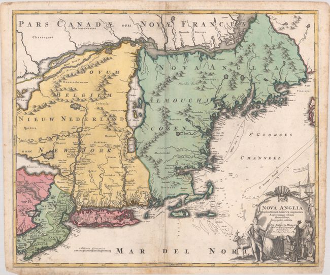
Auction 190, Lot 135
Subject: Colonial New England & Mid-Atlantic United States
Homann, Johann Baptist
Nova Anglia Septentrionali Americae Implantata Anglorumque Coloniis Florentissima, 1730
Size: 22.9 x 19.3 inches (58.2 x 49 cm)
Estimate: $950 - $1,200
Sold for: $600
Closed on 11/16/2022
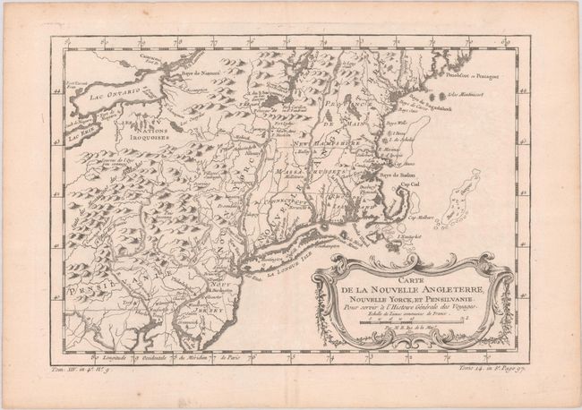
Auction 190, Lot 136
Subject: Colonial New England & Mid-Atlantic United States
Bellin, Jacques Nicolas
Carte de la Nouvelle Angleterre, Nouvelle Yorck, et Pensilvanie. Pour Servir a l'Histoire Generale des Voyages, 1757
Size: 11.8 x 8.1 inches (30 x 20.6 cm)
Estimate: $160 - $190
Sold for: $120
Closed on 11/16/2022
Auction 190, Lot 137
Subject: Colonial New England & Mid-Atlantic United States
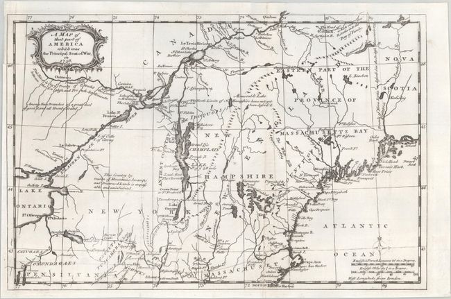
Anon.
A Map of That Part of America Which Was the Principal Seat of War, in 1756, 1757
Size: 13.1 x 8.6 inches (33.3 x 21.8 cm)
Estimate: $350 - $425
Sold for: $250
Closed on 11/16/2022
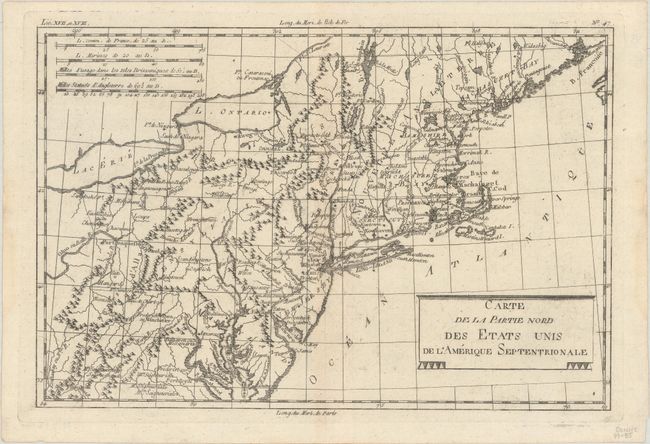
Auction 190, Lot 138
Subject: New England & Mid-Atlantic United States
Bonne, Rigobert
Carte de la Partie Nord des Etats Unis de l'Amerique Septentrionale, 1785
Size: 12.8 x 8.5 inches (32.5 x 21.6 cm)
Estimate: $120 - $150
Sold for: $60
Closed on 11/16/2022
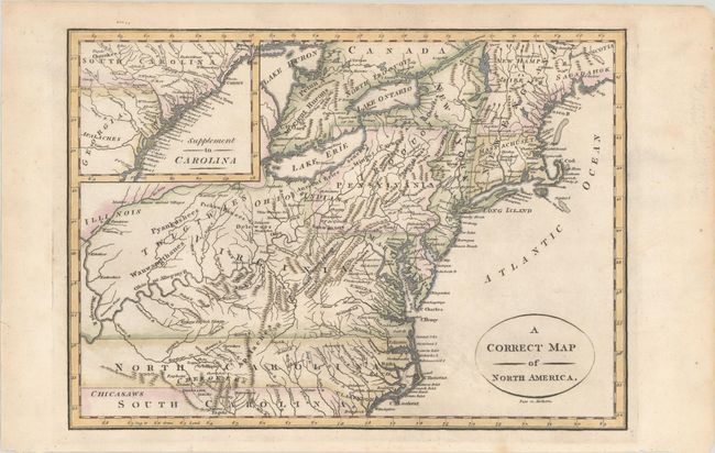
Auction 190, Lot 139
Subject: New England & Mid-Atlantic United States
A Correct Map of North America, 1800
Size: 11.6 x 8.3 inches (29.5 x 21.1 cm)
Estimate: $240 - $300
Sold for: $120
Closed on 11/16/2022
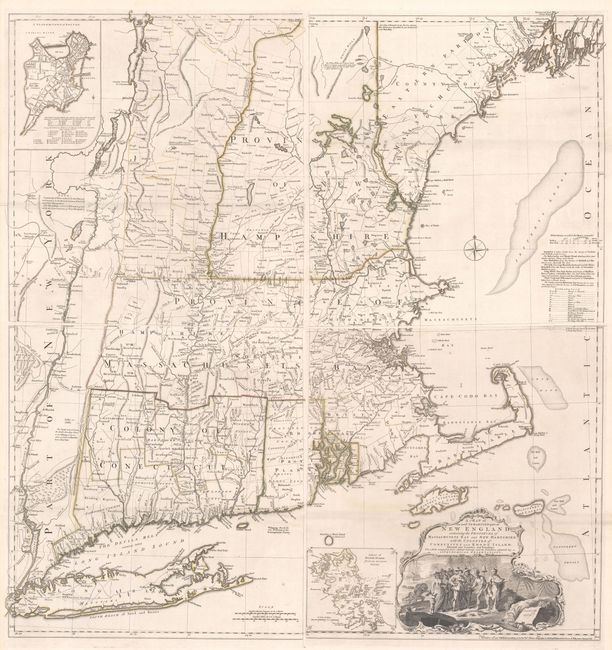
Auction 190, Lot 140
Subject: Colonial New England United States
Jefferys, Thomas
[On 4 Sheets] A Map of the Most Inhabited Part of New England, Containing the Provinces of Massachusets Bay and New Hampshire, with the Colonies of Conecticut and Rhode Island..., 1755
Size: 19.2 x 20.3 inches (48.8 x 51.6 cm)
Estimate: $7,000 - $8,500
Rare State of Jefferys' Influential Map of New England in Contemporary Color
Sold for: $3,250
Closed on 11/16/2022
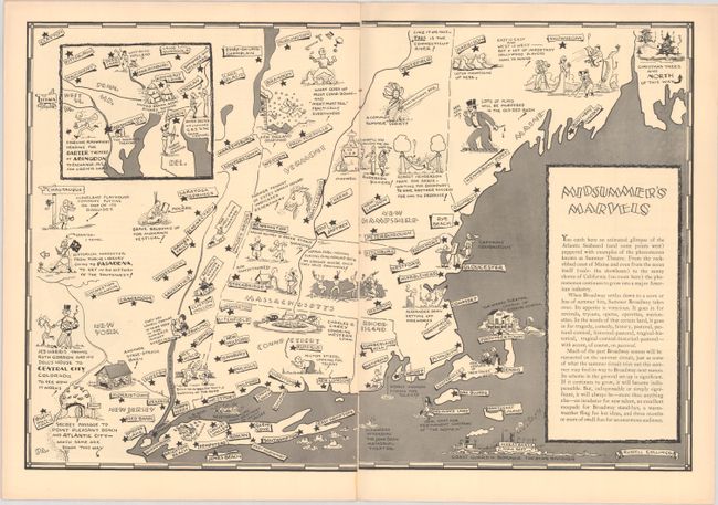
Auction 190, Lot 141
Subject: New England United States
Midsummer's Marvels, 1937-38
Size: 18.8 x 12.6 inches (47.8 x 32 cm)
Estimate: $200 - $230
Sold for: $150
Closed on 11/16/2022
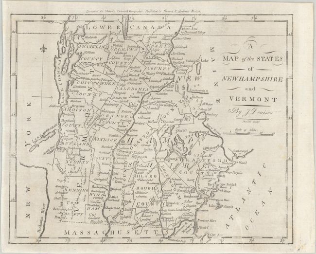
Auction 190, Lot 142
Subject: New Hampshire & Vermont
Morse, Jedidiah (Rev.)
A Map of the States of New Hampshire and Vermont, 1796
Size: 9.2 x 7.4 inches (23.4 x 18.8 cm)
Estimate: $150 - $180
Sold for: $80
Closed on 11/16/2022
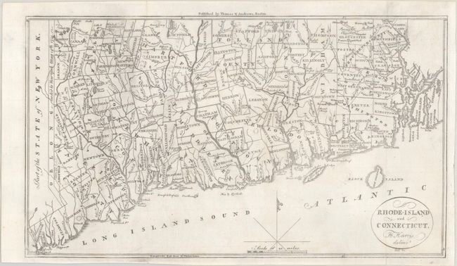
Auction 190, Lot 143
Subject: Connecticut & Rhode Island
Morse, Jedidiah (Rev.)
Rhode-Island and Connecticut, 1796
Size: 13.3 x 7.6 inches (33.8 x 19.3 cm)
Estimate: $150 - $180
Sold for: $120
Closed on 11/16/2022
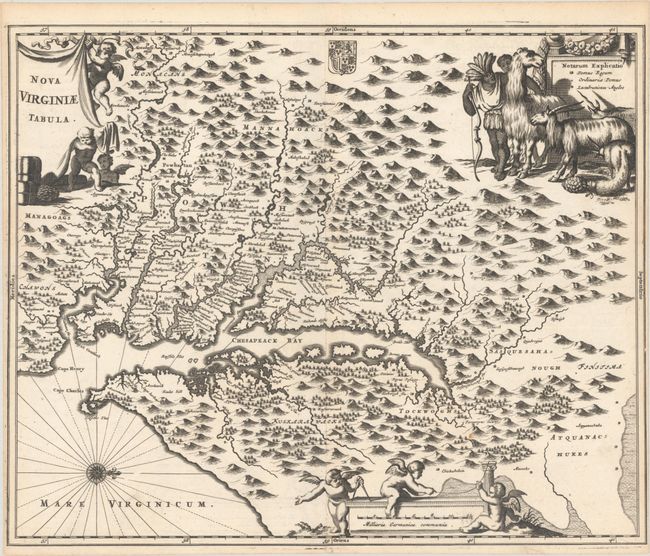
Auction 190, Lot 144
Subject: Colonial Mid-Atlantic United States
Montanus, Arnoldus
Nova Virginiae Tabula, 1671
Size: 14.1 x 11.5 inches (35.8 x 29.2 cm)
Estimate: $800 - $950
Sold for: $600
Closed on 11/16/2022
Auction 190, Lot 145
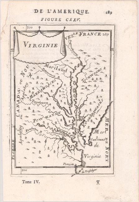
Subject: Colonial Mid-Atlantic United States
Mallet, Alain Manesson
Virginie, 1683
Size: 4.1 x 6 inches (10.4 x 15.2 cm)
Estimate: $200 - $230
Unsold
Closed on 11/16/2022
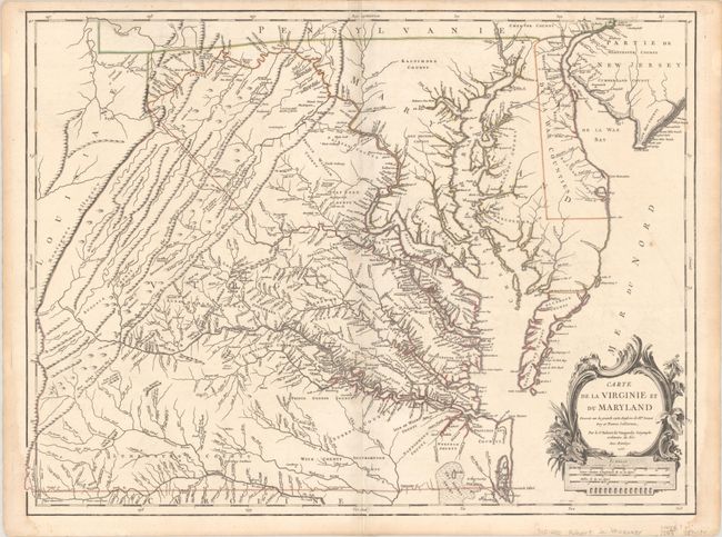
Auction 190, Lot 146
Subject: Colonial Mid-Atlantic United States
Robert de Vaugondy, Didier
Carte de la Virginie et du Maryland Dressee sur la Grande Carte Angloise de Mrs. Josue Fry et Pierre Jefferson..., 1755
Size: 25.4 x 19.1 inches (64.5 x 48.5 cm)
Estimate: $2,500 - $3,250
First State of Robert de Vaugondy's Essential Map of Virginia and Maryland
Sold for: $1,800
Closed on 11/16/2022
164 lots
Page 1 of 4