Catalog Archive
Auction 190, Lot 123

"A Map of the United States Showing the Dates of the First Known Printing in the Several States",

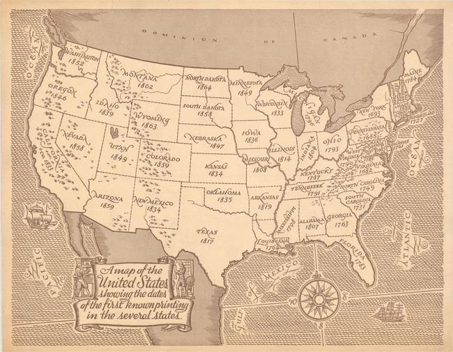
Subject: United States

Period: 1940 (circa)

Publication:

Color: Black & White

Size:
13.4 x 10.4 inches
34 x 26.4 cm
Download High Resolution Image
(or just click on image to launch the Zoom viewer)

This simple, but informative, thematic map by B.A. Benson reveals the first known printing dates in each state. As one might expect, the original thirteen colonies have the earliest printings with Massachusetts (1639) and Virginia (1682) leading the way. West of the Mississippi River, all but Louisiana (1764) had first printings in the 19th century. The map is adorned by classical decorative elements including a banner-style title cartouche, compass rose, and sailing ships.

References:

Condition: B+

On heavy tan paper with minor creases in the corners of the sheet and a short tear along the top sheet edge that has been closed on verso with archival tape.

Estimate: $140 - $170

Sold for: $100

Closed on 11/16/2022

Archived