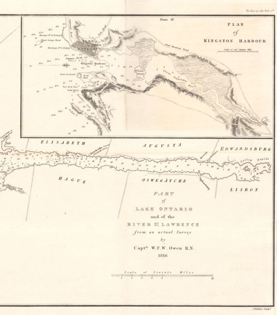
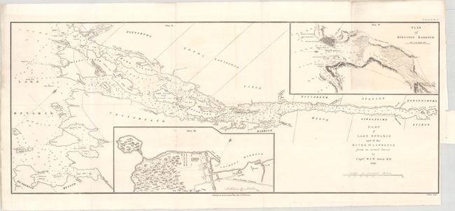
Subject: Lake Ontario & St. Lawrence River
Period: 1816 (dated)
Publication: A Full and Correct Account of the Military Occurrences of the Late War...
Color: Black & White
Size:
23.6 x 9.5 inches
59.9 x 24.1 cm
A detailed chart of the northeastern portion of Lake Ontario and the St. Lawrence River to beyond Ogdensburg. It presents excellent navigational detail including numerous depth soundings, shoals, anchorages, islands, creeks and bays. Features inset maps of the vicinity of Kingston and Sackets Harbor, New York including Fort Pike and Fort Tompkins. Drawn from surveys completed by William Fitzwilliam Owen and issued in William James' War of 1812 account entitled A Full and Correct Account of the Military Occurrences of the Late War between Great Britain and the United States.
References: Phillips (Maps) p. 639.
Condition: B+
Issued folding on a clean bright sheet with a small binding trim at lower right and associated tiny binding tear. There is faint offsetting and a bit of light toning at top right.