Subject: United States, Aviation
Period: 1928-53 (circa)
Publication:
Color:
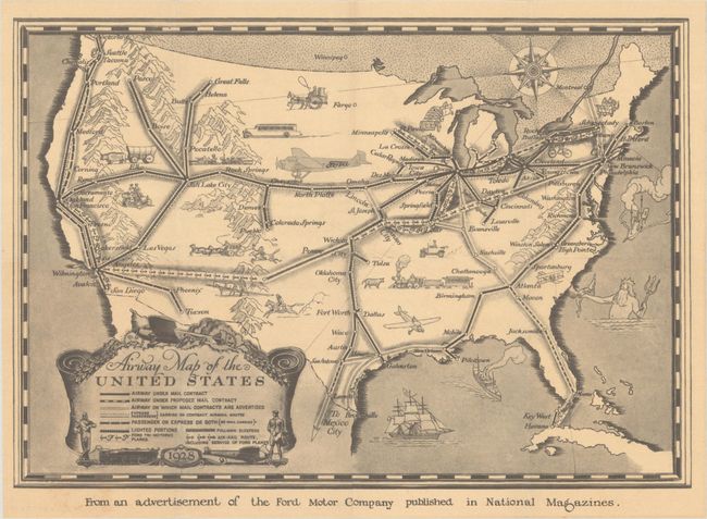
A. Airway Map of the United States, by Ford Motor Company, dated 1928, black & white (13.5 x 9.4"). This pictorial map presents a network of early airway routes and railroads stretching across the United States with a key at bottom locating air mail routes, passenger routes, Ford tri-motored plane routes, and air-rail routes. The Ford plane routes connected Detroit with Chicago, St. Louis and Kansas City as well as Buffalo to Albany. Ford Trimotor, nicknamed the "Tin Goose," operated between 1925-33 and served the emerging civil aviation industry. Because of the plane's limited range (570 miles), however, these air routes were networked with the railroads to offer travelers transcontinental service. Condition: Fine. (A+)
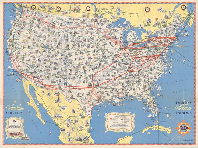
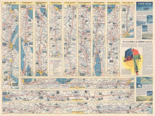
B. American Airlines System Map - Route of the Flagships, by American Airlines, circa 1945, printed color (31.3 x 23.3"). This densely illustrated pictorial map is color-coded to show airline routes in the United States and extending to portions of Canada, Mexico, the Bahamas and Cuba. American Airlines routes are depicted by thick red lines, while other routes are noted by a thin green line. Filling the map are numerous vignettes displaying points of interest, leisure activities, historical sites, and more. The verso contains twelve strip maps showing airline routes between various cities and a section of descriptive text entitled "The Radio Beam is the Highway of the Air." The use of radio signals for commercial aviation increased exponentially following the military's enhancements of this technology during World War II. Condition: Clean and colorful. (A)
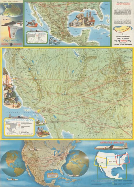
C. American Airlines System Map - America's Leading Airline, by American Airlines, circa 1953, printed color (24.0 x 33.5"). This brochure contains four maps showing American's routes in the United States and Mexico. The recto presents routes along the east coast and central United States, while the verso covers the western United States and Mexico. Each has a legend identifying air routes, through service, railroads, rivers, points of interest, and more. Text panel on back of brochure notes "American Makes History with the First Nonstop Service Coast to Coast in Both Directions." Condition: Clean and colorful. (A)
References:
Condition:
Issued folding. See description above for additional details.