Catalog Archive
Auction 190, Lot 109

"N. 2. Carta Esferica de las Costas Orientales de la America Setentrional qu Comprehende Desde Nueva York Hasta el Golfo y Rio St. Lorenzo... ", Direccion de Hidrografia

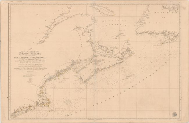
Subject: Northeastern United States & Canada

Period: 1828 (dated)

Publication:

Color: Hand Color

Size:
36.4 x 24.8 inches
92.5 x 63 cm
Download High Resolution Image
(or just click on image to launch the Zoom viewer)

This incredibly detailed Spanish chart extends from New York City north to the St. Lawrence River east to Nova Scotia, Newfoundland and the Grand Banks. It is filled with exceptional navigational detail including numerous depth soundings, shoals, bottom types, offshore islands, and lighthouses identified with yellow hand coloring. Drawn by C. Noguera and engraved by R. Esteve. Adorned by the insignia of the Direccion de Hidrografia in the bottom right corner.

References:

Condition: B+

On a sturdy sheet with light toning and minor offsetting. A faint dampstain runs along the bottom sheet edge.

Estimate: $300 - $375

Sold for: $200

Closed on 11/16/2022

Archived