Subject: United States
Period: 1958-60 (dated)
Publication:
Color: Printed Color
Two maps designed by the General Drafting Company and issued by Esso Standard Oil Company:
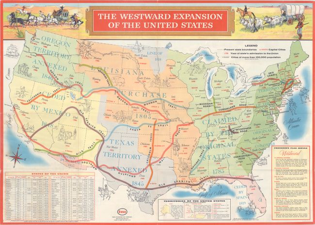
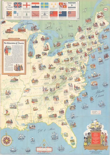
A. Life in Colonial America and the Westward Expansion of the United States, dated 1958 (24.0 x 33.5"). This brochure contains two large maps intended for instruction. The first, The Western Expansion of the United States, shows the U.S. territorial acquisitions from the original 13 colonies to Oregon Territory along with acquisition dates. The map also highlights several important roads and trails including the Oregon, Mormon, and Old Spanish trails. A table at lower left provides land area and population by state. The verso contains a map of the eastern United States that is filled with vignettes of colonial life. Interestingly, while many illustrations involve Indians, there are only scattered references to slaves. Condition: Issued folding with a few faint stains at lower left and one tiny hole in the population table also at lower left. (B+)
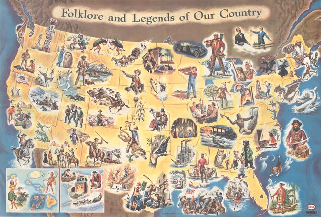
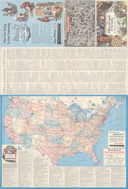
B. Folklore and Legends of Our Country, dated 1960 (33.6 x 22.8"). This large pictorial map was drawn by Frank Soltesz and published by the Humble Oil & Refining Company. Instead of focusing on physical and political geography, the map presents some of the major stories that defined the United States through detailed illustrations. A few of the 65 illustrations that caught this cataloger's eye were Daniel Webster, Blackbeard, Paul Bunyan, Calamity Jane, and the discovery of gold at Sutter's Mill. Luckily, the map has a key on verso for the more obscure references. Also on verso is a "Road Map of the United States" and a listing of tourist attractions by state entitled "Treasuries of Americana." The folklore map is dated 1960 and the road map on verso is dated 1962. Condition: Fine, issued folding. (A+)
References:
Condition:
See description above.