Subject: United States
Period: 1854 (dated)
Publication: Atlante Geografico
Color: Hand Color
Size:
24.3 x 17.2 inches
61.7 x 43.7 cm
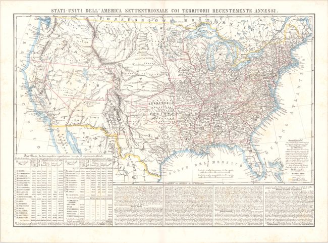
This attractive map of the United States was published in Marzolla's scarce atlas, Atlante Geografico. It features all 31 of the states established by the time of publication, including the newest additions to the Union, California (1850) and Wisconsin (1848). Also depicted are six massive territories that comprise the rest of the nation: Indian Territory, Minnesota, Nebraska, New Mexico, Utah, and Oregon. Numerous towns and cities, roads, rivers, railways, and Indian tribes are located. According to a note in Italian at bottom right, the map is based on J.H. Colton's four-sheet map of the nation published in 1852. Beneath the map is a statistical chart with population figures from the 1790 and 1850 censuses, showing the number of whites, free blacks, and slaves in each state and territory. There are also columns of Italian text describing the country's geography, natural resources, commerce, and more.
References:
Condition: B+
On a bright sheet with some faint scattered foxing.