Catalog Archive
Auction 190, Lot 110

Map to Promote Canadian Trade via the St. Lawrence River

"Map of the Province of Canada, and the Lower Colonies, Shewing the Connection by Steam Navigation with New York, Pennsylvania, Ohio, Indiana, Illinois, Michigan, Wisconsin & Minnesota...", Keefer, Thomas C.

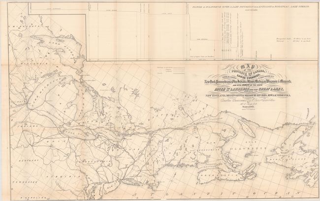
Subject: Northeastern United States & Canada

Period: 1855 (dated)

Publication:

Color: Black & White

Size:
38.9 x 25 inches
98.8 x 63.5 cm
Download High Resolution Image
(or just click on image to launch the Zoom viewer)

This fascinating persuasive map is presented on a somewhat distorted perspective with the St. Lawrence River flowing across the center of the map. It depicts numerous railroads and canals and visually suggests the river's convenient access to points west and south. Across the top is a profile linking Quebec City to Fond du Lac, Wisconsin via the Great Lakes. The map was presented at the Paris Exhibition to show the potential for Canadian ports to serve as gateways to the proposed transcontinental railroads. Lithographed by G. Matthews and published in Montreal.

References:

Condition: B+

Issued folding with minor toning along the fold lines and faint offsetting.

Estimate: $250 - $325

Sold for: $200

Closed on 11/16/2022

Archived