Filtered by Category:United States(Show All Categories)
Showing results for:Auction 179
Catalog Archive
215 lots
Page 1 of 5
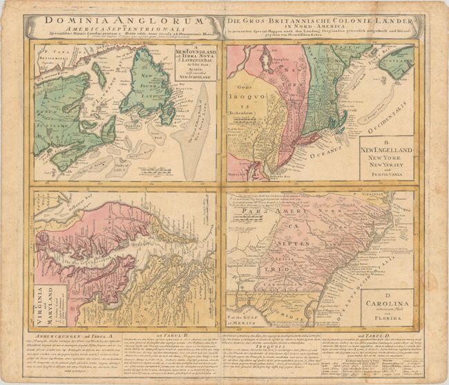
Auction 179, Lot 124
Subject: Colonial Eastern United States & Canada
Homann Heirs
Dominia Anglorum in America Septentrionali... / Die Gros-Britannische Colonie-Laender in Nord-America..., 1740
Size: 21.9 x 19.8 inches (55.6 x 50.3 cm)
Estimate: $375 - $450
Sold for: $375
Closed on 9/16/2020
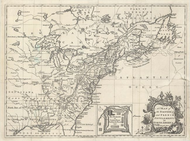
Auction 179, Lot 125
Subject: Colonial Eastern United States & Canada
Hinton, John
A Map of the British and French Settlements in North America, 1755
Size: 14.6 x 10.8 inches (37.1 x 27.4 cm)
Estimate: $600 - $750
Sold for: $650
Closed on 9/16/2020
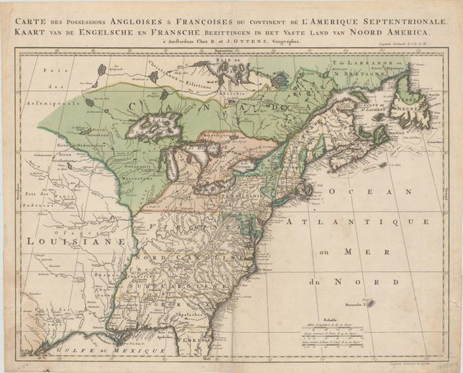
Auction 179, Lot 126
Subject: Colonial Eastern United States & Canada
Ottens, Reiner and Joshua
Carte des Possessions Angloises & Francoises du Continent de l'Amerique Septentrionale / Kaart van de Engelsche en Fransche Bezittingen in het Vaste Land van Noord America, 1755
Size: 22.3 x 16.3 inches (56.6 x 41.4 cm)
Estimate: $1,600 - $1,900
Dutch Version of an Important French & Indian War Map
Sold for: $900
Closed on 9/16/2020
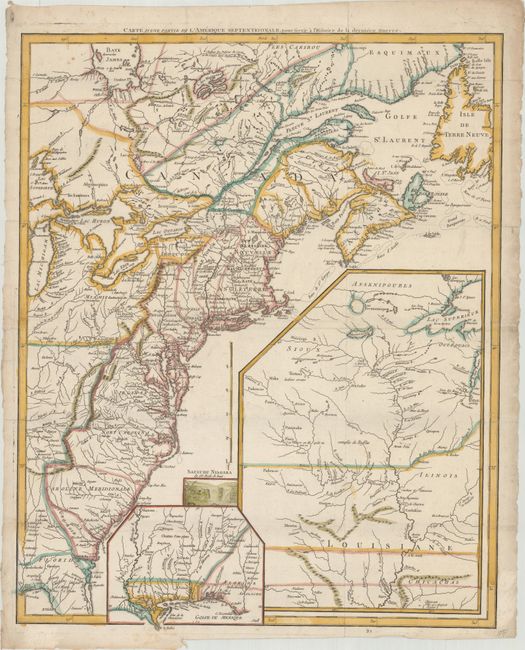
Auction 179, Lot 127
Subject: Eastern United States & Canada
Le Rouge, George Louis
Carte d'une Partie de l'Amerique Septentrionale, pour Servir a l'Histoire de la Derniere Guerre, 1787
Size: 19.4 x 24.1 inches (49.3 x 61.2 cm)
Estimate: $1,000 - $1,300
Sold for: $750
Closed on 9/16/2020
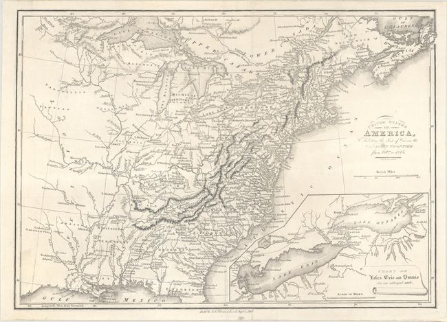
Auction 179, Lot 128
Subject: Eastern United States & Canada
Baines, Edward
United States of America, Exhibiting the Seat of War on the Canadian Frontier from 1812 to 1815, 1816
Size: 13.6 x 9.6 inches (34.5 x 24.4 cm)
Estimate: $250 - $325
Sold for: $150
Closed on 9/16/2020
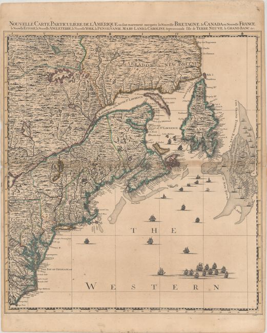
Auction 179, Lot 129
Subject: Colonial Northeastern United States & Canada
Popple/Covens & Mortier
Nouvelle Carte Particuliere de l'Amerique ou sont Exactement Marquees la Nouvelle Bretagne, le Canada ou Nouvelle France, la Nouvelle Ecosse, la Nouvelle Angleterre, la Nouvelle York, la Pensilvanie..., 1741
Size: 20.6 x 22.5 inches (52.3 x 57.2 cm)
Estimate: $2,000 - $2,300
Northeastern Sheet of the Reduced-Size Edition of Popple's Map
Sold for: $1,500
Closed on 9/16/2020
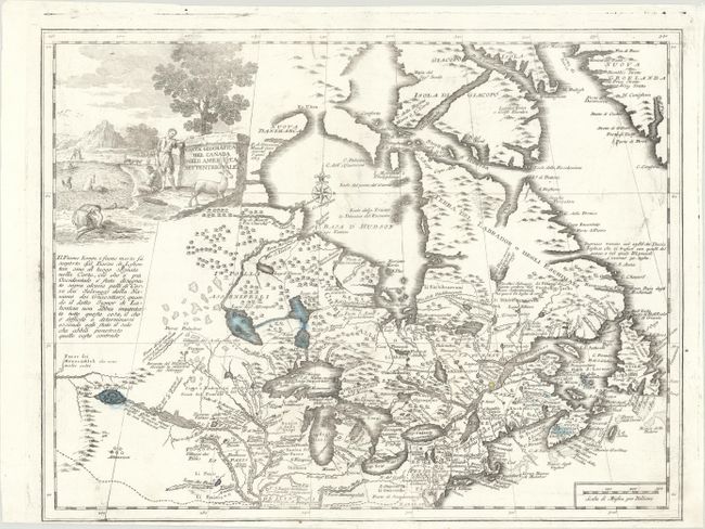
Auction 179, Lot 130
Subject: Colonial Northeastern United States & Canada, Great Lakes
Albrizzi, Girolamo
Carta Geografica del Canada nell' America Settentrionale, 1742
Size: 16.9 x 12.9 inches (42.9 x 32.8 cm)
Estimate: $600 - $750
Sold for: $450
Closed on 9/16/2020
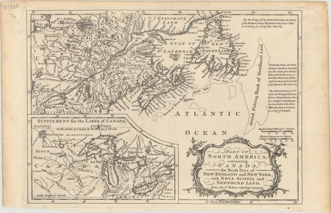
Auction 179, Lot 131
Subject: Colonial Northeastern United States & Canada, Great Lakes
Barrow, John (Sir)
Part of North America; Containing Canada, the North Parts of New England and New York; with Nova Scotia and Newfound Land. From the Sr. Robert with Improvements, 1759
Size: 11.4 x 8.1 inches (29 x 20.6 cm)
Estimate: $140 - $170
Sold for: $160
Closed on 9/16/2020
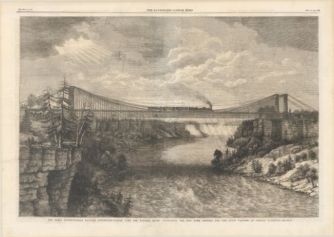
Auction 179, Lot 132
Subject: Niagara Falls, New York, Canada
The Great International Railway Suspension Bridge Over the Niagara River, Connecting the New York Central and the Great Western of Canada Railways, 1862
Size: 20.3 x 13.6 inches (51.6 x 34.5 cm)
Estimate: $60 - $80
NO RESERVE
Sold for: $75
Closed on 9/16/2020
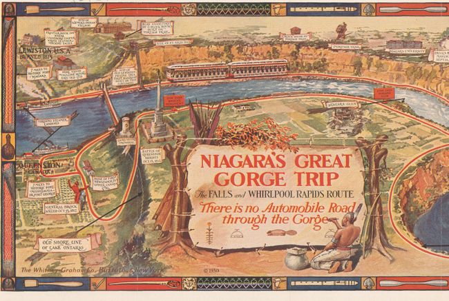
Auction 179, Lot 133
Subject: Niagara Falls, New York, Canada
Niagara's Great Gorge Trip - The Fals and Whirlpool Rapids Route, 1930
Size: 31.1 x 7.6 inches (79 x 19.3 cm)
Estimate: $80 - $100
NO RESERVE
Sold for: $90
Closed on 9/16/2020
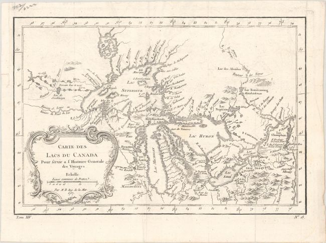
Auction 179, Lot 134
Subject: Colonial Central United States & Canada, Great Lakes
Bellin, Jacques Nicolas
Carte des Lacs du Canada pour Servir a l'Histoire Generale des Voyages, 1757
Size: 11.4 x 7.8 inches (29 x 19.8 cm)
Estimate: $350 - $425
Sold for: $250
Closed on 9/16/2020
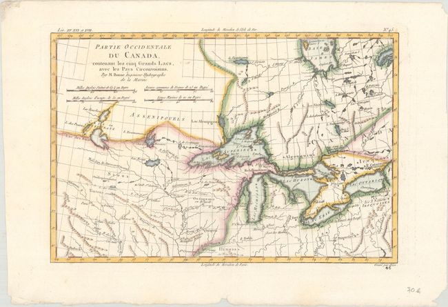
Auction 179, Lot 135
Subject: Colonial Great Lakes
Bonne, Rigobert
Partie Occidentale du Canada. Contenant les Cinq Grands Lacs, avec les Pays Circonvoisins, 1780
Size: 12.3 x 8.2 inches (31.2 x 20.8 cm)
Estimate: $180 - $220
Sold for: $220
Closed on 9/16/2020
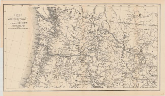
Auction 179, Lot 136
Subject: Northwestern United States & British Columbia
U.S. Government
Route from Fort Ellis Montana to Fort Hope, British Columbia, Travelled by General Sherman July and August 1883, as Shown by Heavy Black Line, 1883
Size: 27.4 x 15.2 inches (69.6 x 38.6 cm)
Estimate: $275 - $350
Sold for: $425
Closed on 9/16/2020
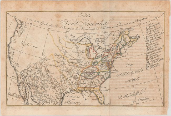
Auction 179, Lot 137
Subject: United States, Franklin
Zimmerman, Eberhard A.W.
Karte von Nord Amerika vom 50sten Grade der Breite bis Gegen den Wendekreiss des Krebses, nach den Neuesten Angaben, 1805
Size: 10.6 x 6.3 inches (26.9 x 16 cm)
Estimate: $200 - $230
Locates the State of Franklin in Present-Day Ohio
Sold for: $350
Closed on 9/16/2020
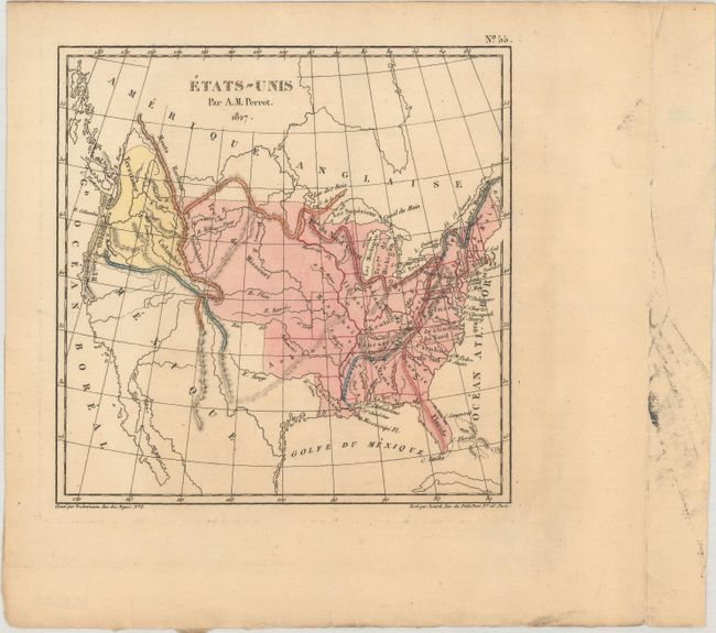
Auction 179, Lot 138
Subject: United States
Perrot, Aristide Michel
Etats-Unis, 1827
Size: 6.3 x 6.3 inches (16 x 16 cm)
Estimate: $110 - $140
Sold for: $80
Closed on 9/16/2020
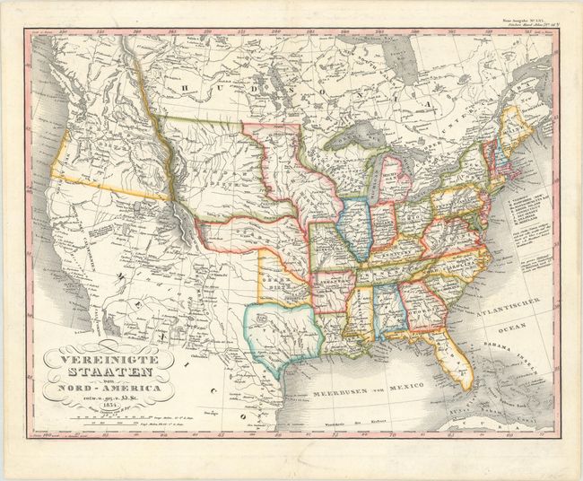
Auction 179, Lot 139
Subject: United States
Stieler, Adolph
Vereinigte Staaten von Nord-America, 1834
Size: 15.4 x 11.9 inches (39.1 x 30.2 cm)
Estimate: $240 - $300
Sold for: $325
Closed on 9/16/2020
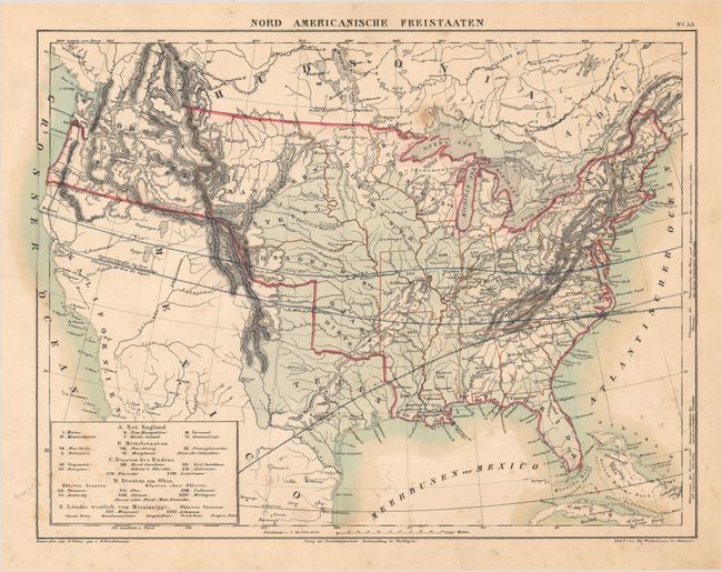
Auction 179, Lot 140
Subject: United States
Winckelmann, Edward
Nord Americanische Freistaaten, 1836
Size: 13 x 9.9 inches (33 x 25.1 cm)
Estimate: $200 - $230
Sold for: $150
Closed on 9/16/2020
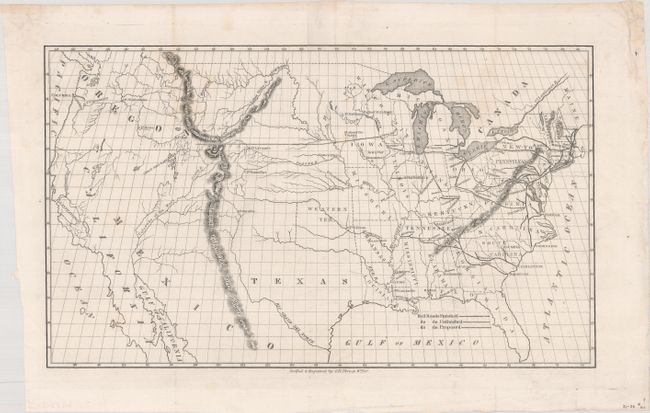
Auction 179, Lot 141
Subject: United States, Railroads
Throop, O. H.
[Untitled - Map of Proposed Routes of Western Railroads], 1846
Size: 15.9 x 9.4 inches (40.4 x 23.9 cm)
Estimate: $200 - $230
Sold for: $100
Closed on 9/16/2020
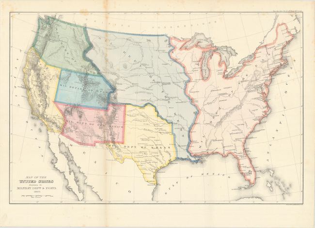
Auction 179, Lot 142
Subject: United States
U.S. Government
Map of the United States Exhibiting the Military Depts. & Posts, 1860
Size: 19.8 x 12.9 inches (50.3 x 32.8 cm)
Estimate: $250 - $325
Sold for: $325
Closed on 9/16/2020
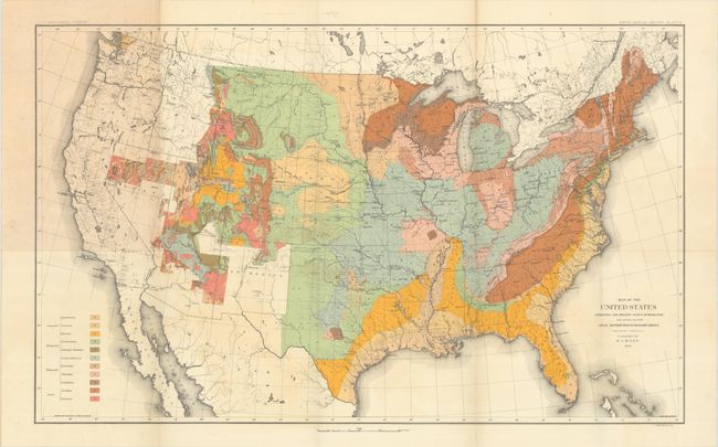
Auction 179, Lot 143
Subject: United States, Geology
U.S. Geological Survey (USGS)
Map of the United States Exhibiting the Present Status of Knowledge Relating to the Areal Distribution of Geologic Groups... [and] Map of the United States Exhibiting the Progress Made in the Geographic Survey [in] Fifth Annual Report..., 1885
Size: 28.2 x 17.3 inches (71.6 x 43.9 cm)
Estimate: $300 - $375
Includes the First Published Geological Map of the United States by the U.S.G.S.
Sold for: $220
Closed on 9/16/2020
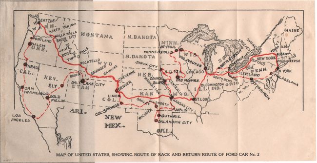
Auction 179, Lot 144
Subject: United States
Map of the United States, Showing Route of Race and Return Route of Ford Car No. 2 [in] The Story of the Race..., 1909
Size: 10 x 5 inches (25.4 x 12.7 cm)
Estimate: $140 - $170
Sold for: $100
Closed on 9/16/2020
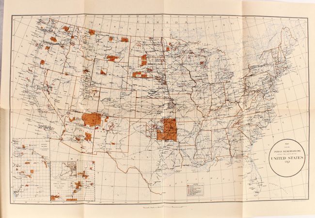
Auction 179, Lot 145
Subject: United States, Indians
Map Showing Indian Reservations Within the Limits of the United States 1913 [and] Map Showing Indian Reservations in the United States... [in] The American Indian in the United States - Period 1850-1914, 1914
Size: 7.3 x 9.9 inches (18.5 x 25.1 cm)
Estimate: $180 - $220
Sold for: $500
Closed on 9/16/2020
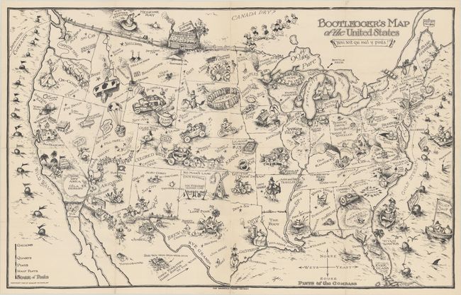
Auction 179, Lot 146
Subject: United States
Bootlegger's Map of the United States, 1926
Size: 33.8 x 21.3 inches (85.9 x 54.1 cm)
Estimate: $1,400 - $1,700
McCandlish's Humorous Prohibition Map
Sold for: $1,000
Closed on 9/16/2020
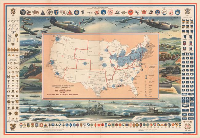
Auction 179, Lot 147
Subject: United States, World War II
Hammond, C. S.
Defense Map of United States Prepared by C.S. Hammond & Co., N.Y. Showing the Mobilization of Our Military and Economic Resources, 1941
Size: 31 x 21.1 inches (78.7 x 53.6 cm)
Estimate: $450 - $550
Sold for: $325
Closed on 9/16/2020
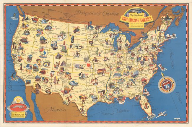
Auction 179, Lot 148
Subject: United States, Transportation
[Lot of 2] The Greyhound Map of This Amazing America... [and] American Airlines System Map, 1941-45
Size: See Description
Estimate: $200 - $230
Sold for: $150
Closed on 9/16/2020
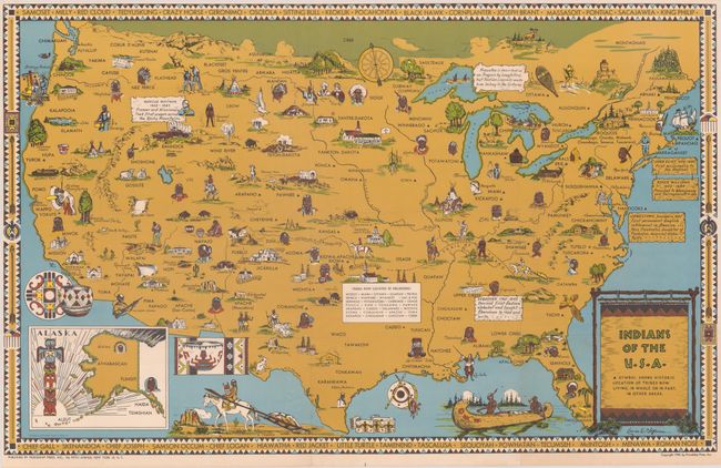
Auction 179, Lot 149
Subject: United States, Indians
[Lot of 2] Indians of the U.S.A. [and] Indian Reservations in the United States 1948, 1944-60
Size: See Description
Estimate: $300 - $400
Sold for: $325
Closed on 9/16/2020
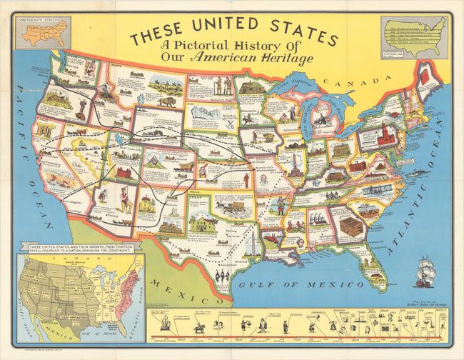
Auction 179, Lot 150
Subject: United States
These United States - A Pictorial History of Our American Heritage, 1949
Size: 34.4 x 26.3 inches (87.4 x 66.8 cm)
Estimate: $100 - $130
NO RESERVE
Sold for: $180
Closed on 9/16/2020
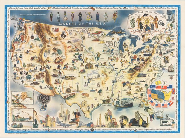
Auction 179, Lot 151
Subject: United States
A Friendship Map, 1956
Size: 37.8 x 27.8 inches (96 x 70.6 cm)
Estimate: $200 - $240
A Map Promoting Peace and Tolerance
Sold for: $230
Closed on 9/16/2020
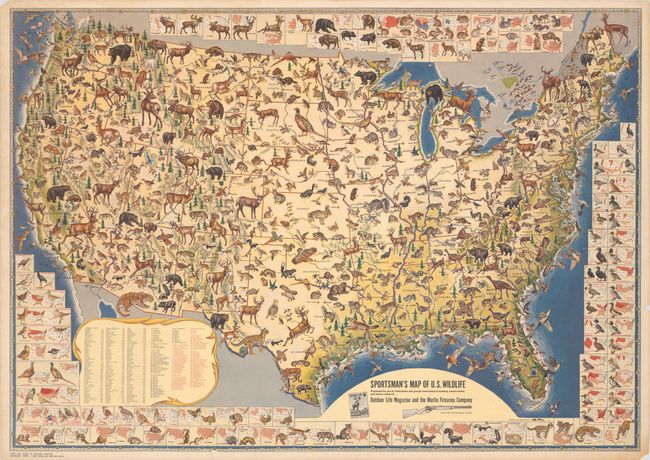
Auction 179, Lot 152
Subject: United States
Sportsman's Map of U.S. Wildlife, 1956
Size: 31.2 x 22 inches (79.2 x 55.9 cm)
Estimate: $160 - $190
Sold for: $250
Closed on 9/16/2020
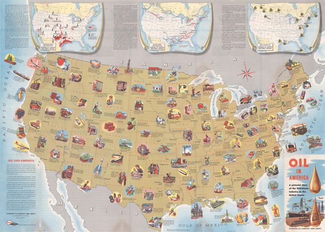
Auction 179, Lot 153
Subject: United States, Oil
Oil in America - A Pictorial Story of the Petroleum Industry in the United States, 1957
Size: 33.4 x 23.9 inches (84.8 x 60.7 cm)
Estimate: $220 - $250
Sold for: $120
Closed on 9/16/2020
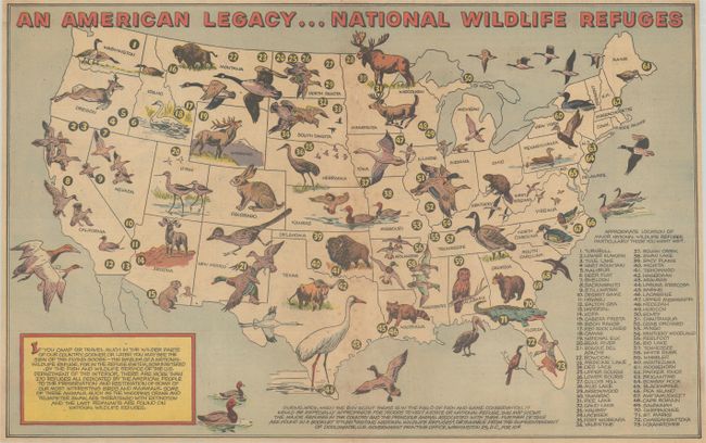
Auction 179, Lot 154
Subject: United States
An American Legacy...National Wildlife Refuges, 1957
Size: 18.7 x 11.6 inches (47.5 x 29.5 cm)
Estimate: $140 - $170
Official Boy Scout Map
Sold for: $110
Closed on 9/16/2020
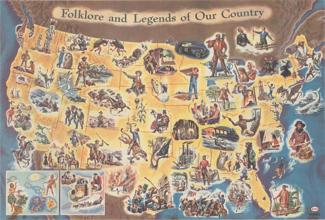
Auction 179, Lot 155
Subject: United States
Folklore and Legends of Our Country, 1962
Size: 33.5 x 22.7 inches (85.1 x 57.7 cm)
Estimate: $140 - $170
Sold for: $170
Closed on 9/16/2020
Auction 179, Lot 156
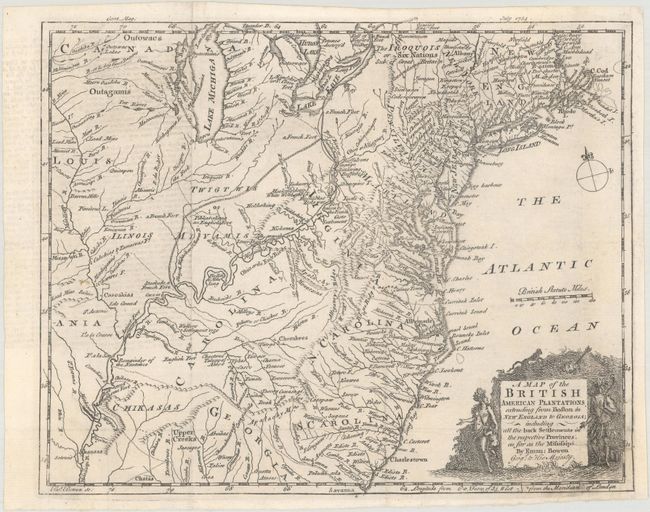
Subject: Colonial Eastern United States
Bowen, Emanuel
A Map of the British American Plantations, Extending from Boston in New England to Georgia; Including All the Back Settlements in the Respective Provinces..., 1754
Size: 10.9 x 8.8 inches (27.7 x 22.4 cm)
Estimate: $375 - $450
Sold for: $300
Closed on 9/16/2020
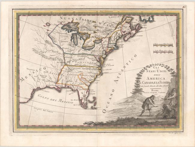
Auction 179, Lot 157
Subject: Eastern United States
Cassini, Giovanni Maria
Gli Stati Uniti dell' America il Canada, e la Florida Carta Generale Delineata Sulle Ultime Osservazni, 1798
Size: 18.8 x 13.6 inches (47.8 x 34.5 cm)
Estimate: $600 - $750
Sold for: $350
Closed on 9/16/2020
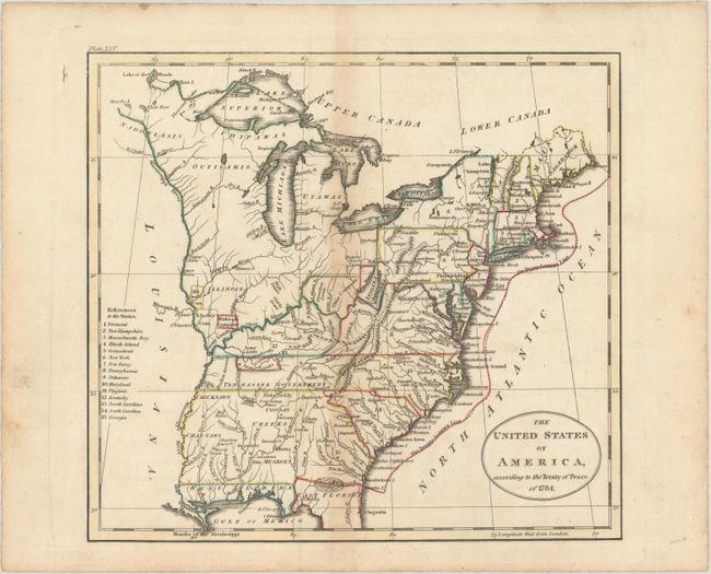
Auction 179, Lot 158
Subject: Eastern United States
Russell, John C.
The United States of America, According to the Treaty of Peace of 1784, 1801
Size: 7.9 x 7.2 inches (20.1 x 18.3 cm)
Estimate: $140 - $170
Sold for: $100
Closed on 9/16/2020
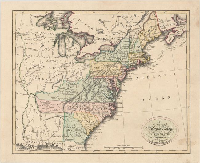
Auction 179, Lot 159
Subject: Eastern United States
Brown, Thomas
A New and Accurate Map of the United States of America, &c. from the Best Authorites, 1801
Size: 13.1 x 10.5 inches (33.3 x 26.7 cm)
Estimate: $550 - $700
Sold for: $400
Closed on 9/16/2020
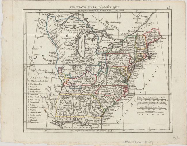
Auction 179, Lot 160
Subject: Eastern United States
Herisson, Eustache
Les Etats Unis d'Amerique, 1806
Size: 8.4 x 7 inches (21.3 x 17.8 cm)
Estimate: $140 - $170
Sold for: $100
Closed on 9/16/2020
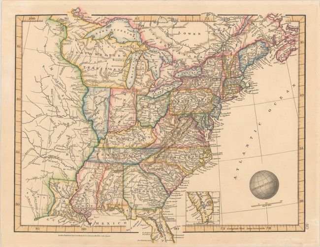
Auction 179, Lot 161
Subject: Eastern United States
Russell, John C.
States of America, 1814
Size: 8.8 x 7.3 inches (22.4 x 18.5 cm)
Estimate: $180 - $220
Sold for: $200
Closed on 9/16/2020
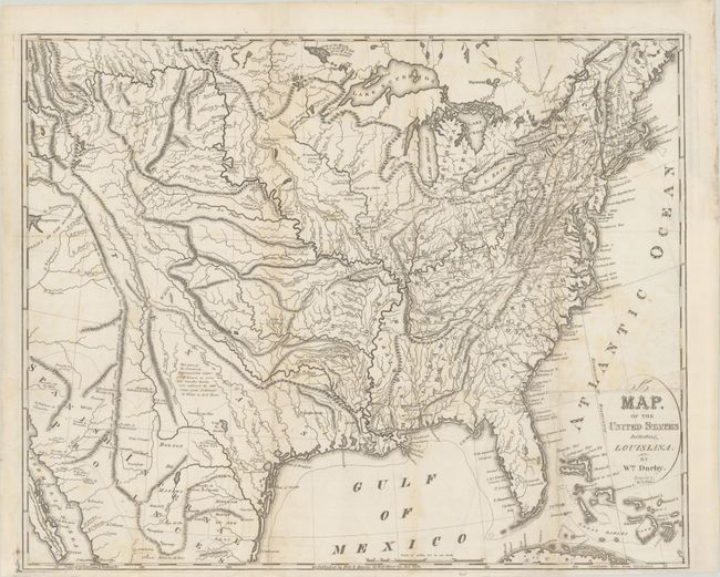
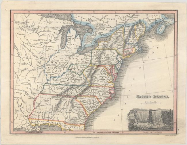
Auction 179, Lot 162
Subject: Eastern United States
Darby, William
A Map of the United States Including Louisiana, 1817
Size: 22.5 x 18.2 inches (57.2 x 46.2 cm)
Estimate: $2,000 - $2,300
Unrecorded State Prior to the Addition of Louisiana
Sold for: $1,200
Closed on 9/16/2020
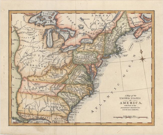
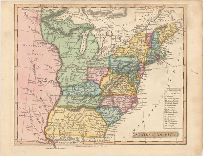
Auction 179, Lot 163
Subject: Eastern United States
A Map of the United States of America, with Part of the Adjoining Provinces from the Latest Authorities, 1817
Size: 10.8 x 8.4 inches (27.4 x 21.3 cm)
Estimate: $200 - $230
Sold for: $150
Closed on 9/16/2020
Auction 179, Lot 164
Subject: Eastern United States
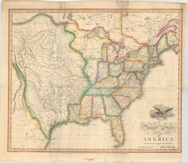
Melish, John
United States of America Compiled from the Latest & Best Authorities, 1818
Size: 19.5 x 16.1 inches (49.5 x 40.9 cm)
Estimate: $1,800 - $2,300
Early & Separately Issued Version of Melish's Important Map
Sold for: $3,000
Closed on 9/16/2020
Auction 179, Lot 165
Subject: Eastern United States
Ewing, Thomas
United States, 1819
Size: 8.4 x 6.9 inches (21.3 x 17.5 cm)
Estimate: $200 - $230
Sold for: $150
Closed on 9/16/2020
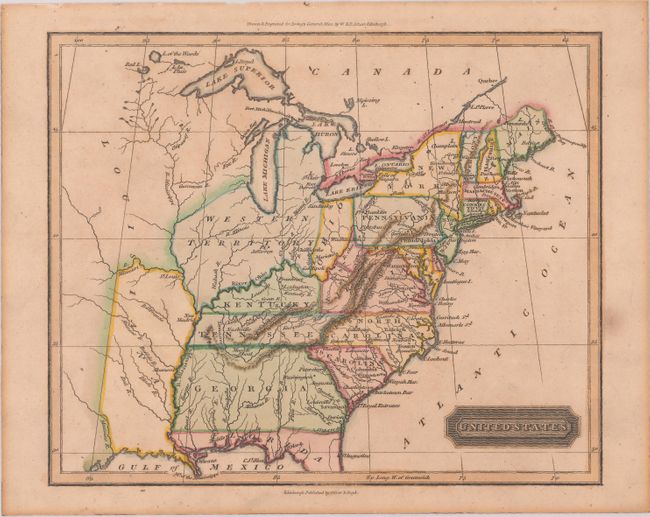
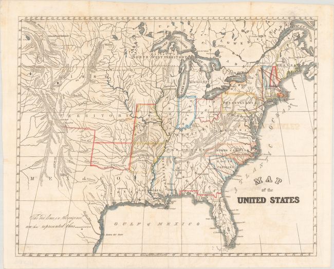
Auction 179, Lot 166
Subject: Eastern United States, Franklin
Wyld, James
United States, 1824
Size: 11.6 x 8.7 inches (29.5 x 22.1 cm)
Estimate: $700 - $850
Sold for: $700
Closed on 9/16/2020
Auction 179, Lot 167
Subject: Eastern United States
Arrowsmith, Aaron Jr & Samuel
United States, 1828
Size: 11.9 x 9.8 inches (30.2 x 24.9 cm)
Estimate: $200 - $230
Sold for: $150
Closed on 9/16/2020
Auction 179, Lot 168
Subject: Eastern United States
U.S. Government
Map of the United States, 1838
Size: 14.6 x 11.6 inches (37.1 x 29.5 cm)
Estimate: $120 - $150
Sold for: $110
Closed on 9/16/2020
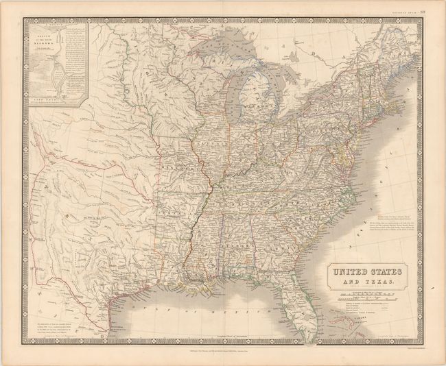
Auction 179, Lot 169
Subject: Eastern United States, Texas
Johnston, Alexander K.
United States and Texas, 1842
Size: 19.6 x 23.8 inches (49.8 x 60.5 cm)
Estimate: $1,000 - $1,300
Highly Detailed British Map Featuring the Independent Republic of Texas
Sold for: $1,300
Closed on 9/16/2020
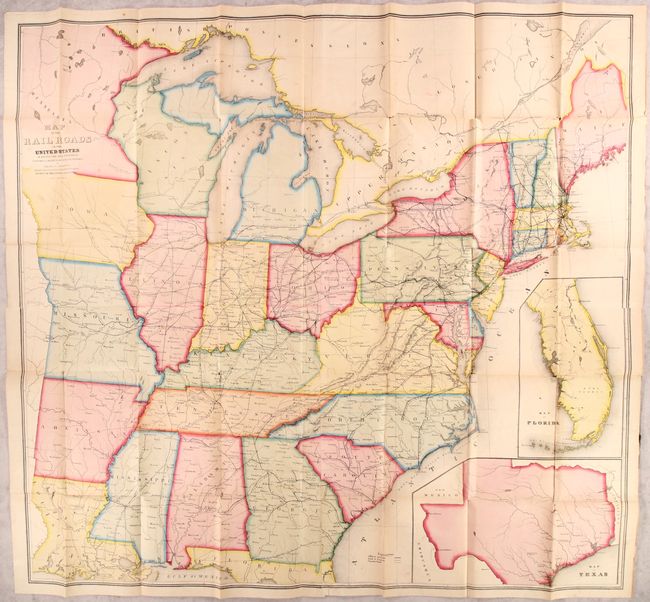
Auction 179, Lot 170
Subject: Eastern United States
Andrews, Israel D.
Map of the Railroads in the United States in Operation and Progress..., 1853
Size: 42.3 x 39.2 inches (107.4 x 99.6 cm)
Estimate: $350 - $425
Sold for: $325
Closed on 9/16/2020
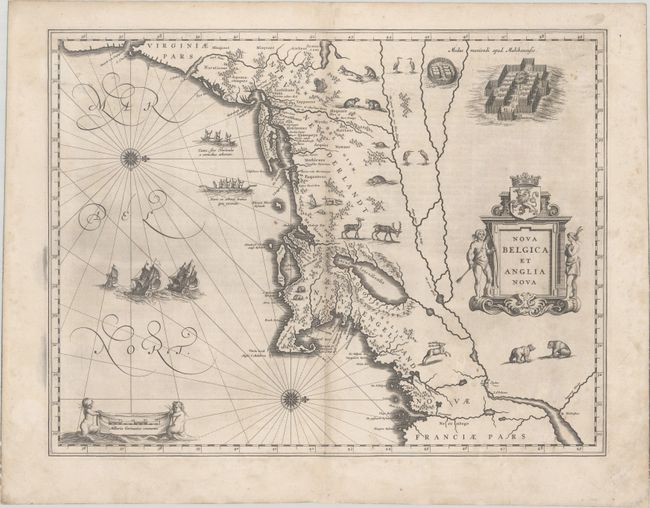
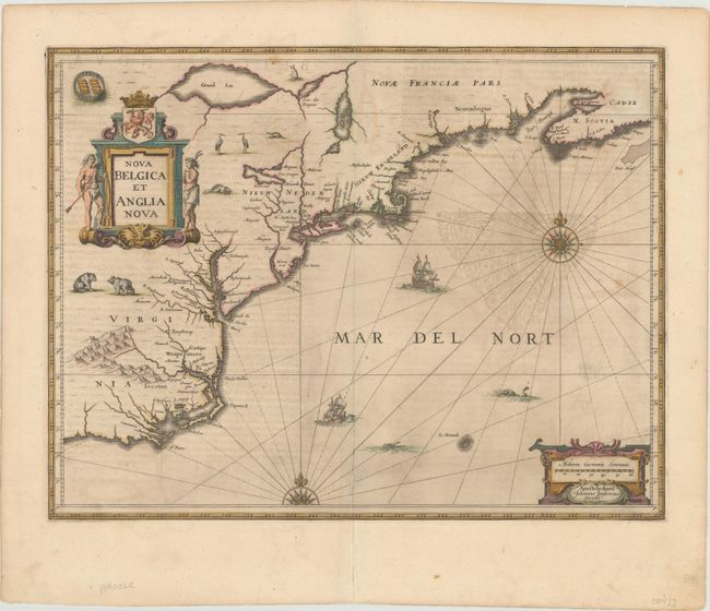
Auction 179, Lot 171
Subject: Colonial New England & Mid-Atlantic United States
Blaeu, Willem
Nova Belgica et Anglia Nova, 1634
Size: 19.9 x 15.3 inches (50.5 x 38.9 cm)
Estimate: $2,000 - $2,300
Important Map of Colonial New England and the Mid-Atlantic - First Edition
Sold for: $1,100
Closed on 9/16/2020
Auction 179, Lot 172
Subject: Colonial New England & Mid-Atlantic United States
Jansson, Jan
Nova Belgica et Anglia Nova, 1646
Size: 19.9 x 15.3 inches (50.5 x 38.9 cm)
Estimate: $1,600 - $1,900
Jansson's Influential Map of the East Coast - in Contemporary Color
Sold for: $1,000
Closed on 9/16/2020
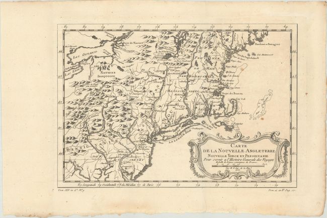
Auction 179, Lot 173
Subject: Colonial New England & Mid-Atlantic United States
Bellin, Jacques Nicolas
Carte de la Nouvelle Angleterre, Nouvelle Yorck, et Pensilvanie. Pour Servir a l'Histoire Generale des Voyages, 1757
Size: 11.5 x 7.9 inches (29.2 x 20.1 cm)
Estimate: $200 - $230
Sold for: $120
Closed on 9/16/2020
215 lots
Page 1 of 5