Subject: Eastern United States
Period: 1817 (circa)
Publication:
Color: Hand Color
Size:
10.8 x 8.4 inches
27.4 x 21.3 cm
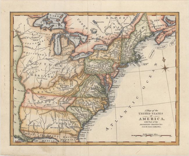
This map of the eastern United States was issued in George Alexander Cooke's Modern and Authentic System of Universal Geography. It was first published in Robert Wilkinson's General Atlas circa 1800. Cartographically, the Western Territory takes in all of the area north and west of the Ohio River with several Indian tribes located and an area of Extensive Meadows located in central Illinois. The Country of the Six Nations covers the region from unnamed Ohio into western New York. A large unnamed territory in the region of Mississippi and Alabama is the tribal territory of the Chickasaws, Cherokees, Choctaws and Muskogees. In the Northeast Main is noted as belonging to Massachusetts Bay. In the south, East and West Florida are well delineated.
References:
Condition: A
A crisp impression on a clean sheet with some minor creasing to the left of the centerfold.