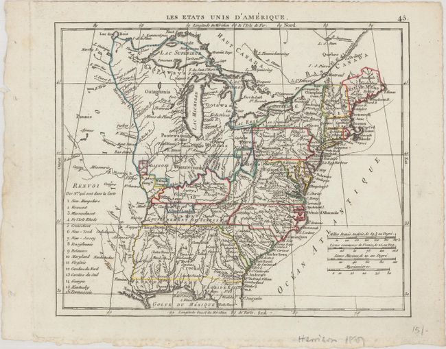
Subject: Eastern United States
Period: 1806 (circa)
Publication: Atlas Portatif
Color: Hand Color
Size:
8.4 x 7 inches
21.3 x 17.8 cm
This small map shows the nascent United States extending to the Mississippi River with a large Louisiana to its west. A large unnamed Northwest Territory encompasses all the land to the north of the Ohio River west of Pennsylvania, and Georgia includes present-day Alabama and Mississippi. The map locates a number of Revolutionary War land grants along the frontier including Illinois Company, New Jersey Company, Wabash Company, and Army Lands. Florida is divided between East and West. Includes a numbered key showing 16 states (omitting Ohio which became a state in 1803) and 4 distance scales.
References:
Condition: A
A nice impression on a clean sheet.