Subject: Eastern United States
Period: 1838 (published)
Publication: HR Doc. 2, 25th Congress, 3rd Session
Color: Hand Color
Size:
14.6 x 11.6 inches
37.1 x 29.5 cm
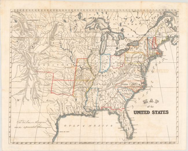
In 1838 Congress was alerted to the fact that the small size of the military forces created grave vulnerability to hostile coastal and interior threats. This map show proposed interior stations for troops to reinforce where they were most likely to be needed for coastal defense. Significantly, it reflected the availability of early railway systems that could be used to quickly transport the troops and their supplies to coastal locations. Four forts are indicated near: St. Louis, MO; Augusta, GA; Harrisburg, PA; Lake Champlain, NY. The map also locates the Republic of Texas.
References: Claussen & Friis #292.
Condition: B+
Issued folding and now flattened and backed with tissue. There is light offsetting and a few faint spots.