Filtered by Category:Canada(Show All Categories)
Showing results for:Auction 179
Catalog Archive
28 lots
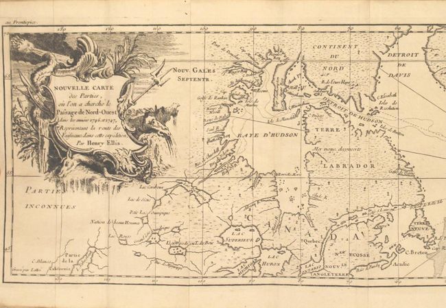
Auction 179, Lot 109
Subject: Canada & North Atlantic
Ellis, Henry
[2 Volumes] Voyage de la Baye de Hudson. Fait en 1746 & 1747, pour la Decouverte du Passage de Nord-Ouest ... Tome Premier [and] ... Tome Second, 1749
Size: 4.4 x 7.6 inches (11.2 x 19.3 cm)
Estimate: $750 - $900
Unsold
Closed on 9/16/2020
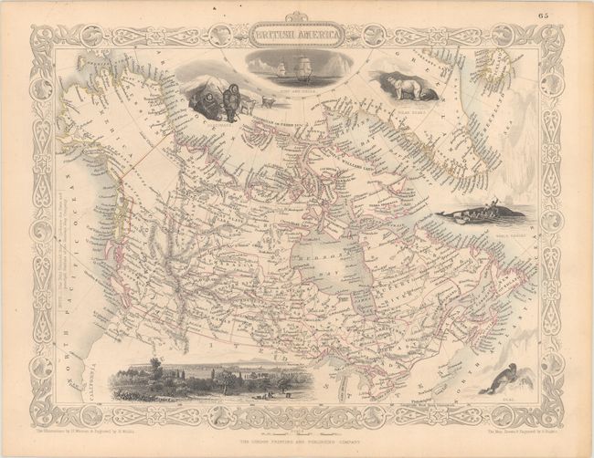
Auction 179, Lot 110
Subject: Canada
Tallis, John
[Lot of 2] British America [and] Nova Scotia and Newfoundland, 1850
Size: 12.8 x 10.1 inches (32.5 x 25.7 cm)
Estimate: $220 - $250
Sold for: $160
Closed on 9/16/2020
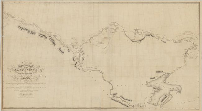
Auction 179, Lot 111
Subject: Northern Canada, Arctic Regions
Franklin, John [Rear Admiral Sir]
The Discoveries of the Expedition Under the Command of Captain Franklin R.D. Near the Mouth of the Mackenzie River, and on the Sea Coast East & West. A.D. 1825-26, 1828
Size: 50.8 x 27.5 inches (129 x 69.9 cm)
Estimate: $400 - $475
Unsold
Closed on 9/16/2020
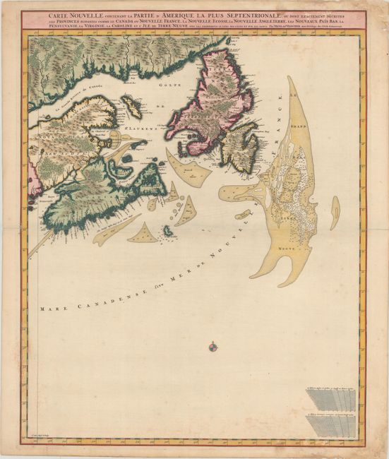
Auction 179, Lot 112
Subject: Eastern Canada
Visscher, Nicolas
Carte Nouvelle Contenant la Partie d'Amerique la Plus Septentrionale, ou sont Exactement Decrites les Provinces Suivantes Comme le Canada ou Nouvelle France..., 1696
Size: 18.6 x 23.3 inches (47.2 x 59.2 cm)
Estimate: $700 - $850
Sold for: $950
Closed on 9/16/2020
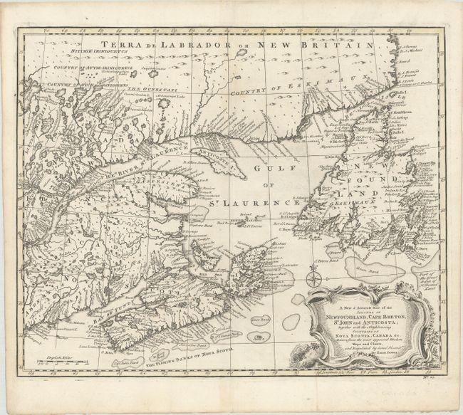
Auction 179, Lot 113
Subject: Eastern Canada
Bowen, Emanuel
A New & Accurate Map of the Islands of Newfoundland, Cape Breton, St. John and Anticosta; Together with the Neighbouring Countries of Nova Scotia, Canada, &c..., 1747
Size: 16.8 x 13.7 inches (42.7 x 34.8 cm)
Estimate: $300 - $375
Sold for: $600
Closed on 9/16/2020
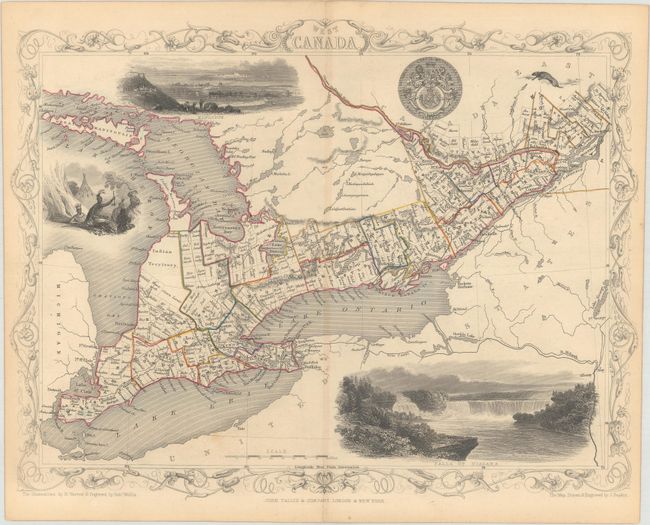
Auction 179, Lot 114
Subject: Eastern Canada, Great Lakes
Tallis, John
West Canada, 1850
Size: 12.9 x 9.8 inches (32.8 x 24.9 cm)
Estimate: $100 - $130
Sold for: $75
Closed on 9/16/2020
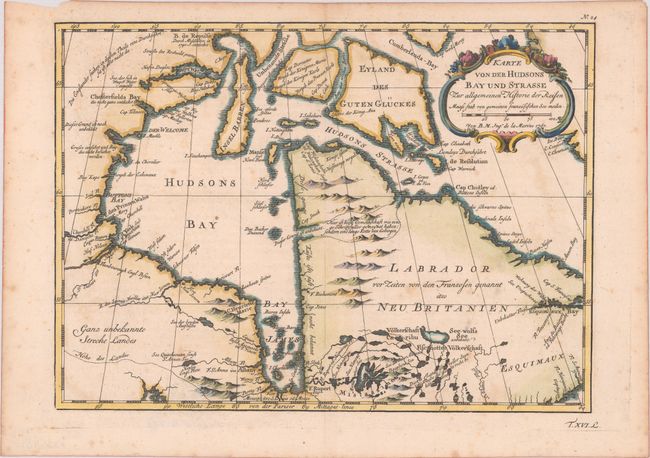
Auction 179, Lot 115
Subject: Eastern Canada, Hudson Bay
Bellin, Jacques Nicolas
Karte von der Hudsons Bay und Strasse zur Allgemeinen Historie der Reisen, 1757
Size: 11.5 x 8.4 inches (29.2 x 21.3 cm)
Estimate: $100 - $130
Sold for: $85
Closed on 9/16/2020
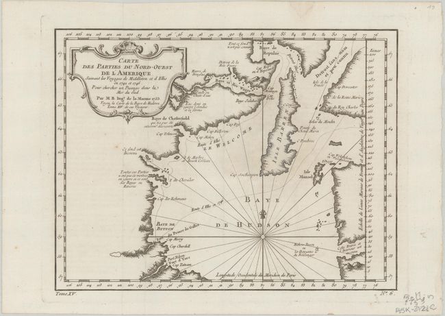
Auction 179, Lot 116
Subject: Hudson Bay, Canada
Bellin, Jacques Nicolas
Carte des Parties du Nord-Ouest de l'Amerique Suivant les Voyages de Middleton et d Ellis en 1742 et 1746..., 1753
Size: 10.8 x 8.3 inches (27.4 x 21.1 cm)
Estimate: $100 - $130
Sold for: $60
Closed on 9/16/2020
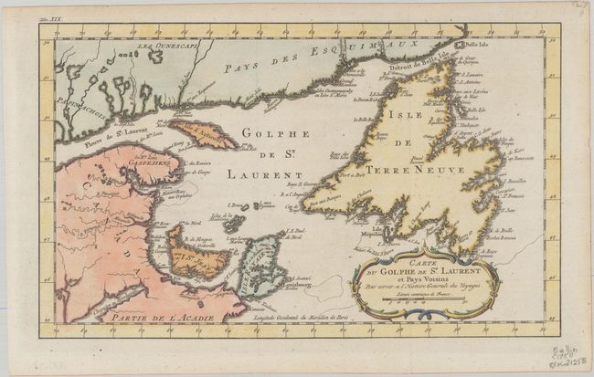
Auction 179, Lot 117
Subject: St. Lawrence Bay, Canada
Bellin, Jacques Nicolas
Carte du Golphe de St. Laurent et Pays Voisins pour Servir a l'Histoire Generale des Voyages, 1770
Size: 14.1 x 8.5 inches (35.8 x 21.6 cm)
Estimate: $120 - $150
Sold for: $90
Closed on 9/16/2020
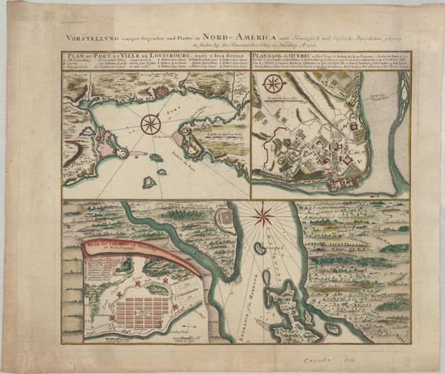
Auction 179, Lot 118
Subject: Quebec, Halifax & Louisbourg, Canada
Homann Heirs
Vorstellung einiger Gegenden und Plaetze in Nord-America unter Franzoesisch und Englische Jurisdiction Gehoerig…, 1756
Size: 20 x 16.8 inches (50.8 x 42.7 cm)
Estimate: $400 - $475
Sold for: $300
Closed on 9/16/2020
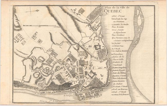
Auction 179, Lot 119
Subject: Quebec, Canada
Le Rouge, George Louis
[Lot of 2] Plan de la Ville de Quebec [and] Vue de Quebec, Capitale du Canada, 1755
Size: 10 x 7 inches (25.4 x 17.8 cm)
Estimate: $275 - $350
Sold for: $200
Closed on 9/16/2020
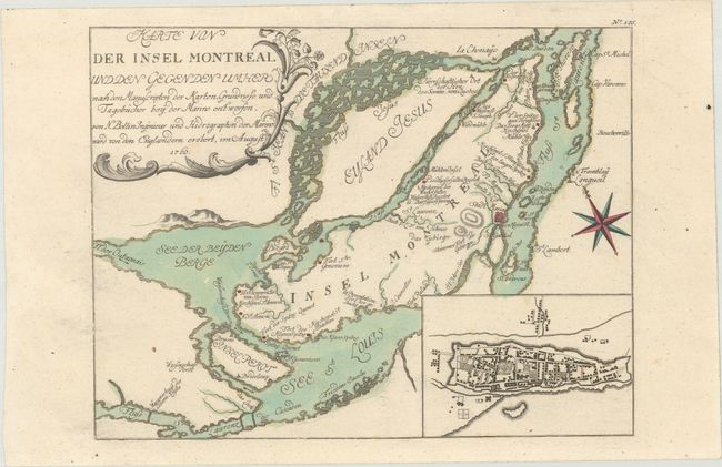
Auction 179, Lot 120
Subject: Montreal, Canada
Bellin, Jacques Nicolas
Karte von der Insel Montreal und den Gegen den Imher..., 1760
Size: 11.4 x 8.6 inches (29 x 21.8 cm)
Estimate: $240 - $300
Sold for: $180
Closed on 9/16/2020
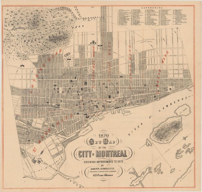
Auction 179, Lot 121
Subject: Montreal, Canada
New Map of the City of Montreal Showing Improvements to Date , 1870
Size: 20.3 x 19.3 inches (51.6 x 49 cm)
Estimate: $200 - $230
Sold for: $300
Closed on 9/16/2020
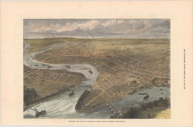
Auction 179, Lot 122
Subject: Winnipeg, Canada
Illustrated London News
Winnipeg, the Capital of Manitoba, in the Canadian Dominion, 1881
Size: 12.3 x 8.4 inches (31.2 x 21.3 cm)
Estimate: $180 - $210
Unsold
Closed on 9/16/2020
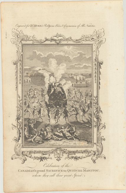
Auction 179, Lot 123
Subject: Canada, Natives
[Lot of 2] Celebration of the Canadian's Grand Sacrifice to Quitchi Manitou, Whom They Call Their Great Spirit [and] The Ceremony of a Divorce, as Practised by the Natives of Canada, in North America, 1780-94
Size: See Description
Estimate: $90 - $120
NO RESERVE
Sold for: $48
Closed on 9/16/2020
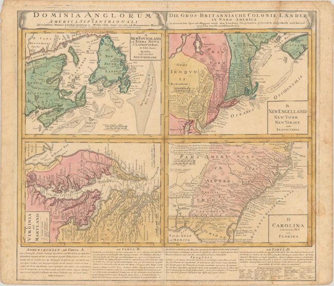
Auction 179, Lot 124
Subject: Colonial Eastern United States & Canada
Homann Heirs
Dominia Anglorum in America Septentrionali... / Die Gros-Britannische Colonie-Laender in Nord-America..., 1740
Size: 21.9 x 19.8 inches (55.6 x 50.3 cm)
Estimate: $375 - $450
Sold for: $375
Closed on 9/16/2020
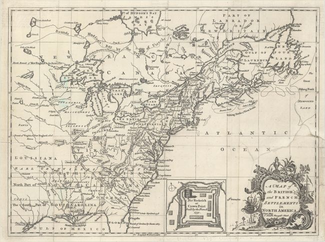
Auction 179, Lot 125
Subject: Colonial Eastern United States & Canada
Hinton, John
A Map of the British and French Settlements in North America, 1755
Size: 14.6 x 10.8 inches (37.1 x 27.4 cm)
Estimate: $600 - $750
Sold for: $650
Closed on 9/16/2020
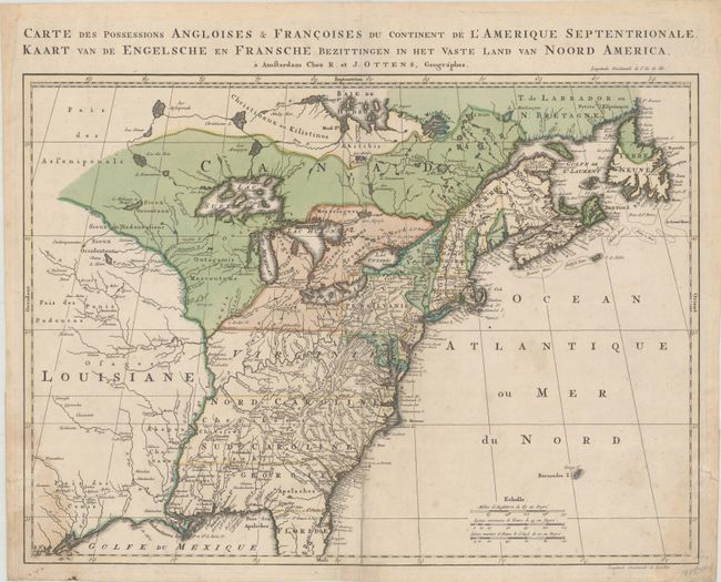
Auction 179, Lot 126
Subject: Colonial Eastern United States & Canada
Ottens, Reiner and Joshua
Carte des Possessions Angloises & Francoises du Continent de l'Amerique Septentrionale / Kaart van de Engelsche en Fransche Bezittingen in het Vaste Land van Noord America, 1755
Size: 22.3 x 16.3 inches (56.6 x 41.4 cm)
Estimate: $1,600 - $1,900
Dutch Version of an Important French & Indian War Map
Sold for: $900
Closed on 9/16/2020
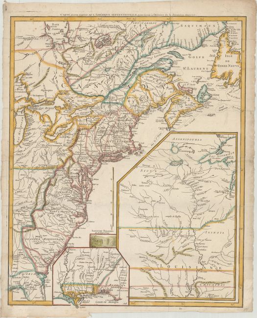
Auction 179, Lot 127
Subject: Eastern United States & Canada
Le Rouge, George Louis
Carte d'une Partie de l'Amerique Septentrionale, pour Servir a l'Histoire de la Derniere Guerre, 1787
Size: 19.4 x 24.1 inches (49.3 x 61.2 cm)
Estimate: $1,000 - $1,300
Sold for: $750
Closed on 9/16/2020
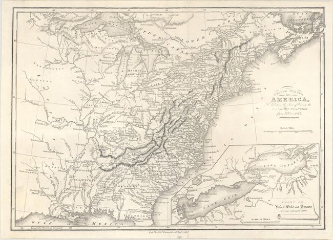
Auction 179, Lot 128
Subject: Eastern United States & Canada
Baines, Edward
United States of America, Exhibiting the Seat of War on the Canadian Frontier from 1812 to 1815, 1816
Size: 13.6 x 9.6 inches (34.5 x 24.4 cm)
Estimate: $250 - $325
Sold for: $150
Closed on 9/16/2020
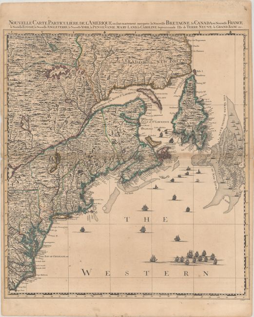
Auction 179, Lot 129
Subject: Colonial Northeastern United States & Canada
Popple/Covens & Mortier
Nouvelle Carte Particuliere de l'Amerique ou sont Exactement Marquees la Nouvelle Bretagne, le Canada ou Nouvelle France, la Nouvelle Ecosse, la Nouvelle Angleterre, la Nouvelle York, la Pensilvanie..., 1741
Size: 20.6 x 22.5 inches (52.3 x 57.2 cm)
Estimate: $2,000 - $2,300
Northeastern Sheet of the Reduced-Size Edition of Popple's Map
Sold for: $1,500
Closed on 9/16/2020
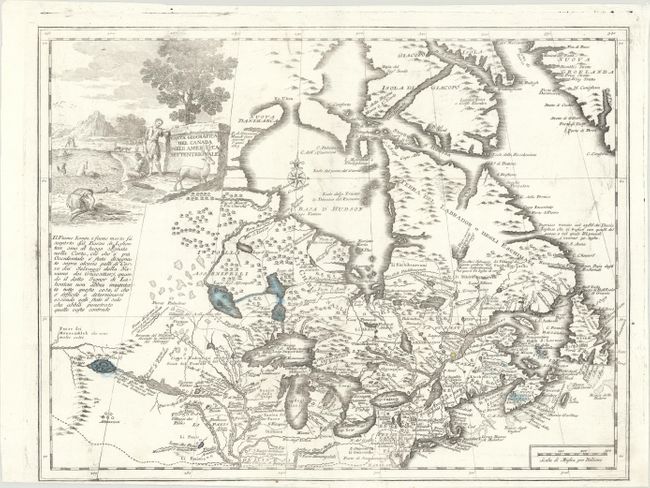
Auction 179, Lot 130
Subject: Colonial Northeastern United States & Canada, Great Lakes
Albrizzi, Girolamo
Carta Geografica del Canada nell' America Settentrionale, 1742
Size: 16.9 x 12.9 inches (42.9 x 32.8 cm)
Estimate: $600 - $750
Sold for: $450
Closed on 9/16/2020
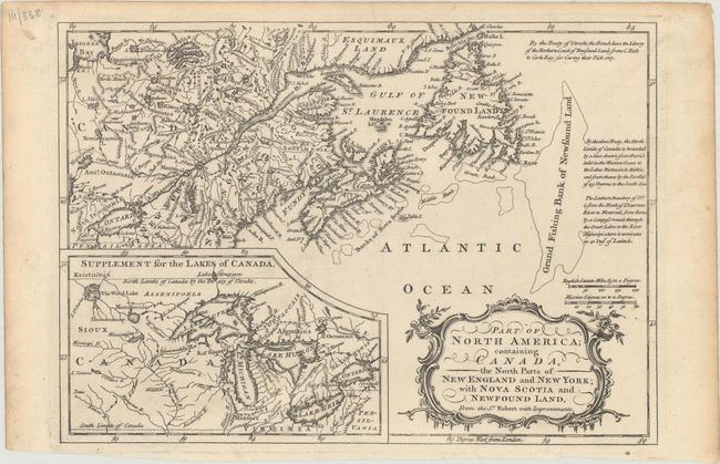
Auction 179, Lot 131
Subject: Colonial Northeastern United States & Canada, Great Lakes
Barrow, John (Sir)
Part of North America; Containing Canada, the North Parts of New England and New York; with Nova Scotia and Newfound Land. From the Sr. Robert with Improvements, 1759
Size: 11.4 x 8.1 inches (29 x 20.6 cm)
Estimate: $140 - $170
Sold for: $160
Closed on 9/16/2020
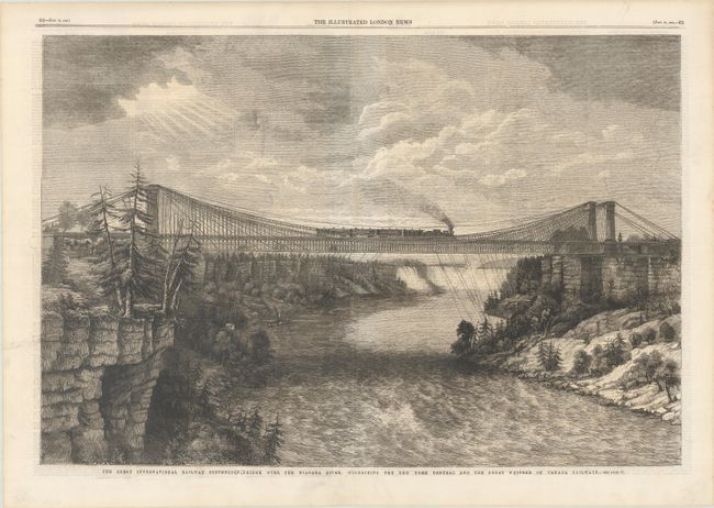
Auction 179, Lot 132
Subject: Niagara Falls, New York, Canada
The Great International Railway Suspension Bridge Over the Niagara River, Connecting the New York Central and the Great Western of Canada Railways, 1862
Size: 20.3 x 13.6 inches (51.6 x 34.5 cm)
Estimate: $60 - $80
NO RESERVE
Sold for: $75
Closed on 9/16/2020
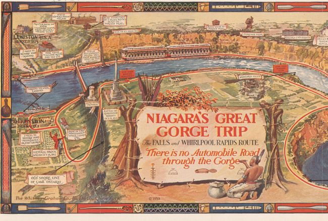
Auction 179, Lot 133
Subject: Niagara Falls, New York, Canada
Niagara's Great Gorge Trip - The Fals and Whirlpool Rapids Route, 1930
Size: 31.1 x 7.6 inches (79 x 19.3 cm)
Estimate: $80 - $100
NO RESERVE
Sold for: $90
Closed on 9/16/2020
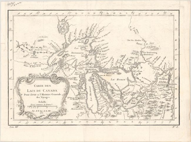
Auction 179, Lot 134
Subject: Colonial Central United States & Canada, Great Lakes
Bellin, Jacques Nicolas
Carte des Lacs du Canada pour Servir a l'Histoire Generale des Voyages, 1757
Size: 11.4 x 7.8 inches (29 x 19.8 cm)
Estimate: $350 - $425
Sold for: $250
Closed on 9/16/2020
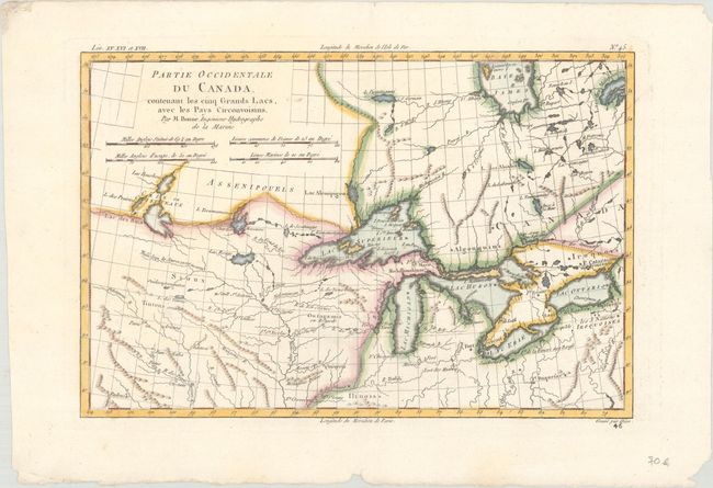
Auction 179, Lot 135
Subject: Colonial Great Lakes
Bonne, Rigobert
Partie Occidentale du Canada. Contenant les Cinq Grands Lacs, avec les Pays Circonvoisins, 1780
Size: 12.3 x 8.2 inches (31.2 x 20.8 cm)
Estimate: $180 - $220
Sold for: $220
Closed on 9/16/2020
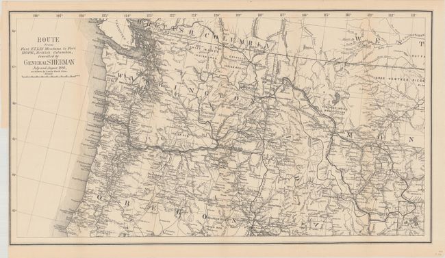
Auction 179, Lot 136
Subject: Northwestern United States & British Columbia
U.S. Government
Route from Fort Ellis Montana to Fort Hope, British Columbia, Travelled by General Sherman July and August 1883, as Shown by Heavy Black Line, 1883
Size: 27.4 x 15.2 inches (69.6 x 38.6 cm)
Estimate: $275 - $350
Sold for: $425
Closed on 9/16/2020
28 lots