Subject: United States, Transportation
Period: 1941-45 (circa)
Publication:
Color: Printed Color
Two pictorial maps depicting the evolving transportation network in the mid-20th century:
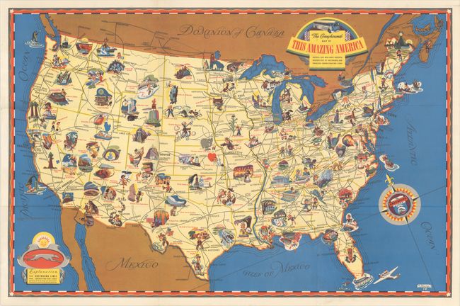
A. The Greyhound Map of This Amazing America - Natural and Man-Made Wonders Reached Best by Greyhound and Principal Connecting Bus Lines, by N. Wagner, dated 1941 (29.0 x 19.0"). This colorful map is filled with charming vignettes and figures which are numbered to an extensive key on verso (117 attractions in total). Greyhound bus routes are delineated in bold black with the interconnecting routes indicated by a dotted line. Further embellished by a decorative title cartouche, compass rose with fleur-de-lis, and legend.
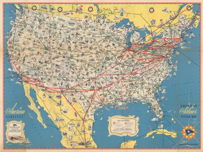
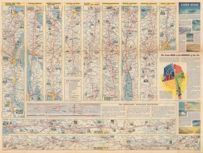
B. American Airlines System Map, by General Drafting Co., circa 1945 (31.2 x 23.3"). This densely illustrated pictorial map is color-coded to show airline routes in the United States and extending to portions of Canada, Mexico, the Bahamas and Cuba. American Airlines routes are depicted by thick red lines, while other routes are noted by a thin green line. Filling the map are numerous vignettes displaying points of interest, leisure activities, historical sites, and more. The verso contains twelve strip maps showing airline routes between various cities and a section of descriptive text entitled "The Radio Beam is the Highway of the Air." The use of radio signals for commercial aviation increased exponentially following the military's enhancements of this technology during World War II.
References:
Condition: A
Colorful examples, issued folding.